
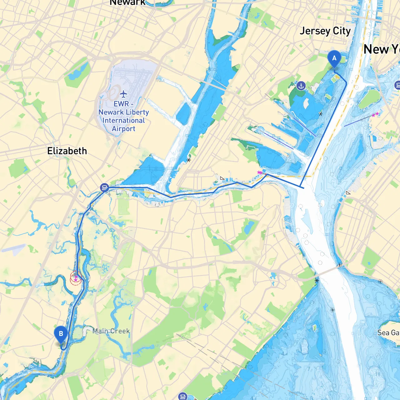
Route OverviewThis journey from Jersey City to Carteret offers a unique blend of urban landscapes and serene waterways. Perfect for experienced boaters seeking a day trip that combines the thrill of navigation with opportunities to pause and explore. The trip spans approximately 15 nautical miles along the shores of New Jersey, with a mix of bustling harbor views and tranquil nature spots.
Starting Point: Jersey City, NJYour adventure begins at the coordinates 40.7026° N, 74.0416° W. Jersey City is known for its vibrant waterfront and stunning views of the Manhattan skyline. Before setting sail, ensure your vessel is fully stocked and well-prepared for the day’s excursion. Check local weather conditions, as these can change rapidly in the harbor environment.
Notable Navigation Considerations:
Route to Carteret:1. Leave Jersey City: Navigate around Liberty State Park and stay on a course parallel to the New Jersey shoreline. Make sure to follow the marked channels.2. Newark Bay: Upon entering Newark Bay, you’ll encounter a junction where you must remain vigilant for large vessels that call the Port of Newark. Maintain a safe distance from the shoreline and observe the local no-wake zones.3. Dunn’s Point: As you progress, you’ll approach Dunn’s Point—an excellent spot for a brief stop to stretch your legs or enjoy a packed lunch. It offers picturesque views of the bay and is often less crowded, making it a peaceful place for a break.4. Linden: Continue towards the Arthur Kill, watching for private marinas and smaller vessels. The waters can get a bit choppy near the mouths of the rivers, especially with any wind.
Points of Interest Along the Route:
Shelters from the Weather:
Arrival at Carteret, NJUpon approach to Carteret, keep a careful eye on your charts, as entrances can sometimes be misleading. The coordinates for Carteret are 40.5703° N, 74.2146° W. Carteret's waterfront is a peaceful end to your day, with a few local eateries to recharge you after your journey.
Recommended Navigational Aids:
- Savvy Navvy: It's a fantastic app for real-time tracking and navigation, particularly helpful for route planning and managing coastal hazards. - Navionics: Provides detailed charts of the area. - Coast Pilot: This offers useful information on local regulations and navigational tips.
Final Thoughts:This route from Jersey City to Carteret combines the excitement of navigating through active shipping lanes with the serenity of quiet enclaves along New Jersey's coastline. Always prioritize safety by monitoring weather conditions, respecting navigational rules, and remaining alert for other vessels. With a few strategic stops and shelter locations in mind, your trip can be both fulfilling and enjoyable! Perfect for powerboaters and experienced sailors who appreciate a mix of city and nature, this journey is one for the books. Bon voyage!