
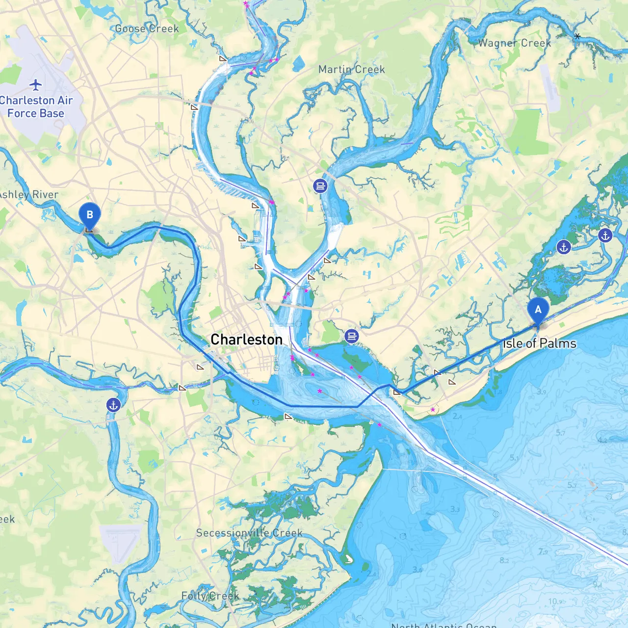
Pilotage Plan: Isle of Palms, South Carolina to North Charleston, South Carolina
Starting your adventure in Isle of Palms, an idyllic barrier island just a short journey from Charleston, you'll be navigating through some beautiful waters full of charm, history, and stark natural beauty. This route suits a range of boaters—from novice to experienced cruisers—offering safe harbors, scenic vistas, and historical landmarks that are hard to resist.
As you set out from Isle of Palms, be mindful of the local tidal currents; the area has a pronounced tidal range which can influence navigation. Keeping track of the tidal schedule is essential for safe entry and exit from the marina.
Your primary course leads south along the Intracoastal Waterway (ICW). As you maneuver through, be attentive to markers and buoys which guide your way along this busy water corridor.
While this route is relatively straightforward, there are some localized shoaling areas you’ll want to keep an eye on. Especially near the Charleston Harbor entrance, depths can change rapidly, so maintaining a constant watch is crucial. Check your nautical charts and perhaps schedule your trip to coincide with high tide to aid your passage.
1. Shem Creek: Located in Mount Pleasant, just outside of Charleston, this navigable creek offers excellent shelter from worsening weather with plenty of anchorage options. 2. Charleston Harbor: With its vastness, should the weather turn sour, this harbor provides safe refuge due to its size and surrounding amenities.
Upon arrival in North Charleston, anticipate entering busy waters filled with commercial traffic, so remain vigilant and adhere to navigation rules to ensure a smooth docking at your destination.
This carefully curated route, rich in both history and breathtaking natural beauty, ensures a safe yet rewarding experience on the water. Whether you’re out for a day trip or just for some quality time with friends and family, this journey promises to be memorable. Enjoy your adventure!