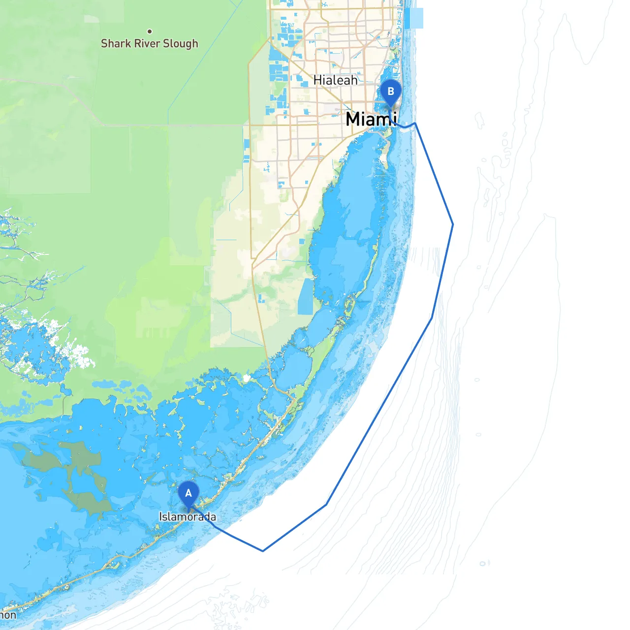
Pilotage Plan: From Islamorada, Florida to Miami Beach, Florida
This route takes you from the scenic waters of Islamorada, often referred to as the “Sports Fishing Capital of the World,” to the vibrant shores of Miami Beach. It’s a beautiful journey through the Florida Keys, providing both scenic views and the chance to experience local marine life. The recommended trip is suitable for intermediate to experienced boaters due to various navigational challenges and the need for awareness of local regulations.
Starting Point: Islamorada, Florida Coordinates: Long: -80.626289821, Lat: 24.933771477
Hazards: As you leave, keep an eye out for submerged rocks and shallow areas especially near the channels. The waters can be busy with fishing vessels and recreational boats, so maintain a watchful eye.
Points of Interest: Before departing, consider stopping by the historic Islander Watersports for a last-minute rental or supplies, or grab a coffee at the History of Diving Museum.
As you set course toward Miami Beach, you will be navigating the stunning waters of Florida Bay. The first leg of the journey involves heading northwest.
Shelter Bays:
Navigational Aids: Pay attention to the markers defining the safe channels. (Look for red and green buoys). They guide you away from shallow areas that could pose a risk to your vessel.
Continue heading up through the waterways, you will pass through Key Largo. Here you’ll find the expansive Florida Keys National Marine Sanctuary, which is rich in coral reefs and marine wildlife.
Activities: Dive or snorkel at John Pennekamp Coral Reef State Park, an opportunity to enjoy the vibrant underwater life.
Navigational Considerations: Be cautious as boat traffic increases near points of interest such as the park entrance. Compliance with the no-wake zones around Marinas and parks is essential for both safety and respect for other boaters.
Continuing north, you have the option to take Card Sound, a natural and somewhat quieter alternative route towards Miami.
Shelter Bays: Card Sound itself offers a protected anchorage point. If the weather becomes challenging, this is a safe place to hunker down while you wait for conditions to improve.
Markers: Watch for the Card Sound Road Bridge; if you’re under 25 feet tall, you can typically sail under it at any time. However, make sure you check for any closures.
As you transition into Biscayne Bay, you’ll see the contrasting skyline of Miami as a stunning backdrop.
Points of Interest: You can stop at the secluded swimming spots on the sandbars or visit coves like the one at Nixon Beach, where you can enjoy picnicking or swimming.
Navigational Aids: Biscayne Bay is abundant with navigational markers. Pay particular attention as you enter the more cosmopolitan approaches, which can become congested: maintain a lookout for larger commercial vessels.
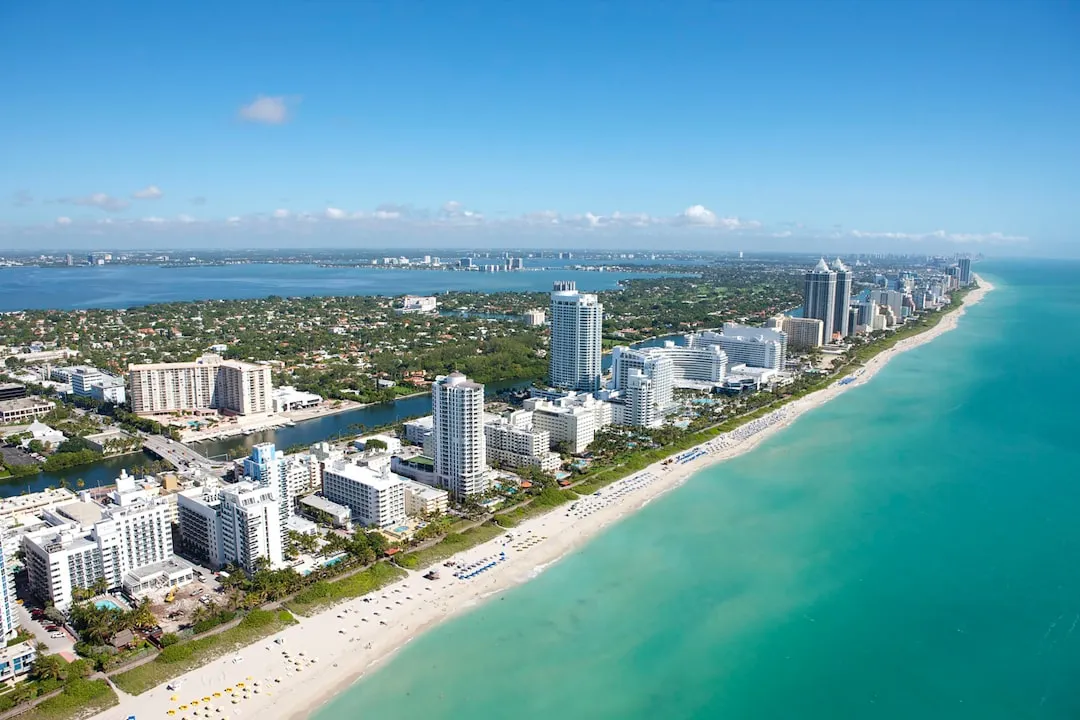
Destination: Miami Beach, Florida Coordinates: Long: -80.14695, Lat: 25.7926166667
At Miami Beach, you’ll be greeted by white sandy beaches and the lively atmosphere that the region is known for.
By following this pilotage plan, you will ensure a safe and enjoyable journey through one of Florida's most beautiful waterways. Enjoy your adventure!