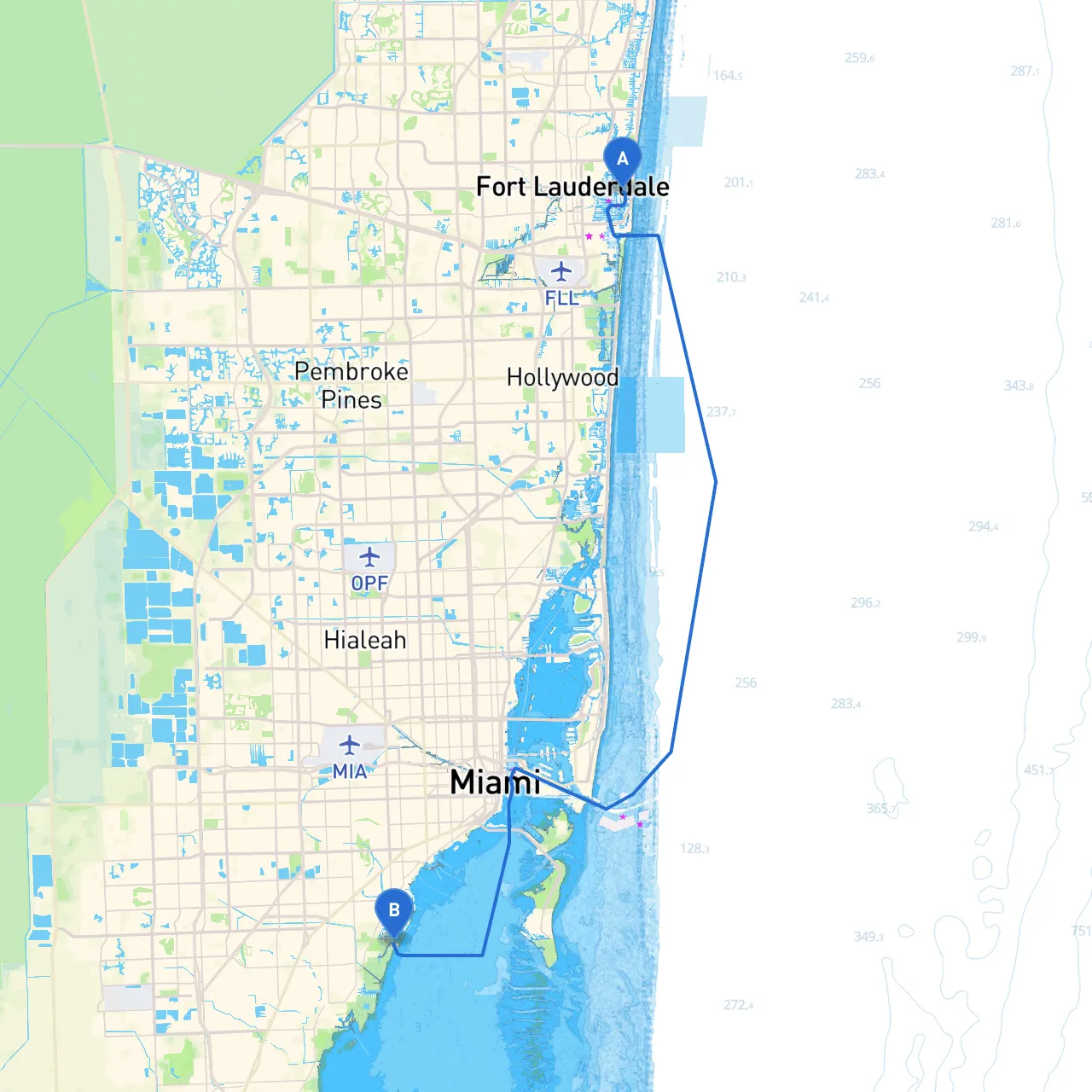
Pilotage Plan for a Boat Trip from Fort Lauderdale, FL, to Coral Gables, FL
Starting Point: Fort Lauderdale, FL Coordinate: Long -80.1105, Lat 26.1192
Ending Point: Coral Gables, FL Coordinate: Long -80.2592, Lat 25.6797
Overview
This route takes you through the beautiful waters of South Florida, making it an ideal day trip for skilled cruisers and leisurely boaters alike. The distance is about 25 nautical miles, offering a steady sailing experience with scenic views, navigational challenges, and a few hidden gems. You will find both sheltered bays and vibrant points of interest along the way, catering to boaters with a penchant for adventure and relaxation.
Route Description:
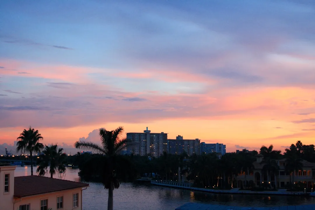
1. Departing Fort Lauderdale
As you leave Fort Lauderdale, ensure you navigate carefully past the hustle-bustle of the Intracoastal Waterway (ICW). The area is marked with plenty of navigational aids, including day markers and buoys guiding your way. Watch out for local powerboats and yachts, especially during peak times when traffic is higher.
2. Intracoastal Waterway (ICW)
Stay in the ICW until you reach Hillsboro Inlet. This channel provides a safe route while allowing you to enjoy the scenic beauty of the waterfront homes and palm-lined streets. Observing safe boating practices is critical here, especially due to numerous vessel types sharing the waterway.
3. Hillsboro Inlet
As you pass Hillsboro Inlet, you can enjoy views of the Hillsboro Lighthouse, a well-recognized landmark. It's a great spot to pause if you want to stretch your legs at a nearby beach or grab light refreshments.
4. Boca Raton
Continuing along the ICW, you will reach Boca Raton, a perfect place for a short stop. The Boca Raton Marina offers temporary docking, and you can explore the nearby parks or grab a meal at one of the waterfront restaurants. If the weather starts to turn, inshore options like Loggerhead Park provide good shelter.
5. Boca Raton Inlet (Condition Review)
While continuing south, monitor the weather closely as you approach Boca Raton Inlet. This inlet can present challenges due to shifting currents, so ensure your vessel's readiness and maintain a lookout for local boat traffic.
6. Transitioning to the Open Waters
After passing the Boca Raton Inlet, prepare for a mix of open water and navigational management as you approach your destination. The shoreline will begin to disappear, presenting an open view of the Atlantic. Always refer to your charts and keep an eye on nighttime navigation lights if your journey stretches into the evening.
Points of Interest and Shelters
Throughout the boat trip, you'll have several opportunities for stops:
- Hillsboro Lighthouse: This iconic spot is not just a beautiful sight but also serves as an excellent navigational reference.
- Boca Raton Marina: Explore restaurant offerings and the beautiful parks surrounding the marina.
- Sandy beaches along the coast: Beautiful beaches provide opportunities for relaxation and letting the kids splash around if you have young ones on board.
In case of rough weather or where local conditions dictate a change in plans, both the Hillsboro Inlet and Boca Raton Inlet serve as suitable bays for shelter. These areas can provide protection until conditions improve.
Navigation Aids and Regulations
As you navigate this stretch, here are some important navigational aids and regulations to keep in mind:
- Markers and Buoys: Pay special attention to the ICW markers to maintain a safe course. There are clear navigational channels, and straying outside these can lead to grounding.
- Speed Limits: Adhere to the speed limits enforced in the ICW and near marinas; compliance ensures both safety and a good relationship with local authorities.
- No Wake Zones: Respect no-wake zones, which are heavily enforced around harbors and populated areas to protect local residents and water quality.
Recommended Boating Apps
To enhance your trip planning and navigation, a few apps can be incredibly useful as you'll need reliable navigation aids:
- Savvy Navvy: This app offers comprehensive charts and navigation tools that help ensure you're following the safest and most efficient route.
- Navionics: Great for detailed nautical charts and real-time updates.
- Weather Apps: Always check predictions from credible weather apps before and during your trip for any sudden changes.
This route from Fort Lauderdale to Coral Gables promises a fantastic yachting experience tailored for both experienced cruisers and families alike. With careful planning and respect for navigation regulations, you'll find this trip an enjoyable and scenic passage through South Florida's vibrant waters. Safe sailing!