Pilotage Plan: Freeport, NY to Staten Island, NY
Overview
Embarking on a boating journey from Freeport, NY to Staten Island, NY, is not just an excursion; it's an experience filled with potential discoveries. This route offers scenic waters, vibrant marine life, and interesting landmarks. Designed for a range of boaters including novice cruisers who may appreciate calm waters and seasoned navigators who enjoy open channels, this trip is rewarding for everyone. However, safety should always remain the top priority, so attention to potential hazards and navigational considerations is paramount.
Route Summary
- Starting Point: Freeport, NY (Coordinates: -73.5735, 40.644)
- Ending Point: Staten Island, NY (Coordinates: -74.13983, 40.54283)
- Total Distance: Approximately 15 nautical miles
- Estimated Duration: 3 to 4 hours, depending on conditions and vessel speed
Departure from Freeport
As you set off from Freeport, begin by navigating out of the narrow channels carefully. Pay attention to the local traffic and remember that this area can be busy with fishing boats and leisure vessels. Be on the lookout for the Freeport Inlet, marked by navigational aids to guide your route into the broader waters of the Atlantic. The inlet is approximately 0.75 nautical miles wide, requiring caution with potential tidal currents.
Notable Points of Interest:
: As you head east, you can check out the beautiful stretch of Jones Beach on the northern shore of the barrier island. It’s a fantastic spot to anchor for a while, especially during the summer months when the beach is busy.
2. Zachs Bay: This sheltered bay is just past Jones Beach, providing an excellent refuge should weather conditions change, or if you simply want a tranquil spot to relax with a picnic.
3. Fire Island Lighthouse: Further along your route, this historic lighthouse is a notable sight and also serves as a navigational aid. If conditions are favorable, consider making a brief stop by the lighthouse for photos or to go ashore and explore the surrounding area.
Navigational Considerations
As you approach the channels leading toward Staten Island, it is crucial to focus on the navigation aids provided along the route. Use the following points to ensure a safe passage:
- Navigation Aids: Keep an eye on buoys that mark channels, particularly the ones in the entrance to Upper New York Bay. The red buoys (even numbers) should be kept to your starboard (right) as you enter the bay.
- Tidal Considerations: Be aware of tidal currents, especially in the Upper Bay region where the Hudson River meets New York Harbor. This area can experience significant water movement, especially during peak tidal periods, making it essential to time your passage accordingly.
Safety Measures
Safety is crucial during any boating excursion. Always:
- Check Weather Conditions: Prior to your departure, be sure to review the marine weather forecasts. Conditions can change quickly, so it may be prudent to delay your departure if bad weather is forecasted.
- Monitor VHF Radio: Keep a watch on channel 16 for emergency communications and updates regarding shipping traffic, especially as you approach Staten Island.
- Personal Safety Gear: Ensure all passengers are wearing life jackets and have access to adequate safety equipment like flares, first aid kits, and fire extinguishers.
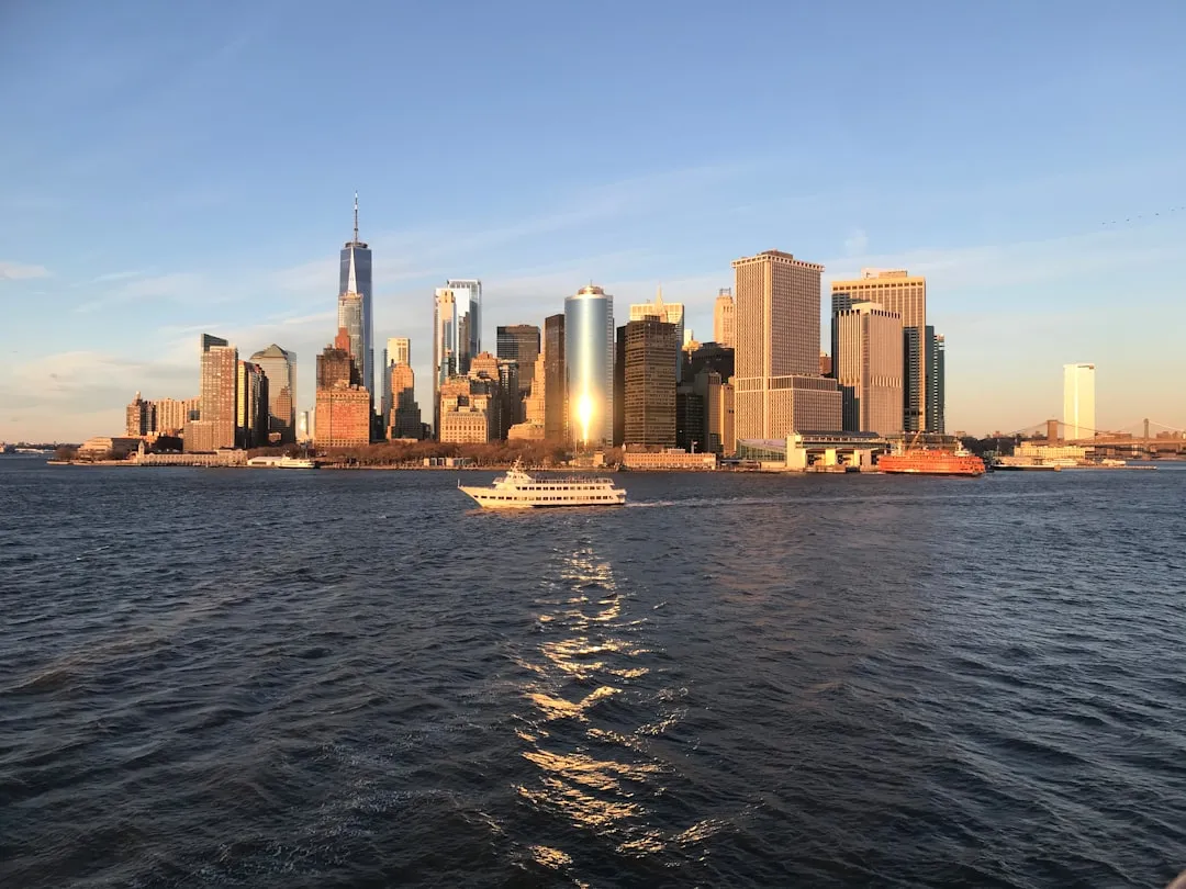
Arrival at Staten Island
As you arrive at Staten Island, you'll notice the busy traffic of Manhattan nearby. Your destination is marked clearly using navigational aids for safe docking. While you continue on your adventure, consider visiting the Staten Island Ferry terminal to experience the vibrant atmosphere and panoramic views of the Manhattan skyline.
Recommended Boating Apps
To assist with your navigation and ensure safety while out at sea, I recommend the use of the following apps:- Savvy Navvy: Offers comprehensive charts, tides, currents, and weather information to enhance your trip.
- Navionics: Excellent for checking charts and marina information.
- Windy: Great for tracking wind conditions that could impact your journey.
This pilotage plan ensures you’ll enjoy a safe, exciting, and memorable trip from Freeport to Staten Island. Embrace the adventure and the beauty of navigating New York's waterways! Happy cruising!