
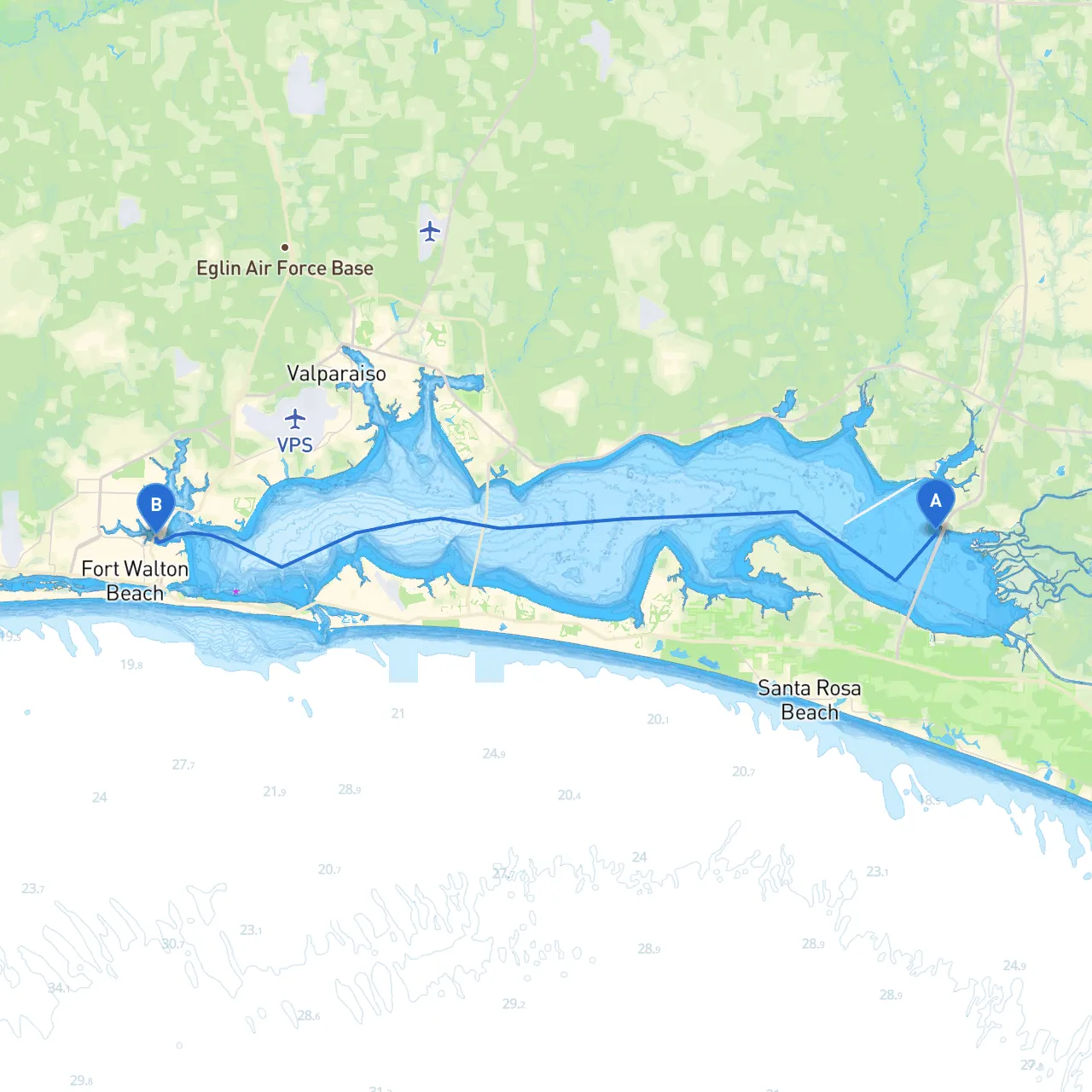
This passage offers a scenic cruise along Florida's Gulf Coast, stretching approximately 20 nautical miles from Freeport to Fort Walton Beach. The route is well-suited for experienced boaters who appreciate the natural beauty of coastal waters while navigating through a variety of environments. While the trip is manageable, attention to weather conditions and navigational points is essential for a safe passage.
2. Navigating Choctawhatchee Bay - Upon departure, head south towards the mouth of the Choctawhatchee Bay. It is wise to monitor local weather forecasts, as conditions can change rapidly. Be aware of the prevailing winds and tidal currents as you approach the bay. - Point of Interest: The bay offers a few small islands, including the serene and often uncrowded Shell Island, where you can enjoy some time in nature if you choose to anchor briefly.
3. Mid-Route Bay Shelters - Should conditions deteriorate, consider Duck Point as an emergency shelter. This area offers a natural barrier from winds and waves, making it a good spot to wait out inclement weather. - Award-Winning Wildlife: This stretch of water is also home to diverse birdlife and marine creatures, making it a potential stop for nature photography and exploration if the weather allows.
4. Navigational Aids - Pay close attention to the markers indicating the entrance to the bay. The intra-coastal waterway can be busy, so vigilance is required when navigating through. - Look for the red and green day markers as you enter deeper waters. These aids will keep you on the safe channel while moving toward your destination.
5. Fort Walton Beach Approach - As you approach Fort Walton Beach, adjust your heading to follow the navigational aids that will guide you into the harbor. The beach is well-marked but remains busy, so keep a watchful eye on other vessels. - You can expect to see several small fishing boats and possibly some recreational watersports during your approach. This is a good indicator of the lively atmosphere that Fort Walton Beach is known for.
Keep your VHF marine radio turned on to stay updated on local broadcasts and maritime traffic. Check in periodically with friends or family to let them know your route and expected arrival.
This passage from Freeport to Fort Walton Beach is an excellent choice for any seasoned boater looking to experience the calmness of the bay while still indulging in the lively aspects of coastal cruising. The blend of tranquil waters with potential for wildlife encounters and picturesque scenery makes it a memorable journey. Prepare to explore, but always prioritize safety above all else.
For navigation, you can utilize apps such as Savvy Navvy, which can assist with planning routes, monitoring weather, and providing essential navigational data, alongside other boating applications that enhance your cruising experience. Boating smart ensures you’ll enjoy countless safe adventures on the water!