
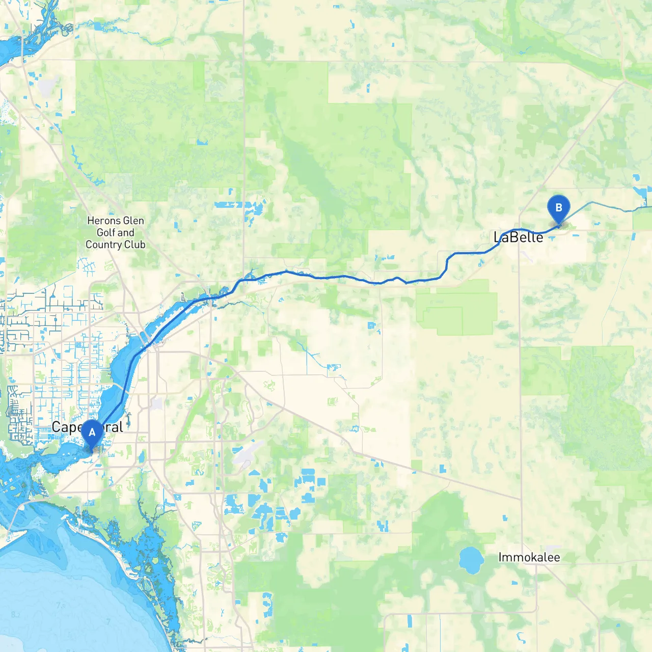
Pilotage Plan: Fort Myers, FL to LaBelle, FL
Overview:This voyage from Fort Myers to LaBelle offers a unique blend of serene waterways and opportunities for exploration. It is perfect for inland navigation enthusiasts and those seeking a peaceful day on the water. The route covers approximately 28 nautical miles, primarily along the Caloosahatchee River, making it suitable for cruising vessels, small motorboats, and kayaks. However, boaters must remain vigilant regarding potential hazards, environmental conditions, and local regulations.
Starting Point: Fort Myers, FL
Departure Preparation:Before setting out, ensure your vessel is well-prepared. Check for safety equipment (life jackets, fire extinguishers), ensure fuel reserves are adequate, and gather navigation tools, including charts, GPS, and communication devices. Weather conditions should be monitored using reliable forecasts or apps.
Distance: Approximately 10 nautical miles Duration: 1-2 hours (depending on speed)
Navigational Considerations:As you leave Fort Myers, you’ll navigate through the Caloosahatchee River. This section is well-marked, but keep an eye on your depth sounder, as the river can fluctuate with changes in tide. The Franklin Locks are an essential navigational feature and a stopping point where boaters can enjoy a brief break. Make sure to follow the lock instructions as outlined by the U.S. Army Corps of Engineers.
Points of Interest:
Distance: Approximately 6 nautical miles Duration: 1 hour
Navigational Considerations:Continuing upstream along the Caloosahatchee, pay attention to local navigation markers. The waterway is generally straight, but be mindful of any floating debris after heavy rain. Additionally, watch for conflicts with other recreational boaters, particularly on weekends.
Points of Interest:
Distance: Approximately 12 nautical miles Duration: 1-2 hours
Navigational Considerations:Proceeding further up the river, maintain awareness of your surroundings and any shifts in the water flow. This section of the river is narrower, so be especially cautious of wake from larger boats.
Points of Interest:
Emergency Shelter & Safety Points:Along the route, Franklin Locks provides a great place for refuge in poor weather due to its sheltered layout. Alva also has Public Boat Launch facilities that can serve as alternate stoppages if required.
Regulations and Restrictions:Ensure that you adhere to local boating regulations. The area is subject to slow speed zones, particularly around wildlife sanctuaries. Monitor your speed and ensure compliance with designated no-wake zones, especially in areas with residential docks and public water access.
Recommended Boating Apps:Some useful apps for navigation include:
Conclusion:This journey on the Caloosahatchee River from Fort Myers to LaBelle is a beautifully picturesque route dotted with opportunities for relaxation, exploration, and a connection with nature. Keep safety as your top priority, and enjoy the tranquility of Florida’s waterways. Happy boating!