
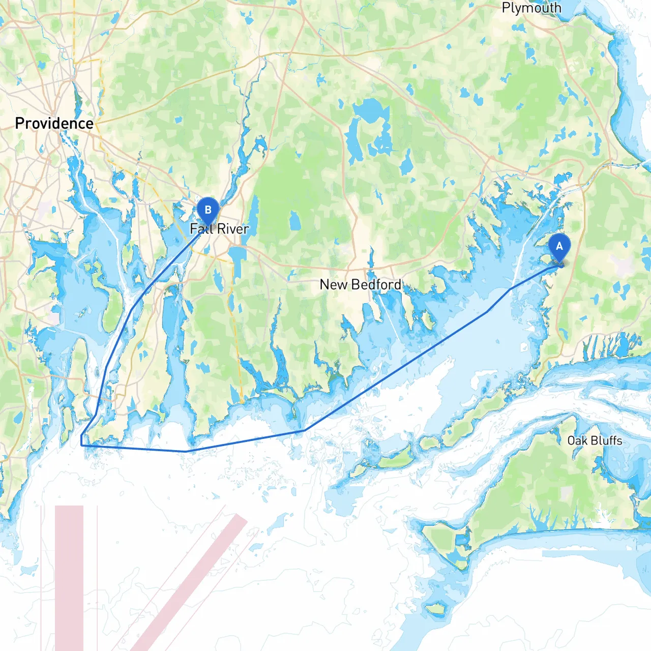
Embarking on a journey from Falmouth to Fall River offers a delightful blend of coastal scenery, charming towns, and navigational challenges that cater particularly well to experienced recreational boaters or those seeking to expand their seamanship skills. This route traverses a mix of open water and sheltered waterways, providing opportunities for both adventure and safety.
Starting Point: Falmouth Harbor, Falmouth, MA Begin your voyage at Falmouth Harbor (coordinates: 41.6576, -70.6239). Known for its bustling marina and yacht clubs, it's a perfect place to stock up on supplies, refuel, and soak in the local maritime ambiance.
Leg 1: Falmouth to Woods Hole As you depart Falmouth Harbor, heading southwest into Vineyard Sound, be aware of the busy navigational channels, particularly on weekends. This first leg is about 5 nautical miles. Maintain a keen lookout for ferry traffic, particularly the Martha’s Vineyard ferries. Stay close to the shore on your starboard side, passing by Woods Hole, which is a picturesque area worth a stop. You may consider anchoring in the protected waters of Woods Hole Harbor, which can offer sanctuary should the weather change unexpectedly.
Points of Interest:
Leg 2: Woods Hole to Buzzards Bay Leaving Woods Hole, head north to enter Buzzards Bay, which is known for its expansive views and active navigation. Potential hazards include shifting currents and shoals, so verify tidal charts and watch for markers. This section is around 8 nautical miles. The bay is relatively open, but you should keep a safe distance from any shoals, particularly off Cuttyhunk Island to your west.
Shelter Bay Options: Should conditions worsen, head towards Popponesset Bay or the Sandwich Marina, both of which provide safe anchorage and shelter from southerly winds.
Leg 3: Buzzards Bay to Taunton River Continue your journey eastward, navigating towards the Taunton River. This leg is approximately 10 nautical miles long. The entrance to the river is marked by prominent buoys, and you will want to tune into VHF channel 16 for any fishing or commercial traffic updates.
Keeping Safe:Watch for fishing traps as you approach the Taunton River and be mindful of speed limits, especially in areas near marina entrances and shallow waters.
Leg 4: Taunton River to Fall River The final stretch of your journey will take you north up the Taunton River into Fall River, approximately 5 nautical miles. Here, the waterway narrows, and you will encounter various commercial vessels. Make sure to keep a safe distance and maintain a vigilant watch for their wakes. Fall River is well-marked, and the harbor entrance is straightforward.
Fall River Landmarks: Upon arrival, you can explore the historic Battleship Cove, home to a fleet of maritime museums and exhibits, including the USS Massachusetts.
For your journey, I highly recommend using several nautical apps to enhance your navigation experience:
This planned route from Falmouth to Fall River is not just a passage; it is a memorable journey filled with scenic views, historical landmarks, and the thrill of navigating amongst diverse marine environments. Ensure you prepare adequately, respect navigation practices, and maintain vigilance at all times to make the most of your boating adventure safely. Happy cruising!