
Overview of the Route This journey from Duluth to Two Harbors along the stunning Lake Superior shoreline offers seasoned boaters and newcomers alike a delightful experience. With breathtaking natural vistas, charming towns, and opportunities for adventure, this trip is rich with exploration while emphasizing safety and navigation. The waterway is characterized by its numerous navigational aids, sheltered bays, and local points of interest.
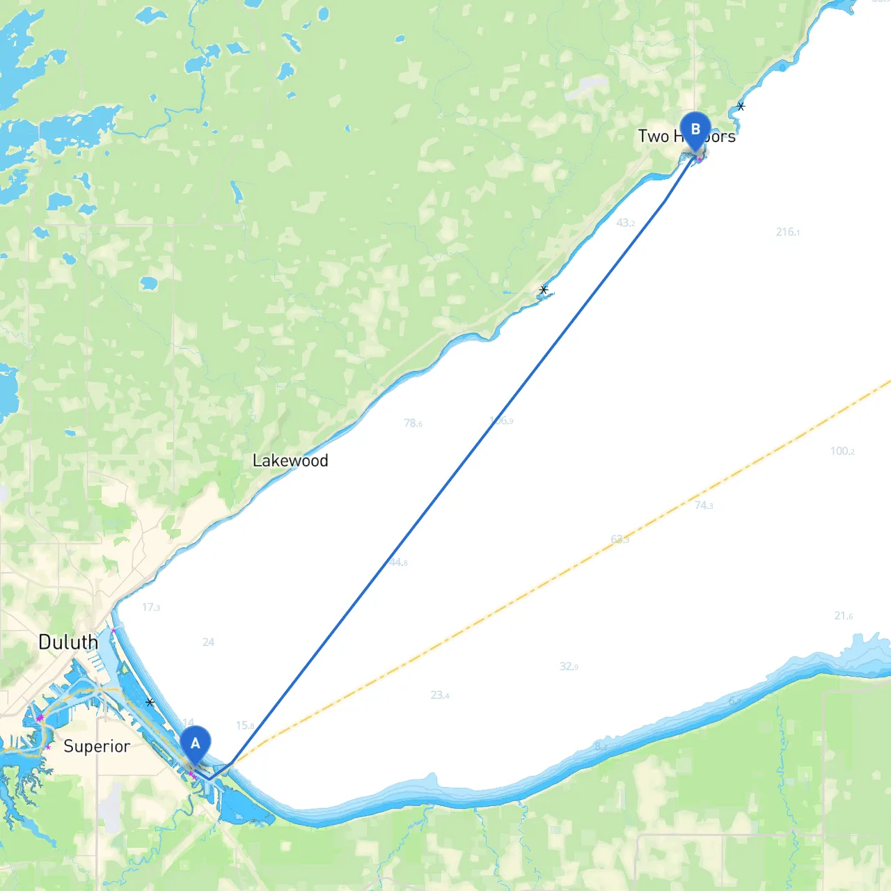
Starting Point: Duluth, Minnesota Coordinates: 46.7085833333, -92.0321333333 Duluth serves as the gateway to Lake Superior and boasts a vibrant maritime history. Before departure, ensure that your vessel is well-stocked with supplies, and perform a thorough pre-voyage check, including safety gear (life jackets, flares, etc.) and communication devices.
Route Overview The distance from Duluth to Two Harbors is approximately 26 nautical miles, and the route can be divided into a few key segments for easier navigation:
1. Duluth Harbor to Point of Interest – Park Point As you depart from the Duluth harbor, navigate towards Park Point, which is known for its beautiful sandy beaches and scenic views. Keep an eye out for navigational buoys marking the harbor entrance—there will be significant vessel traffic, so stay vigilant. This area is a good spot to stop for a break and enjoy the views of the harbor and the iconic Aerial Lift Bridge.
2. Point of Interest – Agate Bay As you continue toward Two Harbors, consider sailing towards Agate Bay. This sheltered bay offers excellent protection from the prevailing winds and is a great option should weather conditions change suddenly. If time allows, the Agate Bay Lighthouse is a notable landmark worth a visit, providing great photo opportunities and historical insight.
3. Navigational Considerations Apart from buoys marking navigable channels, watch for the north and south breakwaters at Two Harbors as you approach your destination. Keep track of depth using a depth sounder, especially as you transition from deeper waters to shallower bays.
4. Points of Interest – Split Rock Lighthouse Just a short distance south of the route, Split Rock Lighthouse is one of the most photographed lighthouses in the United States. Though off-route by a few miles, it is an iconic stop if conditions allow for a slight detour. Visiting this site can provide valuable insights about maritime safety and history.
5. Final Destination: Two Harbors Coordinates: 47.0154166667, -91.6664666667 As you arrive in Two Harbors, prepare for a well-marked harbor entry. The harbor is known for hosting various festivals and events, which can be a great way to experience local culture. Ensure you are aware of any harbor regulations regarding mooring and docking procedures.
Safety Considerations:
Apps for a Safe Journey To augment your navigation and ensure safety, consider using various boating apps. Savvy Navvy is highly recommended for its user-friendly interface and excellent routing capabilities. Additionally, you might want to check Nautical Chart apps for detailed marine charts and alerts regarding hazards, or marine weather apps to stay abreast of changing conditions.
This route to Two Harbors is perfect for both experienced sailors and those just starting their journey in boating. It expertly combines the thrill of adventure with measures to prioritize safety, providing an unforgettable experience on the majestic waters of Lake Superior. Enjoy your journey!