
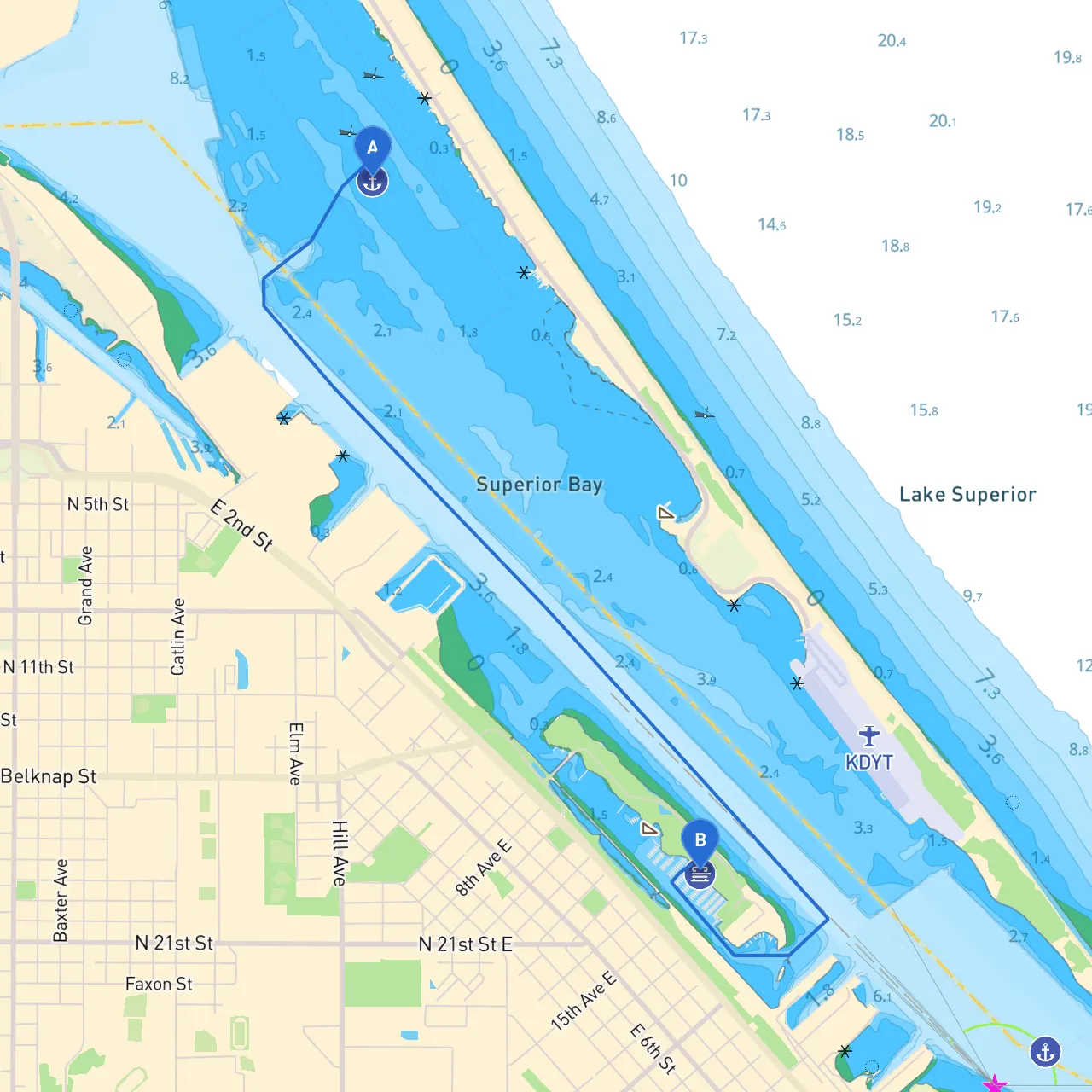
Starting Point: Duluth, Minnesota Ending Point: Superior, Wisconsin Distance: Approximately 7 nautical miles via the shortest navigable route
This short trip across the harbor of Duluth and into the waters of Superior, Wisconsin, presents an ideal journey for boater enthusiasts of all levels, from novice cruisers to seasoned sailors. With numerous points of interest, sheltered bays, and stunning views of Lake Superior, this route encourages an appreciation for the local scenery while prioritizing safety as you navigate these waters.
As you set off from Duluth, prepare to enjoy the spectacular sights of the Duluth-Superior Harbor. Make sure to adhere to harbor traffic rules, as it's a busy shipping area. The best starting point is from the public dock or marina facilities near Canal Park, where you can check conditions before you embark.
Key Navigational Aids:
As you move out into the harbor, be mindful of various recreational boaters and commercial vessels—staying vigilant is essential. Acknowledge the marked navigation channels established to keep the water traffic organized.
Hazards: Keep clear of shallow areas and dredged parts of the harbor. The water depths can change due to sediment, and it’s important that your vessel’s draft is suitable for the depth of water in this region.
1. The Aerial Lift Bridge: A unique feature of Duluth, this bridge lifts to allow boats passage—an iconic sight worth admiring before you embark.2. Canal Park: Stop along this part of the harbor if time allows. This area has waterfront dining and scenic parks perfect for a break.
As you leave the harbor, you’ll find St. Louis Bay to your right. This expanse offers sheltered anchorage should weather conditions turn unfavorable. The bay is also scenic for those looking to enjoy short nature hikes or simply relax while taking in the views of surrounding landscapes.
Shelter Option: Find a spot on the northeast shore for a protected anchorage, ensuring you are clear of any mooring zones designated for larger vessels.
Continuing across the bay, you'll need to pay careful attention to the Northeast and Northwest Piers of the Superior harbor, which serve as crucial markers for navigation into the final destination.
Navigational Aids:
Always check the latest marine weather reports before departure. Wind conditions can drastically change on Lake Superior, so be prepared with alternative routes or return plans. Familiarize yourself with local boating regulations and practices, especially regarding speed limits in residential waters and fishing zones.
For enhanced navigation and safety, consider downloading these essential boating apps:
This pilotage plan for cruising from Duluth to Superior encompasses a rich mix of safety, local phenomena, and scenic beauty. By prioritizing your safety while providing an engaging experience, this route is perfectly designed for all kinds of boaters looking for a memorable day on the water. With the right preparations and a spirit of exploration, you're bound to have an incredible journey! Safe travels!