
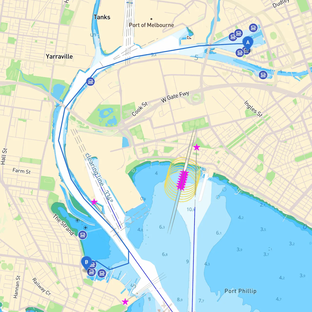
Pilotage Plan: Docklands, VIC, AU to Williamstown, VIC, AU
Route Overview:This delightful boating route from Docklands to Williamstown offers a scenic blend of urban vistas and stunning waterfront views. Covering a distance of approximately 5 nautical miles, it is suitable for a wide range of boaters, from novice to experienced sailors. Expect to navigate through bustling harbors and serene waterways, with options for shelter and attractions along the way.
Section 1: Starting Point - DocklandsCoordinates: (144.9416, -37.8195)
As you depart from Docklands, take in the impressive skyline and modern architecture. Before leaving, check for any last-minute updates on local weather conditions and any minor craft advisories. This area is well-marked, with plenty of navigational aids such as buoys and marina signs to guide you.
Notable Hazards:
Points of Interest:
Section 2: Heading West on the Yarra RiverOnce you’ve navigated through the bustling Docklands, steer westward on the Yarra River. Maintain a careful lookout for changes in current and watch for the transition from river to bay.
Shelter Opportunities:
Section 3: Entering Port Phillip BayAs you exit the Yarra River, you’ll transition into Port Phillip Bay. Here, be mindful of the varying tidal conditions that can affect your speed and navigability. The bay is generally well-marked with aids to navigation and channel buoys that signify safe passages.
Navigational Aids:
Section 4: Approaching WilliamstownThe final leg of your journey will take you closer to the picturesque waterfront of Williamstown, a vibrant, historical area with plenty of views to enjoy.
As you approach the shoreline, you’ll enter the busy waters frequented by ferries and fishing vessels, so keep a vigilant watch for traffic.
Points of Interest:
Local Restrictions:
Safety Considerations:
Conclusion:This route from Docklands to Williamstown promises a blend of urban and natural beauty, catering to boaters looking to experience the charm of both city and sea. With adequate shelter options, vibrant attractions, and essential navigational aids, it’s a memorable journey that encourages responsible and safe boating practices.
For a smoother experience, consider utilizing boating apps like Savvy Navvy, which provide real-time navigation support and hazard alerts to keep your adventure safe and enjoyable. Enjoy your day on the water!