Home
 /
 / 

Clarksville to Mt. Juliet by boat

Clarksville to Mt. Juliet

Distance - 92.2 Nm

Avg Speed
5 kts
10 kts
20 kts
30 kts
Time Estimate
18 hr 25 min
9 hr 12 min
4 hr 36 min
3 hr 4 min
Clarksville to Mt. Juliet

Clarksville to Mt. Juliet

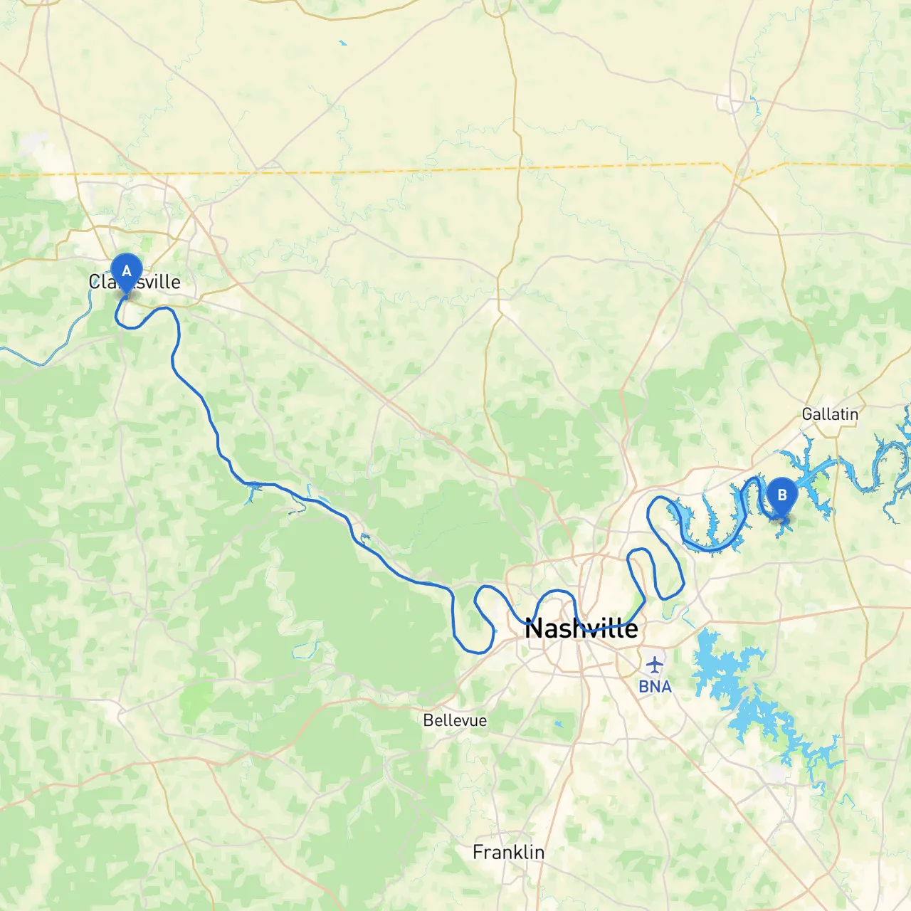
**Pilotage Plan: Clarksville, TN to Mt. Juliet, TN****Route Overview:** Embarking from Clarksville, Tennessee, and navigating to Mt. Juliet is not just a journey; it is an expedition that showcases the beautiful Tennessee landscape. This route offers several unique features, blending scenic views with potential spots for shelter and exploration along the Cumberland River, making it especially suitable for recreational boaters looking for a mix of tranquility and adventure. ### 1. **Starting Point: Clarksville, Tennessee**Clarksville serves as the launching point for your trip. The area is rich in history and natural beauty, providing a picturesque landscape as you set out onto the Cumberland River. Before you depart, consider visiting the historic downtown or exploring McGregor Park, which has lovely river views.### 2. **The Route Details**Your journey unfolds as you head south on the Cumberland River, winding through a mixture of residential areas and natural beauty. The river is well-marked, and following the navigational aids will ensure a smooth passage.- **Navigational Aids:** Keep an eye out for buoys and markers indicating safe navigational channels. The navigational charts provided by the U.S. Army Corps of Engineers will be particularly helpful. Familiarize yourself with regional maps or use savvy navvy for an interactive experience and to track your position in real time.### 3. **Points of Interest Along the Route**- **Natchez Trace Bridge:** As you approach mile marker 148, this stunning bridge can be a worthwhile sightseeing stop. It offers excellent photo opportunities and a chance to stretch your legs. - **Barkley Dam:** Located just downstream, this facility is worth a short visit if you're interested in the engineering marvels of the region. It's also a good fishing spot if time permits.- **Bays for Shelter:** - **Sandy Creek:** About halfway into your journey, Sandy Creek provides a safe haven if the weather turns inclement. It’s a natural cove that offers protection from strong winds and waves. - **Cedar Creek:** Another great option if the conditions deteriorate, Cedar Creek has enough space for temporary mooring and is relatively calm.### 4. **Local Regulations and Safety Considerations**As you navigate, be mindful of local speed limits, especially in residential areas. Always adhere to no-wake zones to ensure the safety of wildlife and fellow boaters. Familiarize yourself with the Tennessee boating regulations, including requirements for life jackets and emergency equipment. - **Weather Monitoring:** Before departure, ensure you check the weather forecast, as conditions on the water can change rapidly. Apps like Weather Underground could be useful, along with savvy navvy for real-time navigational updates.### 5. **Culmination at Mt. Juliet, Tennessee**Arriving in Mt. Juliet opens up a whole new set of activities. The city is known for its beautiful parks, such as the Charlie Daniels Park, which features walking trails and picnic areas. You could also explore local dining options or simply enjoy the serene view of the Cumberland at the waterfront.### ConclusionThis route from Clarksville to Mt. Juliet promises scenic vistas and numerous opportunities for exploration while emphasizing safety and navigation. Perfect for recreational boaters, couples, and families alike, it resonates with you whether you are a seasoned mariner or a leisure boater ready for a delightful adventure on the water. Always remember that awareness, preparation, and a respect for nature will ensure an enjoyable and safe experience.

More routes from Clarksville to Mt. Juliet

No items found.