
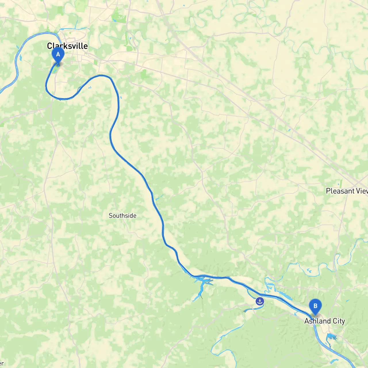
Pilotage Plan for Boat Trip from Clarksville, Tennessee to Ashland City, Tennessee
Route Overview
This delightful journey stretches approximately 37 nautical miles along the Cumberland River, offering beautifully scenic views and notable landmarks. Perfect for weekend boaters and experienced yacht masters alike, this route offers a blend of adventure and serenity. It's important to prioritize safety on this waterway, so let's dive into the details for your trip from Clarksville to Ashland City.
Starting Point: Clarksville, TN
Coordinates: Latitude 36.5097, Longitude -87.3693
Clarksville provides a vibrant embarkation point with comprehensive amenities, including fuel stations and dining options. Ensure to check weather conditions regularly, as clashing weather patterns can develop quickly on the river.
Midway Point: Points of Interest and Safe Havens
1. Barkley Lock and Dam: - As you navigate south on the Cumberland River, you’ll approach this key structure around the 25-mile mark. - Watch for navigation light markers that indicate the lock entrance. It's crucial to communicate your approach with VHF channel 16 or the designated channel for the lock. - Be aware of water level changes while traversing the lock, which can be a significant hazard if not noted.
2. Beech Bend Park: - This amusement park is a fun stopover, designed for families and thrill-seekers. It's located a short distance from the riverbank, making it accessible by using a smaller boat. Facilities for docking are available.
3. Cedar Creek: - A great protective area to take cover in case of sudden weather changes. Located roughly at the halfway mark, this creek provides an excellent get-out point for a break while enjoying the beauty of nature.
4. Piney River: - Another safe haven located south of Cedar Creek. This area offers beautiful surroundings. Limited facilities are here, but it’s a perfect spot for resting or fishing.
Important Navigation Considerations
Destination: Ashland City, TN
Coordinates: Latitude 36.2777, Longitude -87.0747
Upon arriving in Ashland City, you can embrace the small-town charm or scour for local dining. The area provides various docking facilities, making it convenient to explore once off the boat. As you approach, take in the beautiful landscapes that envelop the river.
Conclusion
This pilotage plan not only showcases the stunning scenery of the Cumberland River but also highlights essential safety measures and useful stopping points along the way. Whether you’re a leisurely boater or an experienced navigator, this route offers something for everyone while ensuring you stay safety-conscious throughout your adventure. Don’t forget to check local marine forecasts and have fun along the way! Safe travels!