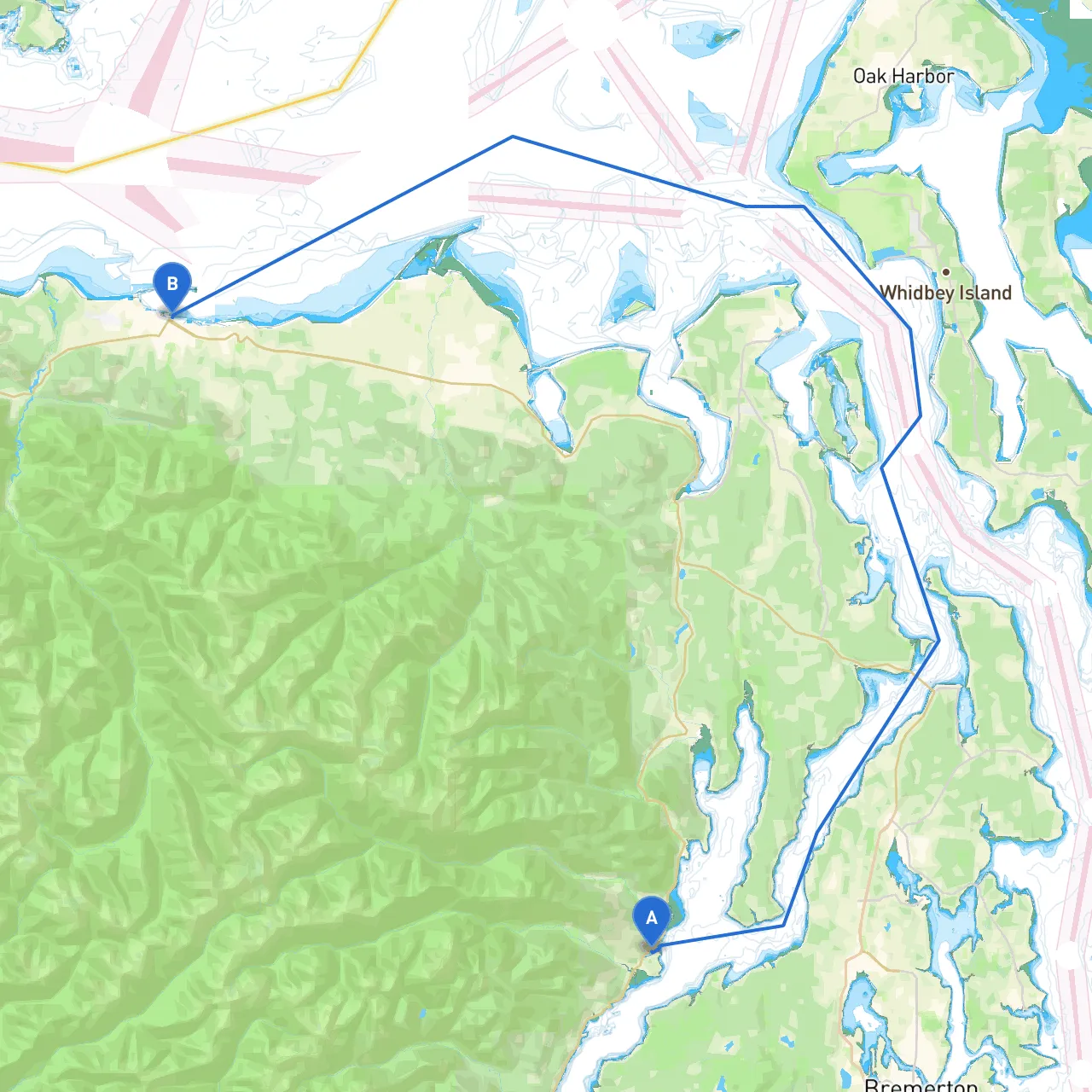

Overview:Setting off from Brinnon, Washington, to Port Angeles is an exciting trip through the picturesque waters of the Puget Sound and the Strait of Juan de Fuca. This route is particularly suitable for recreational boaters who enjoy scenic views while keeping safety as a priority. Let’s break down the journey into manageable sections, highlighting navigational considerations, notable locations, and potential shelter bays in case the weather takes a turn.
Coordinates:
Brinnon is an excellent departure point with easy access to the Hood Canal. Before setting out, ensure the vessel is equipped with safety gear, including life jackets, flares, and a working VHF radio. The weather can change quickly in this region, so checking the forecast is crucial.
Leg 1: Brinnon to Pleasant Harbor Distance: Approximately 8 nautical miles
Beginning your journey, head northwest along the Hood Canal. Look out for the entrance to Pleasant Harbor, a nice and safe anchorage. This secluded area can provide shelter if any inclement weather arises. The harbor is surrounded by towering evergreen trees and scenic hills, making it a wonderful first stop.
Navigational Aids: Be mindful of the navigational buoys marking the entrance to Pleasant Harbor. Maintain a close watch on your GPS or chart plotter, as the area can have shifting currents.
Leg 2: Pleasant Harbor to Dabob Bay Distance: Approximately 6 nautical miles
Departing Pleasant Harbor, set course for Dabob Bay. This bay is known for its rich wildlife and is a great spot for birdwatching. As you approach Dabob Bay, keep an eye out for crab pots; they are plentiful in this area.
Hazards: Watch for shoals and shallow areas around the bay. Navigating too far into these can lead to grounding, particularly during low tide.
Leg 3: Dabob Bay to Port Ludlow Distance: About 7 nautical miles
From Dabob, it’s a direct route to Port Ludlow. This area is ideal for a stopover; the marina here offers amenities like fuel, food, and restrooms. The picturesque setting provides a tranquil place to stretch your legs and enjoy the scenery.
Notes: There's a well-marked deep-water channel, but be aware of potential logging activities nearby. Always keep your distance from any vessels engaged in towing or setting logs.
Leg 4: Port Ludlow to Cape George Distance: Approximately 8 nautical miles
Sailing past Cape George, you’ll encounter beautiful coastal views and can expect to see marine life, including seals and the occasional otter. This section can be windy, so prepare for gusty conditions.
Navigational Aids: Keep the Cape George Lighthouse in sight as a landmark, as it guides you past this section. Additionally, pay attention to the buoys marking shipping channels; respecting these is critical for safe navigation.
Leg 5: Cape George to Port Angeles Distance: Roughly 12 nautical miles
As you approach Port Angeles, you’ll be navigating into the Strait of Juan de Fuca. This stretch can be particularly challenging due to tidal currents and ferry traffic. Ensure your vessel is in good condition to handle potentially rough seas. Along this leg, plenty of interesting sites can be seen on the coast, including the Olympic National Park.
Sheltering Options: If conditions worsen, the entry to Port Angeles provides good sanctuary, with Stellar Bay and the Port Angeles harbor offering good shelter from harsh winds.
Final Navigation Notes: Keep an ear on Channel 16 for marine traffic and any navigational warnings. The area is known for busy ferry routes, so be vigilant about right-of-way and ensure proper communication with nearby vessels.
Coordinates:
Upon reaching Port Angeles, you’ll find a bustling harbor with plenty of amenities. Take some time to enjoy the local attractions, including shops and restaurants, or simply take in the stunning views of the Olympic Mountains.
This journey from Brinnon to Port Angeles is full of vibrant sights and possible detours while offering a perfect blend of adventure and safety—ideal for recreational boaters looking to explore the beauty of the Pacific Northwest. Enjoy the voyage!