Home
 /
 / 

Boston to Provincetown by boat

Boston to Provincetown

Distance - 43.5 Nm

Avg Speed
5 kts
10 kts
20 kts
30 kts
Time Estimate
8 hr 41 min
4 hr 20 min
2 hr 10 min
1 hr 26 min
Boston to Provincetown

Boston to Provincetown

### Pilotage Plan: Boston, Massachusetts to Provincetown, Massachusetts#### Overview
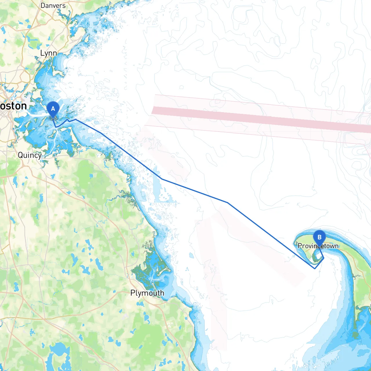
Embarking on a journey from Boston to Provincetown offers an exciting blend of historical coastal towns, breathtaking landscapes, and unique maritime experiences. This route is suited for recreational boaters who appreciate the charm of New England while navigating through potentially challenging coastal waters. It is essential to remain vigilant and plan adequately for safety, but the allure of this voyage makes it undeniably appealing.#### Section 1: Departure from Boston**Starting Point:** Boston Harbor **Coordinates:** Longitude -70.9365, Latitude 42.325As you set sail from Boston Harbor, keep in mind that this is one of the busiest ports in the United States. Be especially aware of commercial traffic, including ferries and cargo ships. The large ships often operate on predictable routes, but maintaining a safe distance is critical.**Notable Points of Interest:**- **Boston Lighthouse (The Boston Light) / Little Brewster Island:** A fantastic first landmark to spot, this historic lighthouse has stood since 1716. It is a great starting point for your journey.#### Section 2: Navigational Aids and HazardsAs you make your way through the harbor, pay close attention to navigational aids such as buoys, markers, and channel markers. Check local charts for updated positions of hazards, as sandbars and changing tides can present challenges.#### Section 3: The Route to ProvincetownThe course will take you directly eastward across the waters of Massachusetts Bay and into Cape Cod Bay. The distance is approximately 50 nautical miles, and depending on conditions, you can typically expect a travel time of around 5 to 7 hours.1. **Passage through the East Boston Channel:** This is your first stretch. Maintain a course that leads you through the designated channel to avoid any submerged hazards.2. **Navigating by Cohasset:** As you round the coast, the gorgeous town of Cohasset will come into sight. Although you may not anchor here, keeping it on your port side enriches the trip with views of quaint homes and rocky shorelines.3. **Scituate Harbor:** This charming harbor is an excellent backup shelter should weather conditions turn unpleasant. The harbor features a range of marinas and is known for its picturesque lighthouse.4. **Duxbury Bay:** Just off the route, Duxbury Bay presents another potential stopping point. The bay is well-known for its calm waters and beautiful beaches. It’s an ideal location for a brief respite and to enjoy a picnic or explore the shore.#### Section 4: Final Approach to ProvincetownAs you continue towards Provincetown, begin to pay attention to navigation markers as you approach the entrance to Cape Cod Bay. **Navigational Aids:**- The iconic **Race Point Light** is a critical landmark to keep in view, indicating you are nearing Provincetown. These waters can be tricky due to tidal currents, so approach with caution. #### Section 5: Arrival in Provincetown**Destination:** Provincetown Harbor **Coordinates:** Longitude -70.1745, Latitude 42.0525As you enter Provincetown, the vibrant atmosphere welcomes you. It’s known for its LGBTQ+ friendly community, art galleries, and stunning sea views. The harbor is relatively spacious, but do be aware of mooring regulations and local busy traffic with other recreational boats and whale-watching excursions.**Safety Considerations:**- Always monitor the weather reports for changes in wind conditions and potential storms.- Adhere to local boating regulations, including speed limits in certain zones, particularly near residential areas and tourist hotspots.#### Recommended Boating AppsTo enhance your experience and keep you safe while navigating these beautiful waters, I recommend the following mobile apps:- **Savvy Navvy:** This user-friendly app offers route planning, weather updates, and real-time navigation support, which is an absolute asset for any boater.- **Windy:** For wind and wave forecasts.- **Navionics:** For detailed nautical charts that can show depth and hazards.This itinerary from Boston to Provincetown promises to be not only a safe passage but a delightful experience. With the right precautions, local insights, and respect for the marine environment, your boating adventure will be memorable and enjoyable. Safe travels!

More routes from Boston to Provincetown

No items found.