
Coordinates: Long -70.9365, Lat 42.325
Coordinates: Long -71.01184483614202, Lat 42.31908222488573
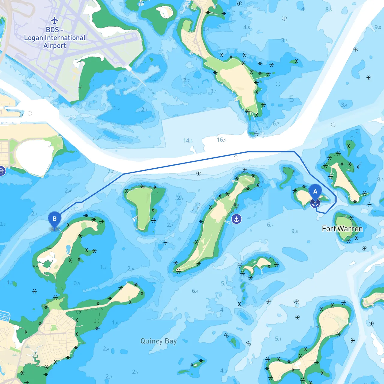
This route offers an excellent blend of picturesque views and navigational experiences suited for experienced cruisers and those who enjoy precise piloting. Navigating through the waters surrounding Boston requires attention to local regulations, wildlife, and the bustling harbor environment.
1. Boston Harbor Islands: As you depart from the city, the Boston Harbor Islands present an incredible opportunity for exploration. Spectacle Island and Georges Island have beaches, picnic areas, and historic forts. You can drop anchor here if you wish to take a break from boating and enjoy picnicking or even hiking.
2. Castle Island: A historical site home to Fort Independence, this island is easily reachable and worth a visit. It provides an opportunity for on-shore activities and a quick exploration of local history.
3. Approaching the Inner Harbor: As you traverse closer to the city, gaze upon the impressive skyline. Secure a vantage point by heading near the docks at the New England Aquarium or the Boston Tea Party Ships & Museum for a glimpse of local culture.
1. Weather Awareness: The New England coastline can change rapidly. Monitor forecasts closely, particularly during the summer months when thunderstorms can pop up. Ensure you have a reliable weather app and consider using radar for any unexpected storm. Local marine services may also provide real-time updates.
2. Busy Shipping Lanes: As Boston is a major maritime hub, expect heavy traffic from commercial vessels in certain parts of the harbor. Stay vigilant and maintain a safe distance from larger commercial traffic, particularly as you approach the shipping channels.
3. Navigational Aids: Pay attention to navigation buoys, especially in and around the harbor. Make sure to follow local charts and be familiar with the buoyage system in Boston's waters to avoid any hazards, particularly shoals and rocks.
4. Tide and Current: Understanding the tides is crucial as they can significantly affect your sailing experience. The tides in Boston can cause strong currents, particularly in the Mystic and Charles Rivers. Check tidal charts before you depart, as timing your journey with the tide can help maintain a safe and pleasant experience.
1. Hingham Bay: If conditions deteriorate, Hingham Bay provides a well-protected harbor to pause and reassess your journey. It's about a 10-nautical mile trip south, and conditions are often calmer here.
2. Revere Beach: If you find yourself further eastward, this location offers a break away from busy nautical traffic and the chance to relax onshore.
This route highlights some of Boston’s most charming spots, blending adventure with enriching historical context. As you navigate along this shoreline, you’ll experience the perfect mix of vibrant urban landscapes and serene islands, making it suitable for boaters who appreciate both safety and the joy of cruising.
As you plan your trip, do consider using helpful apps like Savvy Navvy to map your route effectively and stay updated on navigational conditions. Craftsmen sail through these waters best when equipped with knowledge and the right technology. Enjoy your journey and stay safe out there!