
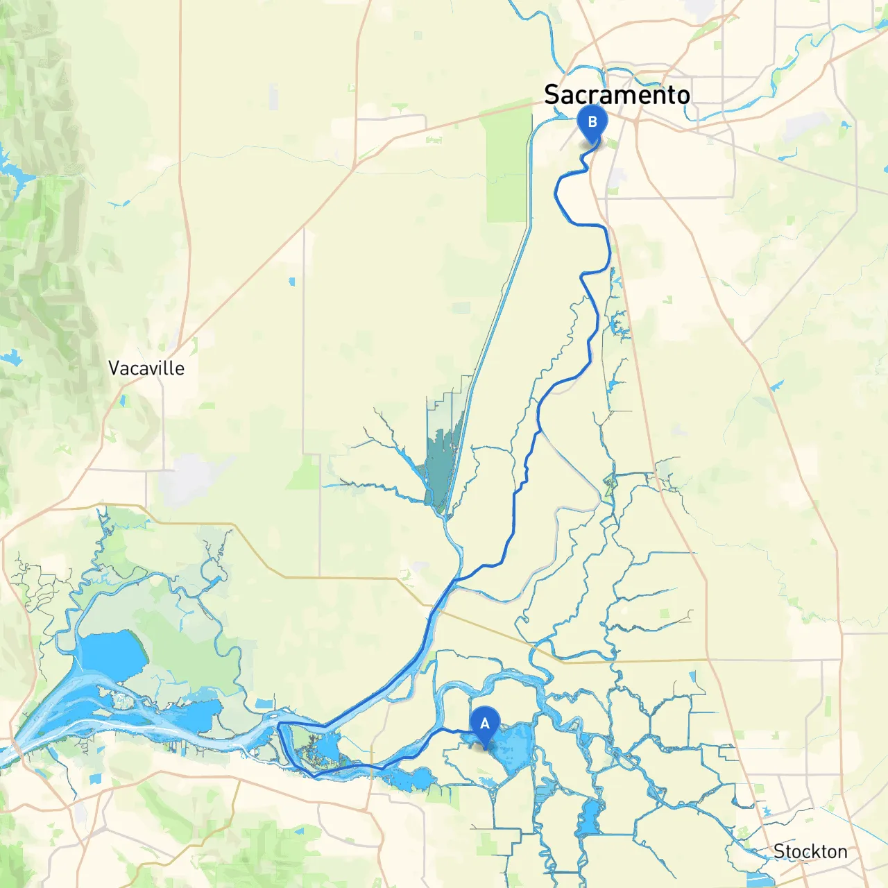
Pilotage Plan: Bethel Island, CA to West Sacramento, CA
Departure Point: Bethel Island, CAYour journey starts at Bethel Island, a quaint spot in the Sacramento-San Joaquin Delta, well-known for its picturesque settings and friendly marina facilities. Before you cast off, ensure all supplies are checked, and your vessel is in seaworthy condition. Make sure to account for the tides, as they can affect your cruising path.
Route OverviewThe route to West Sacramento is approximately 20 nautical miles and primarily navigates through the delta waterways. The passage consists of meandering channels, making it ideal for leisurely cruising. This route is particularly suitable for recreational boaters and those who enjoy exploring naturally scenic routes while staying vigilant about local navigational elements.
Section 1: Bethel Island to Franks TractAs you leave Bethel Island, head east towards Franks Tract. The channels can be narrow and winding, so maintain your speed at a safe level to avoid wake turbulence. The first significant point of interest is Franks Tract State Recreation Area, a great spot where you can anchor and explore if time allows. This area offers beautiful views and is a popular spot for birdwatchers and nature enthusiasts.
Hazards and Navigational Aids:Watch for shallower waters in certain areas, particularly near the edges of Franks Tract. Utilize channel markers to guide your way, paying special attention to the buoys that define the navigable areas. Be wary of other recreational traffic, as this location can get busy with small boats and personal watercraft.
Section 2: Through the Delta ChannelsContinue navigating through the delta channels towards your next waypoint. The next significant landmark is the confluence of the Sacramento River which you’ll navigate towards. Here, it's crucial to monitor your charts or a navigation app like Savvy Navvy for real-time updates on water currents and traffic conditions.
This stretch of the route offers stunning views, with lush wetlands and historic Delta towns dotting the shoreline. Make a note of potential shelters along the way such as the small bays and inlets, allowing for a safe haven if weather conditions change.
Section 3: Approach to West SacramentoAs you approach West Sacramento, you’ll be in the lower Sacramento River area. This segment presents a busy waterway, so extra caution is vital. Keep an eye out for large vessels and commercial traffic, as they can create significant wake which may affect smaller boats.
Navigational markers here are plentiful, guiding you safely towards the deep water channels. The West Sacramento marina is well-marked and provides all the amenities you may need upon your arrival.
Local Regulations and Restrictions:Along the way, you may encounter areas with specific speed limits and no-wake zones, especially near residential areas and marinas. Ensure you adhere to these regulations as they are in place for safety and to protect the local ecosystem.
Points of Interest:While you’re in West Sacramento, consider visiting the River Walk Park which offers excellent views of the river and provides amenities like picnic areas and paths for walking or cycling. If time permits, you may even want to stop at the nearby Old Sacramento area, rich in history and charm, offering plenty of dining and shopping options.
Safety First:Always carry a first-aid kit, PFDs for all passengers, and a reliable means of communication on board. Keep an eye on local weather reports and be prepared to alter your plans if rough weather is forecasted.
This route is perfect for local boaters looking for a peaceful day trip or families wanting to create memories on the water. With its blend of beautiful scenery and accessible shelter options, you can enjoy your journey while prioritizing safety and comfort. Make use of your navigation tools, and you’re bound to have a memorable adventure on the water!