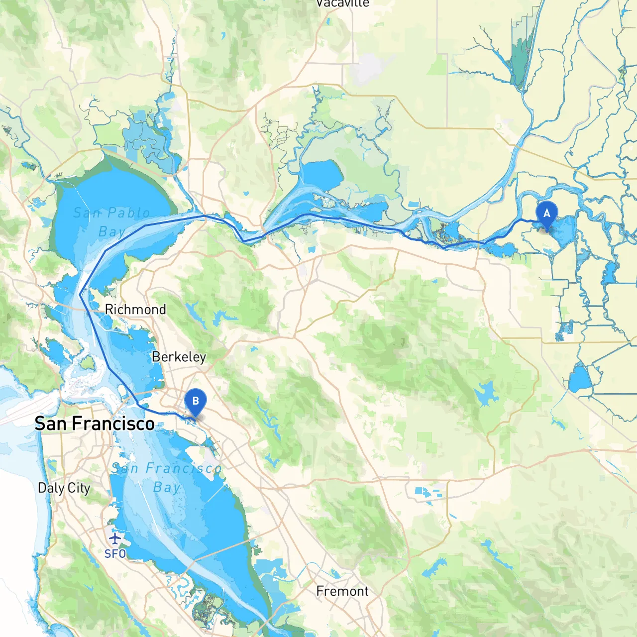
Begin your journey at Bethel Island, a tranquil spot nestled in the California Delta. Before departing, ensure that your vessel is fully equipped and that you’re familiar with your charts. The starting point is a boat-friendly area with easy access to the Delta’s winding waterways. As you prepare for departure, remember to check local weather conditions and tides, particularly as they can significantly affect your navigation.
Your route will primarily follow the Delta waterways, cutting through picturesque marshlands and channels before reaching the San Francisco Bay. It’s a well-loved route among seasoned boaters, combining natural beauty with various points of interest along the way.
1. Franks Tract State Recreation Area: Approximately 3 nautical miles from Bethel Island, this area offers a great opportunity for a short stop. It serves as a popular spot for picnicking and birdwatching. The waters here can become choppy, so keep an eye on the wind conditions.
2. Hogs Island: Located about 5 nautical miles down river, you can find shelter in the bays around this small island. It’s a great spot for fishing and enjoying the serene Delta ecosystem. Should the weather turn sour, Hogs Island provides good cover from strong winds.
3. Sacramento-San Joaquin Delta National Wildlife Refuge: A bit further along, this refuge is a must-see with its exquisite wildlife. It's a slightly longer detour but worth it for the breathtaking views and peaceful atmosphere.
4. Antioch Marina: Situated roughly 12 nautical miles from your starting point, this marina provides a perfect stop for refueling and refreshments. You can safely moor your vessel here, and there are several dining options nearby.
As you navigate from Bethel Island to Oakland, several pivotal navigational aids will assist you.
As you approach the San Francisco Bay area, be vigilant about strong currents and tides around the Carquinez Strait and San Pablo Bay. These areas can be challenging, especially for less experienced boaters.
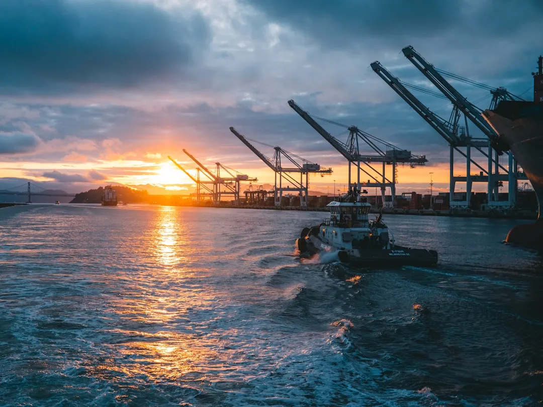
When you reach Oakland, you’ll find yourself navigating a bustling urban harbor, which brings its own set of challenges such as larger vessels, ferry traffic, and commercial shipping routes. Keep a sharp lookout for vessels, and make sure to adhere to any local navigational rules, especially during peak traffic times.
Though this journey from Bethel Island to Oakland may present some navigational challenges, the rewards include stunning wildlife, tranquil spots for breaks, and the dramatic skyline of Oakland as your backdrop upon arrival. This route is particularly suitable for recreational boaters who enjoy a mix of nature and urban exploration. Just remember: safety first! Always check the weather, adhere to local regulations, and keep your navigation aids at hand for a smooth journey. Enjoy your adventure on the waters!