Pilotage Plan from Bay Head, New Jersey to City of New York, New York
Overview
Embarking on a nautical journey from Bay Head, NJ, to the bustling metropolis of New York City promises a mix of scenic beauty, interesting landmarks, and fascinating navigational challenges. This route, while designed for safety and leisure, offers numerous opportunities for exploration and enjoyment along the Jersey Shore and into the New York Harbor. This plan is particularly suitable for recreational boaters, including experienced cruisers and those who enjoy a leisurely trip with a degree of sophistication.
Section 1: Departure from Bay Head, NJ
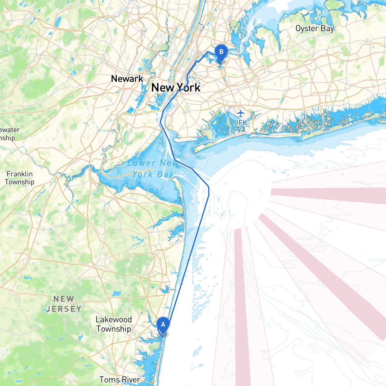
Starting Point: Bay Head, NJ (Coordinates: -74.0493, 40.0657)
Kick off your adventure by heading southeast from your starting point. As you set sail, make a note of the following navigational aids:
- Barnegat Inlet Lighthouse: This iconic lighthouse not only serves as a great waypoint but also offers splendid views and historical significance. As you approach the inlet, watch for aids marking the channel.
Hazards: The Barnegat Bay can have shifting shoals and depths change quickly. Stay within marked channels to avoid grounding.
Section 2: The Intracoastal Waterway (ICW)
After navigating at Barnegat Inlet, make your way toward the well-marked Intracoastal Waterway. Staying on the ICW will provide a sheltered route along the New Jersey coastline. Here are a few notable stops along the way:
- Shark River Inlet and the Shark River: This waterway is a well-protected area where you may take refuge should weather conditions decline. The inlet also offers a chance to explore local marine life.
- Belmar: A charming town where you can stop for refreshments, explore the local beaches, or even visit a seafood restaurant for a fresh meal.
- Point Pleasant Beach: This area isn’t just about the beaches; it’s also an opportunity for sightseeing and enjoying some local attractions.
Navigational Aids: Follow the green and red markers diligently, and pay attention to any notice boards indicating shallow areas or hazards. Tidal currents can affect your speed significantly in these parts.
Section 3: New York Harbor Approach
As you continue north, the approach to New York City begins to take shape. You will navigate past notable landmarks such as Sandy Hook and Raritan Bay.
- Raritan Bay: A spacious bay that provides ample shelter from inclement weather. It also offers stunning views of the coastline and skyline.
- The Statue of Liberty: As you near Manhattan, make sure to take time to view the Statue of Liberty and Ellis Island. These landmarks are not just sights to see—they are steeped in history.
Hazards: Pay close attention to the busy shipping lanes around the Verrazzano-Narrows Bridge. Keep a lookout for large vessels, including ferries, tugboats, and cargo ships.
Section 4: Entry into New York City
City of New York, NY (Coordinates: -73.8505, 40.7742)
Once you are through the Narrows, follow the markers leading into Upper New York Bay. All traffic rules apply here, and you must comply with speed limits and no-wake zones, especially around populated areas like Battery Park and the South Street Seaport.
- Points of Interest: After safely entering the harbor, consider a visit to the various marinas that offer docking facilities. Each location has unique attractions—consider a stroll around the Financial District, or a visit to the bustling neighborhoods of Brooklyn.
Local Regulations: Ensure you are familiar with local boating regulations, including observing no-wake zones, respecting marine life around the harbors, and maintaining communication with the Coast Guard if needed.
Safety Brief: Always wear your life jackets, keep an eye on your marine VHF radio for weather updates, and plan your return in daylight if possible.
Navigation Aids & Apps
Utilize navigational aids such as federal and state markers, and equip yourself with modern technology. Apps like
can assist in plotting routes, monitoring weather forecasts, and providing real-time tidal information. Other recommended boating apps include:
- Navionics: For chart plotting and navigational insights.
- US Coast Guard's Mobile App: It provides safety tips, boating regulations, and links to local resources.
This trip from Bay Head to New York City is not just a journey; it’s a navigational adventure filled with stunning views and opportunities for stops along the way. Prioritize safety with every turn you take, and enjoy each moment on the water. Happy cruising!