
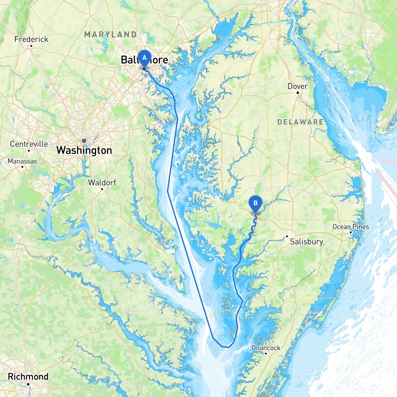
Route Overview This journey from Baltimore, Maryland, to Vienna, Maryland, spans approximately 70 nautical miles, primarily through the scenic waterways of the Chesapeake Bay. It is a delightful mix of rich history, natural beauty, and safe navigational routes, ideal for boaters looking for a day or weekend getaway.
Starting Point: Baltimore Harborside Coordinates: -76.6099166667, 39.2849
As you leave the bustling harbor of Baltimore, take a moment to appreciate the iconic skyline and maritime activity. This is a perfect place for boaters of all skills, given the availability of facilities and services. Before departing, ensure your vessel's safety gear is in order and familiarize yourself with local harbor regulations.
Navigate westward along the Patapsco River towards its mouth. Keep an eye on the navigational aids such as buoys marking the channel. The Patapsco can be busy, so maintain a safe speed and be alert for commercial vessels and recreational traffic.
Shelter Stop: Magothy River As you approach the mouth of the Patapsco River, consider a potential stop at the Magothy River for shelter. It's a lush area known for its quiet coves and picnic spots.
Once you emerge from the river, you’ll enter the vastness of the Chesapeake Bay. Here, majestic sailboats and fishing vessels are commonplace. The open waters provide beautiful views, but remember to watch for shifting winds and wave patterns.
Important: The Bay can sometimes be unpredictable; always check the weather forecast and have emergency plans in case of sudden changes.
Cruising towards Kent Island, look out for the popular Kent Island Narrows. Not only is it a picturesque area, but it also boasts great local restaurants and marine services. Anchor here for an idyllic lunch stop, enjoying local seafood and the charming waterfront.
Shelter Opportunities: In case of inclement weather, Kent Narrows is a good place to take shelter. The area has multiple marinas and safe harbor facilities.
The entrance to the Choptank is marked and well-defined. This stretch is rich with wildlife and beautiful shorelines. The tranquility of the river is perfect for boaters looking to relax and soak in the environment.
As you approach Vienna, you will find laid-back charm and picturesque views. The town is small but filled with friendly locals and has several attractions worth visiting, including local showcases of history and natural beauty.
Navigational Considerations: The Choptank River can have strong currents; be cautious when navigating here, especially during peak tidal changes. Follow any local notices regarding regulations, maintaining an awareness of any wildlife protection areas as you near the shore.
This trip captures the essence of Chesapeake Bay boating. It’s a perfect route for cruising, fishing, and simply enjoying the natural landscape. From the lively city of Baltimore to the quiet charm of Vienna, this pilotage plan keeps safety at the forefront while inviting you to enjoy all the sights and sounds along the way. Make sure you have a trusted navigation app on hand, such as savvy navvy, to assist you in route planning and real-time navigation, and remember to adhere to all local boating regulations.
Bon voyage, and enjoy your maritime adventure!