
Pilotage Plan: Baltimore, Maryland to North East, Maryland
Embarking on a journey from Baltimore to North East offers a delightful blend of scenic views, historic landmarks, and safe harbors. This route is particularly suitable for recreational day cruisers and weekend sailors looking for a relaxing getaway while keeping safety a top priority.
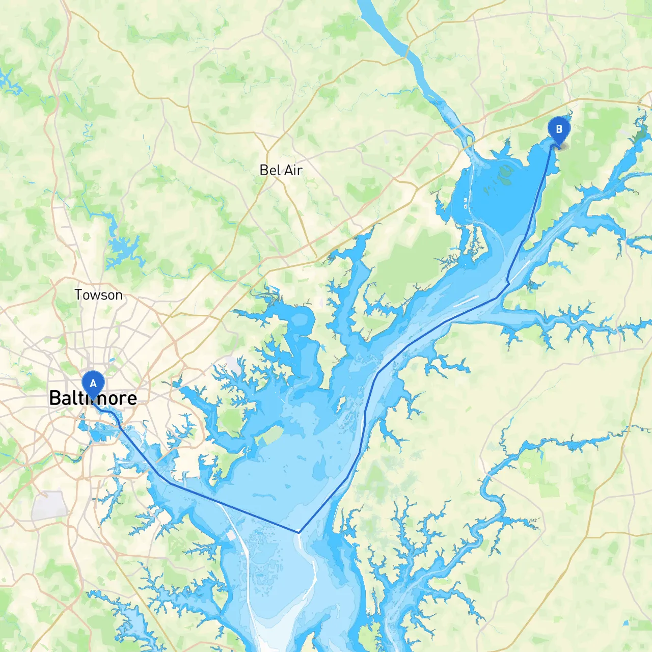
Starting Point: Baltimore, Maryland Your journey begins at the well-known Inner Harbor of Baltimore. This bustling area serves as a great place to stock up on supplies, fuel, and enjoy unique attractions such as the National Aquarium or the Maryland Science Center before setting off.
1. Departing Baltimore: Starting your journey, you’ll navigate past the Key Bridge, keeping to the 2 nautical mile channel where significant commercial traffic can be found. Pay attention to the markers and buoys; ensure you're adhering to navigation charts that indicate depth and hazards.
2. Heading Down the Patapsco River: As you exit the harbor, you’ll enter the Patapsco River. Continue to follow the river southwest toward the Bay. Be mindful of the strong currents, especially near the approaches to Fort McHenry, where historical ships often anchor.
3. Entering the Chesapeake Bay: Once you reach the mouth of the Patapsco River where it meets the Chesapeake Bay, you’ll find yourself in open waters. This is a great place to enjoy the vastness of the bay, but watch out for shifting winds that can create choppy conditions.
4. Navigating the Bay: Stay east of the shipping channels marked with buoys as you make way toward the Northeast River. You’ll follow the bay northbound, keeping a lookout for navigation aids. The lighthouse at Sandy Point serves as a great visual marker on your route.
Upon departing from Chester River, continue north, frequently checking your depth sounder and closely following the channel buoys toward the North East River. The entry to the river is well-marked, but be cautious of shallows on either side.
North East, Maryland:Your destination can be found at the mouth of the North East River, just off the bay. The river has a welcoming atmosphere, with several marinas and waterfront dining options. Don’t hesitate to explore the quaint town, known for its charming shops and friendly community feel.
Enhance your journey with mobile applications to assist navigation and safety:
In summary, this route from Baltimore to North East is not only a safe passage but a delightful exploration of the Chesapeake Bay. With ample opportunities to enjoy the natural beauty and local culture, it promises both adventure and serenity on the water. Safe sailing!