
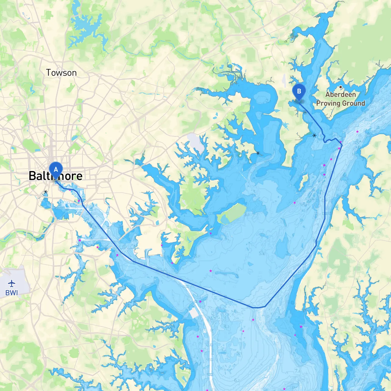
This scenic route from Baltimore to Edgewood, Maryland, presents a unique opportunity for boaters to explore the beauty of the Chesapeake Bay and its surrounding waterways. While safety is our priority, the journey also offers points of interest and potential shelter should the weather become unfavorable. The route is well-suited for leisure boaters, especially those looking for a short day trip filled with both relaxation and exploration.
Your journey will take you approximately 25 nautical miles northeast from Baltimore Harbor to Edgewood on the Bush River. This route predominantly follows the Patapsco River and the Upper Chesapeake Bay, featuring plenty of navigational aids, landmarks, and safe havens.
2. Patapsco River Navigation - Head upstream on the Patapsco River, maintaining a lookout for the Francis Scott Key Bridge (a good landmark). Stay alert for commercial traffic which can be frequent in this area. - Hazards: Be cautious of strong currents, especially during tidal changes.
3. Approaching the Key Bridge to the Colgate Creek - After passing under the Key Bridge, you’ll have options to explore Colgate Creek, which provides sheltered anchorage spots.
4. Port Deposit & Conowingo Dam - If you have time, a detour to Port Deposit can be worthwhile. It's a picturesque spot where you could drop anchor and briefly explore the charming town. - Pay attention to the Conowingo Dam, around 14 nautical miles from Baltimore; this can influence water levels.
5. Nearing Edgewood - Continue downstream into the Bush River, keeping an eye on the buoys and ensuring you abide by any navigational restrictions in the region. - Approaching Edgewood, you will find the river widening, providing beautiful views of the surrounding nature.
- Historic Havre de Grace: A short detour will bring you to this quaint town known for its maritime history and lighthouse. - Conowingo Dam: A powerhouse in the region, it's fascinating for those interested in local ecology.
This journey from Baltimore to Edgewood is not only an excursion to explore stunning waterways but also an excellent opportunity to hone cruising skills. Ideal for calm days and suited for moderate boaters, the route is abundant in charm, but always prioritize safety and situational awareness. Enjoy your adventure on the water!