
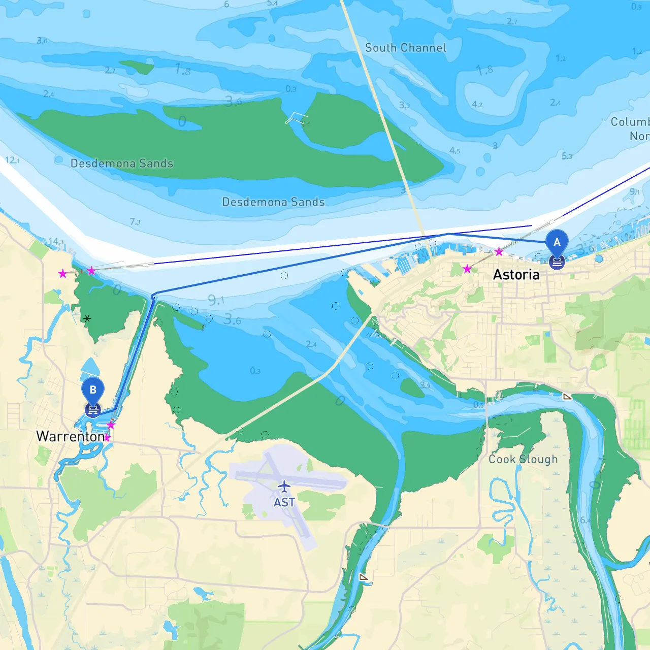
Departure: Astoria, Oregon Destination: Warrenton, Oregon
Overview: This trip from Astoria to Warrenton covers approximately 13 nautical miles through the picturesque waters of the Columbia River estuary. Suitable for experienced boaters and novices looking to gain confidence in their seamanship, this inland waterway journey is relatively protected, with ample opportunities for sightseeing and shelter should weather conditions turn unfavorable. Adverse weather can arise quickly in this region, making careful planning essential.
1. Astoria Riverwalk: Start your journey at the vibrant Astoria Riverwalk, where you can take in the historic waterfront and the iconic Astoria-Megler Bridge. Enjoy the views, and take a moment to appreciate the thriving maritime heritage before you set sail.
2. Hammond Marina: As you head out, consider a short detour to the Hammond Marina. Not only does it offer temporary docks for snacks or stretches, but it’s also a fantastic spot to witness pelican congregations and kayakers braving the waters.
3. Fort Stevens State Park: This historically significant park is located on the northern side of the Columbia River bar. A stop here means a chance to explore the remnants of coastal defense structures. It’s an enriching cultural interlude from your boat.
As you navigate from Astoria to Warrenton, watch for shallow areas and tidal fluctuations that can necessitate extra caution. The Columbia River is known for its powerful currents; hence, pay attention to the tidal charts before departing.
Hazards to Note:
1. Departure from Astoria: Set southeast from the marina, line yourself up past the buoys marking the Astoria shipping channel. Maintain a slow speed until you are well away from the docks.
2. Heading to Warrenton: As you navigate eastward towards Warrenton, hug the northern bank of the river. The currents here can be tricky, especially near tidal shifts, so consult local current tables for the most favorable time to travel.
3. Landmarks Along the Route: Keep the stunning view of the coastal cliffs and Fort Stevens in sight; they are perfect visual points of reference as you approach Warrenton. The lighthouse near the entrance can help confirm that you are on the right path.
As you navigate, pay careful attention to:
For the best experience while at sea and to stay compliant with navigational safety, consider downloading these essential boating apps:
This journey from Astoria to Warrenton is a delightful venture through the historical and natural riches of the Columbia River estuary. The balance of safe navigation, adequate shelter options, and a connection to local attractions makes this trip a fulfilling experience for any boater. Always prioritize safety, but embrace the adventure ahead.