
Pilotage Plan: York, Maine to Kittery, Maine
Route Overview:Embarking on this delightful journey from York to Kittery offers an exquisite opportunity to explore the scenic beauty of the Maine coastline. This passage is particularly suitable for experienced leisure boaters looking for a moderately sheltered route, showcasing picturesque coastal views, historic landmarks, and safe haven bays, should weather conditions change unexpectedly.
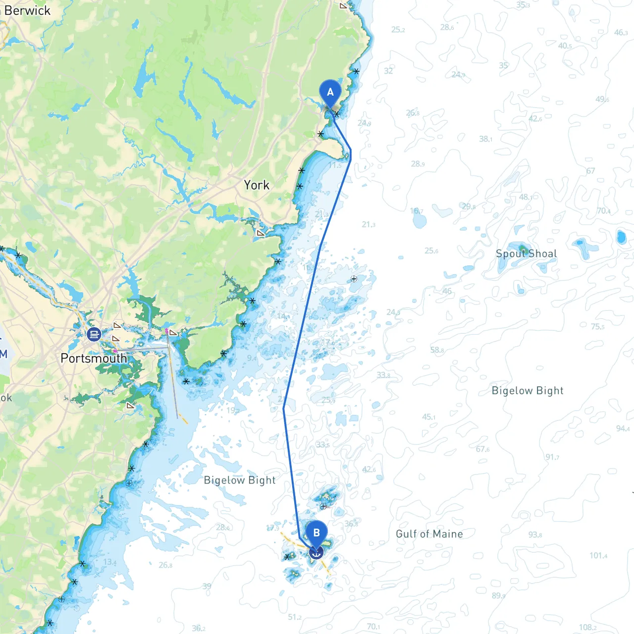
Departure from York, Maine:You’ll start your trip from the beautiful sandy shores of York Beach, where the Atlantic Ocean stretches out in all its glory. As you set sail, check your navigation system for all relevant charts and weather updates. Daylight savings and tidal charts play an essential role in ensuring a smooth voyage; hence, plan your departure around the local tidal schedule to avoid unnecessary navigation hurdles.
Notable Hazards and Navigation Considerations:Be aware of the rocky outcrops and tidal currents as you depart. Dangerous spots like the Nubble Light, a beautifully iconic lighthouse off Cape Neddick, requires respect. Maintain a safe distance, as swells can be unpredictable near lighthouse areas. As you approach Cape Neddick Point, the waters may become choppy, so keep a close watch on weather conditions.
Points of Interest and Landmarks:As you continue along the route, you’ll encounter several noteworthy spots. The calm waters by the Marginal Way in Ogunquit are worth a stop. It’s famous for its scenic oceanfront walkway. A brief anchorage here allows you to step ashore for a leisurely stroll or grab a bite at local eateries offering fresh seafood.
Sheltering Bays:If weather conditions begin to worsen, consider diverting into Ogunquit River. This protected inlet offers excellent shelter and has a narrow entrance; however, it's well-marked and navigable for moderate-sized boats. If you’re feeling adventurous, don’t forget to explore the tidal flats. Furthermore, Wells Harbor also offers a safe haven, complete with local services that can assist should you find yourself in need.
Navigational Aids along the Route:Throughout your journey, keep an eye on navigation markers. The Isles of Shoals will be on your starboard side—while these islands are beautiful, they are heavily exposed and should be approached carefully. You’ll see navigational buoys marking the routes through the area; fellow boaters often recommend using a combination of paper charts and GPS for safety. Ensure you’re familiar with AIS (Automatic Identification System) data, as you will likely intersect with other vessels, especially near busy inlets.
Local Regulations:Particular areas may have speed limits and boating restrictions to protect local wildlife. As you approach Kittery, be aware of the busy shipping lanes, particularly around the Piscataqua River. Watch for commercial vessels, and maintain a vigilant lookout for signs marking restricted zones.
Approach to Kittery, Maine:As you ease towards Kittery, the waters become calmer. The scenic views of Old Fort McClary, located on the Kittery side, present a great photo opportunity and provide historical context for this seaside town. Consider a quick visit to the fort after anchoring; it offers a peek into Maine’s colonial past and stunning views of the river and surrounding area.
Recommended Boating Apps:For added safety, consider incorporating boating apps into your cruising routine. Savvy Navvy is highly recommended for its user-friendly interface and detailed charts. You may also check MarineTraffic for real-time vessel tracking and information, and Navionics for comprehensive charts and community updates.
In a nut shell, this passage from York to Kittery not only provides safety but also an enriching experience as you soak in the coastal charm of Maine. Prepare for a magnificent adventure where nature and history seamlessly entwine. Happy cruising!