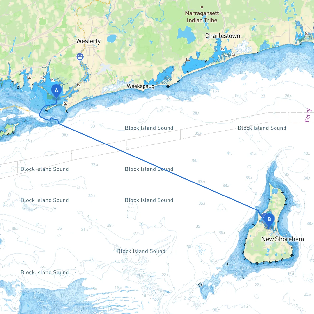
Pilotage Plan: Westerly, Rhode Island to Block Island, Rhode Island
Starting Point: Westerly, Rhode Island, USA Ending Point: Block Island, Rhode Island, USA
This picturesque journey across the waters surrounding Rhode Island is perfect for seasoned boaters and newcomers alike. The passage offers stunning views, opportunities to explore beautiful bays, and safeguards against unforeseen weather changes.
Route Overview
The distance from Westerly to Block Island is approximately 12 nautical miles. This trip generally takes a few hours, depending on conditions, and the route traverses the waters of the Atlantic, along with glimpses of local historic landmarks and beautiful natural formations.
Major Points of Interest and Notable Landmarks
1. Westerly River Entrance: As you depart, enjoy the sight of the charming waterfront homes and busy marina life. Keep an eye out while navigating the Westerly River mouth, which can be tricky at low tide.
2. Misquamicut Beach: Located just to the south of Westerly, this beach is a popular spot for swimming and sunbathing. It's a great place to stop if you'd like to stretch your legs for a bit.
3. Napatree Point: A beautiful barrier beach that protects Little Narragansett Bay, Napatree Point offers a serene location to anchor or beach your boat for a short hike to enjoy sweeping views of the ocean.
4. Watch the ferries at Point Judith Light: As you approach Block Island, this historic lighthouse is a vital navigation aid. It stands as a landmark, particularly for larger vessels, and can provide shelter if conditions worsen.
Shelter and Safe Havens
- Napatree Point: This location offers a protected haven with calm waters, especially favorable if wind and wave conditions become challenging.
- Point Judith Harbor: Situated near the mainland, this harbor can provide a safe alternative for seeking refuge in case of sudden weather conditions.
Navigation Considerations
As you embark on your journey, speed, wind, and current conditions are vital elements to factor into your navigation plan. Ensure that you:
- Monitor Weather Conditions: Always check local forecasts and updates; Rhode Island weather can change quickly. Make use of reliable apps like Savvy Navvy to stay updated with weather and tide information.
- Pay Attention to Navigational Aids: Use buoys, markers, and the renowned Point Judith Lighthouse as reference points to maintain your course and avoid hazards.
- Be Mindful of Fishing Areas: Several commercial and recreational fishing waters exist along the route, so watch for buoys marking gear and always adhere to local regulations regarding marine life.
- Keep an Eye on Traffic: This isn’t a remote body of water; expect to encounter other boaters, fishing vessels, and possibly larger ships, particularly as you approach Block Island. Maintain a safe distance and be vigilant about right-of-way rules.
Local Regulations and Restrictions
- Familiarize yourself with any state-mandated speed limits, particularly near marinas.
- Review local regulations on fishing and anchoring, as certain areas may have restrictions during peak seasons.
- Always ensure that your vessel has the required safety equipment: life jackets, flares, a fire extinguisher, and a first-aid kit.
Conclusion
This passage from Westerly to Block Island combines designated locales for shelter and a breathtaking on-water adventure along the scenic Rhode Island coast. The natural beauty, recreational options, and historical landmarks will undoubtedly make this trip memorable. Enjoy the open waters and sail safely!