
Pilotage Plan: Wellfleet, Massachusetts to East Boston, Massachusetts
IntroductionThis journey from Wellfleet to East Boston is an exciting and scenic passage that not only offers the thrill of coastal cruising but also provides substantial safety measures for boaters. With its wealth of natural beauty, vibrant coastal life, and occasional challenges in navigation, this trip is suitable for intermediate to experienced boaters seeking a blend of adventure and relaxation.
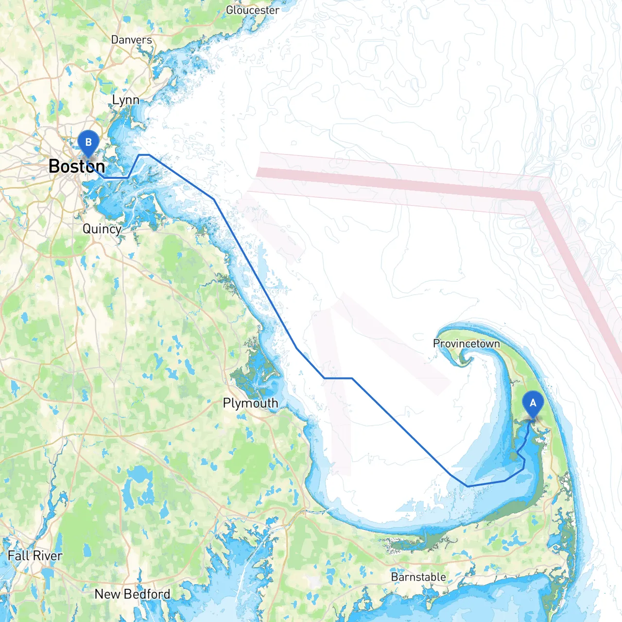
Route OverviewThe route is approximately 60 nautical miles, taking you from the tranquil waters of Wellfleet, through the Cape Cod Bay, around the iconic Boston Harbor Islands, and finally into the bustling harbor of East Boston. While there are several landmarks and points of interest along the way, boaters should also remain vigilant of local hazards and navigational aids that are crucial for a safe and enjoyable voyage.
Section 1: Departure from WellfleetAs you depart from Wellfleet’s protected harbor, keep an eye on the tidal currents, especially the outgoing tide that can create a challenging chop in the outer bay. Wellfleet itself is surrounded by stunning beaches and the impressive Wellfleet Bay Wildlife Sanctuary, making it a perfect starting point for adventure.
Section 2: Navigating Cape Cod BayOnce clear of the Wellfleet Harbor, head northeast toward the outer bounds of Cape Cod Bay. Below you will encounter Truro and P-Town, which can be excellent temporary stops to refuel or restock if needed.
Pay attention to navigational aids such as the "Cape Cod Light" and the "Race Point Light" off the tip of Provincetown, which are crucial for guidance, especially in reduced visibility. Cape Cod Bay is relatively shallow, and boaters should be mindful of submerged hazards and the incredible shifting sands during low tide.
Section 3: Entering Boston HarborAs you approach the Boston Harbor area, the scenery begins to change dramatically. The harbor is wide and busy, filled with commercial traffic, recreational boats, and stunning views of the city skyline. Make sure to prepare for intricate navigation through several marked channels. Notable navigational aids include the "Boston Light" situated on Little Brewster Island, a historical site as the oldest lighthouse in the U.S.
Section 4: Points of InterestThere are several popular landmarks en route, including:
Section 5: Shelter BaysSeveral bays along the route offer safe harbor in case of bad weather:
Section 6: Navigational Regulations and HazardsPay attention to the local regulations regarding no-wake zones, especially around populated areas and near ferry routes. The Boston Harbor also has regulated deep-water shipping channels; maintain a lookout for large vessels that may be moving quickly and may not be as maneuverable.
Safety ConsiderationsAlways check local weather forecasts before departure and remain updated on conditions during the trip. Ensure you have proper safety gear on board, including life jackets, flares, a functioning VHF radio for communication, and a detailed chart of the area.
Recommended Navigation AppsFor a smooth cruising experience, consider utilizing excellent navigation technologies. Savvy Navvy is a top choice among boaters for its user-friendly interface and comprehensive charting. Additionally, apps like Navionics and Windy can provide enhanced weather insights along with important navigational details.
ConclusionThis route from Wellfleet to East Boston is characterized by natural beauty, historical significance, and a sense of freedom that comes with coastal cruising. By prioritizing safety and being well-prepared, boaters can enjoy everything this trip has to offer while creating lasting memories on the water.