Route Overview
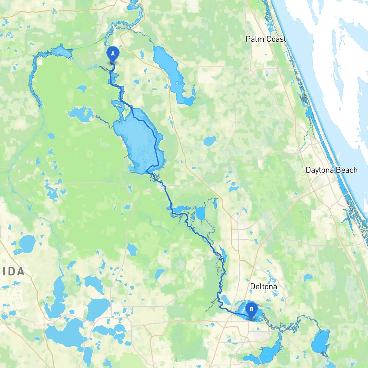
Embarking on this journey from Welaka, Florida, to Sanford, Florida, offers not just a scenic cruise through the winding waterways and lush landscapes of the St. Johns River but also an opportunity for solace and enjoyment. This route measures approximately 20 nautical miles and is suitable for all boating enthusiasts, particularly those who appreciate nature and seek sheltered bays to anchor in case of sudden weather changes.
Coordinates: Longitude -81.6804, Latitude 29.4870 Distance to Sanford: Approximately 20 nautical miles
Welaka, a small town situated on the banks of the St. Johns River, is a perfect launch point. Before setting off, consider refueling and checking local amenities, as this quaint community will give you a warm welcome. Don't forget to note the local weather conditions as they can change unexpectedly.
Take a moment to visit Welaka State Forest, just a short trip south on the river. The park offers beautiful trails and wildlife observation, making it a beneficial stop for a break before you navigate onward.
Navigational Waypoints & Hazards
1. Initial Leg (Welaka to the Rainey Point) - Depart Welaka and head south on the St. Johns River. The first key landmark you will pass is Rainey Point, a decent shelter option incase of changing weather conditions. Always pay attention to local buoys and markers; there can be low spots due to shifting sandbars.
2. Second Leg (Rainey Point to the Hontoon Island State Park) - Continue downriver towards Hontoon Island State Park about 7 nautical miles away. This park features pristine nature trails and is a popular spot for picnic lunches or a brief hike. Keep an eye on markers, as the river can shift, and currents may become stronger approaching this area.
3. Navigating the Channel After Hontoon - After Hontoon, watch for the channel narrowing, which can cause confusion. The St. Johns River is normally deep, but shifting channels can lead to unexpected shallows. Maintain a vigilant lookout for local traffic, including fishing boats and recreational crafts.
Coordinates: Longitude -81.2633, Latitude 28.8150
Upon reaching Sanford, you find a larger city with various amenities, dining options, and opportunities for exploration, such as the Central Florida Zoo and Botanical Gardens, or a walk along the Lake Monroe waterfront with stunning views.
This trip from Welaka to Sanford is an excursion that boasts natural beauty and ample opportunities to explore. As with any boating journey, safety is paramount. Be alert for weather changes, navigate using updated charts, respect local regulations, and enjoy the adventure along the winding waterways of Florida.
To enhance your experience and stay informed, consider using the following apps:
Embarking on this route not only ensures a beautiful experience but prioritizes safety amidst Florida's stunning landscape. Happy cruising!