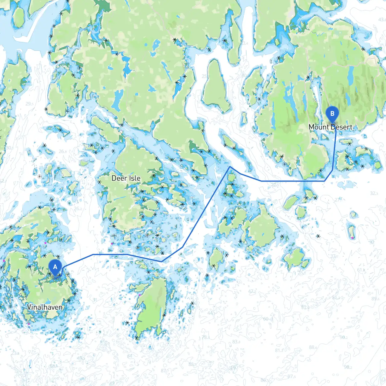
Pilotage Plan from Vinalhaven, Maine to Northeast Harbor, Maine
Starting Point: Vinalhaven, Maine (44.087, -68.812)
Vinalhaven is a beautiful island community well-known for its rugged coastline, lobster fishing, and charming harbor. As you prepare to depart, check the local weather conditions and ensure that your vessel is equipped for the open waters. The waters can be quite dynamic, so adequate preparation is key.
Planning Your Course:
Your journey will take you approximately 20 miles south to Northeast Harbor, Maine. This route is well-suited for experienced sailors and boaters who enjoy coastal navigation amidst stunning scenery and the chance to encounter local wildlife.
- Setting Sail: Start by exiting Vinalhaven Harbor.
- Pay close attention to the harbor entrance, as currents can be strong. Follow the buoys that mark the channel, ensuring you stay within the designated navigation area.
- Navigating the Vinalhaven Narrows:
- After leaving Vinalhaven, you’ll encounter the Vinalhaven Narrows. This area is crucial to navigating safely. Take note of the rocks and shoals nearby. Use your chartplotter or marine GPS to maintain your bearings as you pass through.
- Watch the tides here; it's essential to sail during favorable tidal conditions to avoid getting caught out in shallow areas.
- First Point of Interest: The “Grindle Point” Lighthouse:
- As you make your way south, you will spot the Grindle Point Lighthouse on nearby Isle au Haut to your east. A great spot to take a photo or simply enjoy the views; it’s about 2 nautical miles from Vinalhaven. If the weather allows, consider a quick visit to Isle au Haut, a charming island with hiking trails and scenic vistas.
- Heading Towards the Deer Isle Archipelago:
- Continuing towards Northeast Harbor, watch for the Deer Isle Archipelago. This area is dotted with small islands and is a perfect place to stop if you need to seek shelter. Look out for the protected waters of “Blue Hill Bay,” which can provide a safe haven in case the weather turns rough.
- Navigating Account for Local Hazards:
- Be cautious of the various rocks and ledges scattered throughout the waters. Use buoyage systems and visual aids to navigate safely, and keep an eye on local fishing vessels, particularly when approaching Deer Isle, where lobster traps are prevalent.
- Mid-Point Anchorages:
- If you’re looking for a mid-journey rest, “Brooklin” is a quaint village nearby that offers anchorage and a charming atmosphere. You can enjoy the views of the Penobscot Bay while anchoring for a break.
- Final Leg: Approaching Northeast Harbor:
- As you start to enter Northeast Harbor, ensure you’re aware of the right navigation markings. The harbor entrance is well-buoyed, but verify your charts as this area has busy traffic with seasonal boaters and local fishermen.
- Don’t forget to look for the famous “Eagle Island,” a historic site marking the home of Admiral Peary, which can be seen from your approach to the harbor.
Important Navigational Aids and Safety Considerations:
- Use your VHF radio to stay in touch with local communications, particularly channel 16 for emergencies and channel 9 for local hailing.
- Be aware of any local regulations, especially regarding speed limits in certain areas and zones where fishing is restricted.
- Always keep a lookout for navigation buoys, especially the red and green markers that indicate your passage through channels.
Emergency Bailing and Shelter Options:
In case of sudden weather changes:
- The coastline is blessed with numerous bays and secluded inlets—such as “Blue Hill Bay” and “Somes Sound” near Acadia National Park—that can provide safe anchorage.
- Always have a safety kit onboard, including life jackets, flares, and a first aid kit, ensuring that you have the essentials in case of an emergency.
Recommended Apps:
To enhance your navigational experience, consider using savvy navvy for accessible and precise charting alongside other popular marine apps. These tools can provide real-time weather updates and detailed navigation assistance.
Conclusion:
This route from Vinalhaven to Northeast Harbor is a delightful mix of adventure and scenic coastal views, perfect for those with experience navigating Maine's coastal waters. With ample opportunities to explore, anchor, and enjoy the incredible landscapes, this piloting plan emphasizes safety while ensuring a memorable boating experience. Safe travels!