
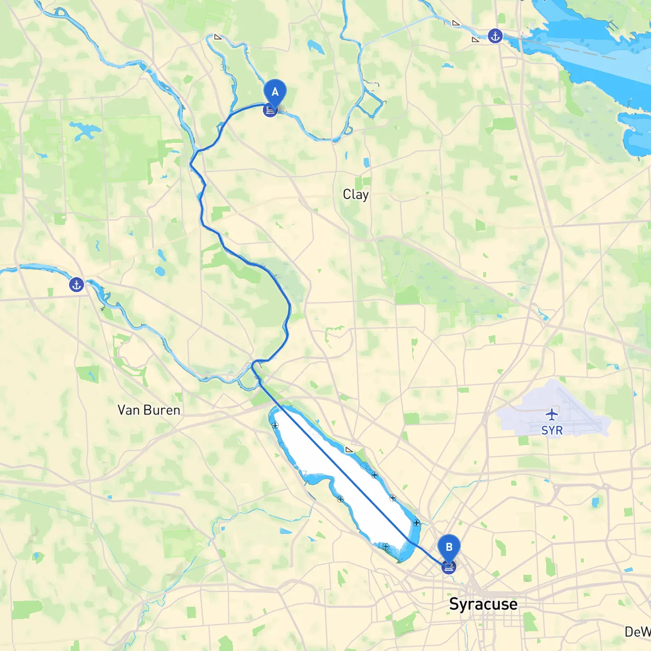
Coordinates: -76.2437666667, 43.2144666667 Destination: Syracuse, NY Coordinates: -76.1633833333, 43.0605833333
This route is particularly suitable for day cruisers and leisure boaters who enjoy a straightforward trip, with the advantage of scenic views and close proximity to urban amenities. The journey will take you primarily through the scenic Oneida River as you make your way to Syracuse.
1. Departing Clay: Begin your trip by navigating from Town of Clay. As you leave, take a moment to enjoy the view of the area’s scenic waterfront. Ensure your navigational aids are set to your route towards the mouth of the Oneida River.
2. Weather Considerations: Always check the weather forecast before departure. An unexpected storm can arise, making it essential to be aware of available safe havens.
1. Entering the Oneida River: After casting off from Clay, you will enter the Oneida River. This section is well-marked, but it's crucial to be attentive to navigation buoys guiding your course. Keep an eye out for flashing lights indicating shallow waters; these can change depending on the season.
2. Points of Interest: One standout attraction en route is the Oneida Lake, a beautiful large lake just a couple of miles northwest of your route. It’s a fantastic spot for those wishing to take a break—consider dropping anchor and enjoying some leisurely fishing or a swim.
3. Shelter Opportunities: If the weather worsens, safe havens like Joseph A. Barlow Park and Julius S. Kahn Park provide areas to dock. These parks have facilities and can be great spots to wait out a storm and enjoy the local flora.
1. Navigational Aids: As you cruise down the Oneida River, keep an eye out for navigational aids such as buoys and markers. These are crucial in helping you stay within safe depths and avoid hazards.
2. Local Restrictions: Familiarize yourself with any local boating regulations. Some areas may enforce speed limits or restrict activities, especially in designated wildlife refuge zones. Compliance is essential not just for safety but also to preserve these vital ecosystems.
1. Entering Syracuse: As you approach Syracuse, the shoreline will start becoming more urban. Remain vigilant as you navigate through slightly busier waters, ensuring you keep distance from larger vessels that may not maneuver as quickly as smaller craft.
2. Attractions and Activities: Once you arrive, there are many attractions like the Erie Canal Museum and access to the Onondaga Lake. This is a perfect time for a land excursion to explore everything Syracuse has to offer.
3. Docking in Syracuse: There are various public docks available; inquire about transient slips ahead of time, especially during peak boating season.
This route from the Town of Clay to Syracuse is perfect for leisure boaters looking for a mix of natural beauty, accessible amenities, and safe navigation. The emphasis on safety is paramount, with well-marked channels, local regulations that support preservation, and designated areas for shelter in inclement weather. Don’t forget to download essential boating apps like Savvy Navvy, which can enhance your navigation and keep you updated on weather conditions and tides, ensuring a safe and enjoyable trip.
Safe travels and enjoy the journey on the water!