
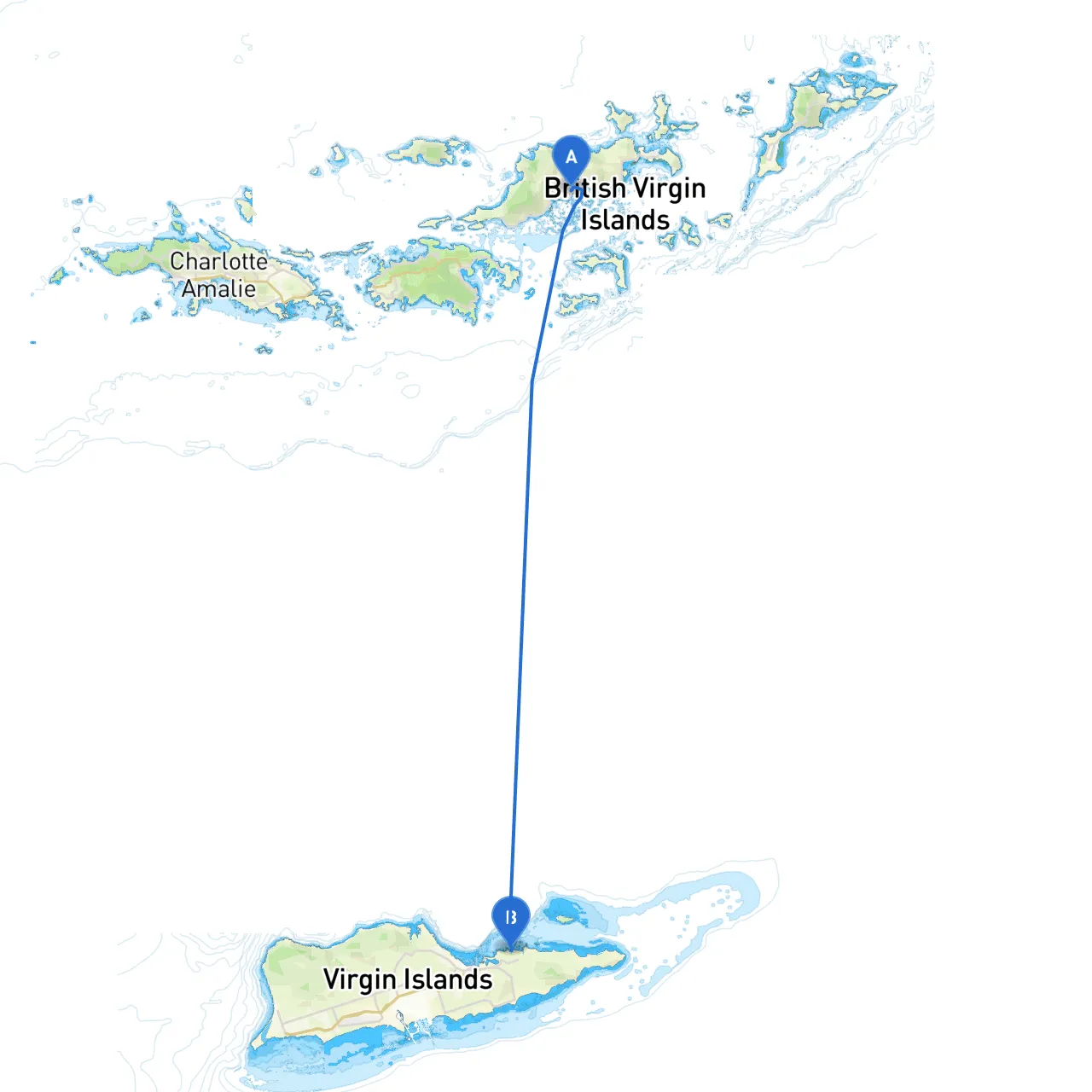
Pilotage Plan: Tortola, CAR, VG to St. Croix, BVI, VG
Route Overview:This itinerary takes you from the stunning shores of Tortola, British Virgin Islands, with its lush green hills and crystal-clear waters, to the vibrant island of St. Croix, US Virgin Islands. This route is well-suited for experienced boaters who enjoy a combination of scenic views, navigational challenges, and occasional stops in picturesque harbors.
Starting Point: Tortola, CAR, VGDeparture from Tortola provides a fantastic starting experience with access to the North Sound, ideal for checking your gear and provisions. Tortola’s Road Town has facilities like marinas and provisioning stores to ensure you’re ready for your journey.
Bays and Shelters Along the Route:1. Cane Garden Bay: A popular spot just west of Road Town is known for its beautiful beach and lively atmosphere. If the weather turns, this bay provides a sheltered anchorage and a chance to unwind a bit before heading out.
2. Jost Van Dyke: This small island is home to Great Harbour and White Bay. A perfect place for a pitstop, the Soggy Dollar Bar on White Bay is famous for its Painkiller cocktails. It's also a good anchorage should conditions deteriorate.
3. Sandy Cay: Another beautiful spot to consider. This tiny island offers a nature reserve with shallow water access, making for a perfect break amid your journey.
Navigational Considerations:As you head from Tortola towards St. Croix, pay attention to the following navigational aids and considerations:
Navigational Hazards:
Important Regulations:Be mindful of the following regulations while navigating these waters:
Route to St. Croix:Once you leave Tortola, head south toward Jost Van Dyke, using navigation aids for guidance. After a brief stop at Jost to recharge, set your course 175° to reach the western coast of St. Croix. Depending on weather conditions, you may aim for Christiansted or Frederiksted on the north shore, both excellent destinations with abundant amenities and exploration opportunities.
Points of Interest on St. Croix:Upon arrival, you can enjoy beautiful beaches, explore the historical towns of Christiansted and Frederiksted, or visit various national parks like the Salt River Bay National Historical Park.
Final Thoughts:This trip is for the boater who enjoys a bit of adventure while valuing safety and preparedness. The passage offers both sheltered havens and cultural experiences, making it a memorable experience to explore the Caribbean islands. Your journey not only allows you to navigate stunning waters but pays homage to the distinct character of each location along the route.
Apps to Enhance Your Trip:To assist with navigation and weather tracking, particularly when in unfamiliar waters, consider using Savvy Navvy. You might also benefit from other reliable maritime apps such as Navionics and PredictWind to elevate your sailing experience. Safe travels!