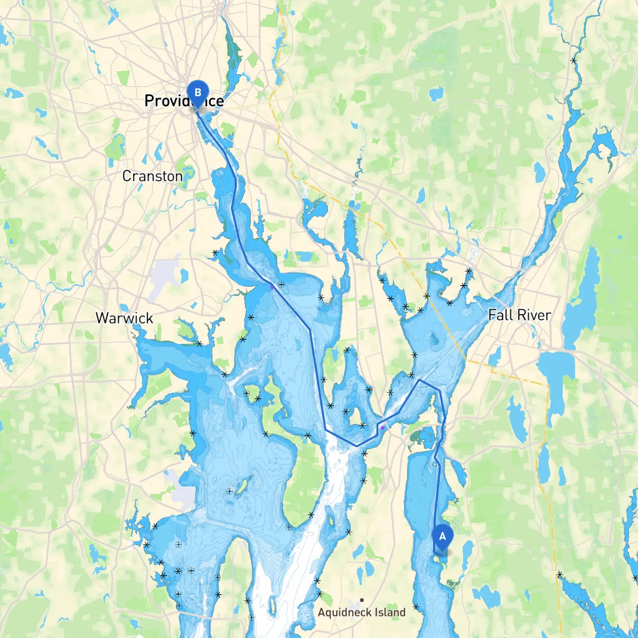
Pilotage Plan: Tiverton, Rhode Island to Providence, Rhode Island
Embarking on a boat trip from Tiverton to Providence is an exciting opportunity to experience the rich maritime culture of Rhode Island while navigating picturesque waters. This journey spans approximately 10 nautical miles and is suitable for both novice and experienced boaters. With striking coastal scenery, ample opportunities for shelter, and intriguing points of interest along the way, this route is filled with potential for a memorable day on the water.
1. Departure: Tiverton, Rhode Island
- Location: Depart from Tiverton, located at coordinates (41.5627° N, 71.2138° W).
- Harbor Conditions: Before leaving, check the local weather and tide conditions. Tiverton’s harbor is sheltered and offers a smooth departure into Mount Hope Bay. Make sure to observe traffic rules and any local boating regulations.
2. First Leg: Mount Hope Bay
- Navigation Hazards: As you set out, be cautious of the submerged rocks near the southern end of the bay. Pay attention to navigation aids such as the Mount Hope Bay Buoy, located at approximately coordinates (41.5736° N, 71.2281° W) which helps mark the channel.
- Shelter Options: If weather conditions worsen, consider ducking into the small mooring spots near Prudence Island or explore the Sakonnet Point, which can provide a safe haven from rougher seas.
3. Points of Interest
- Prudence Island: A fantastic spot for a quick stop, Prudence Island offers walking trails and beaches. This peaceful environment is ideal for birdwatching and enjoying a picnic.
- Tiverton Four Corners: Although slightly inland, this area is rich in local art, antiques, and quaint shops, making it worth a short detour if you have time.
4. Transitioning to Narragansett Bay
- As you approach the entrance to Narragansett Bay, heed the navigation buoys that guide you into the main channel. The bay entrance can be busy, especially on weekends, so maintain a keen lookout for vessel traffic.
- Navigational Aids: Follow the green and red buoys carefully to stay within the marked channel. Keep an eye out for the "East Passage" navigation markers which guide you towards Providence.
5. Providence Harbor
- Arrival: As you reach Providence (41.8175° N, 71.4023° W), you will be greeted by the stunning city skyline and the vibrant atmosphere of the waterfront.
- Attraction Options: Look into mooring at the Providence Boat Ramp where you can access facilities, and enjoy local restaurants and attractions such as the WaterFire event held in the warmer months.
6. Safety Considerations
- Ensure your life jackets are onboard and readily accessible for all passengers.
- Regularly check weather updates during the trip, and be mindful of changing wind and wave conditions.
- Use your boater communication devices and keep them charged, especially for emergencies.
Navigation Apps
To enhance your navigational experience and stay informed throughout your journey, consider using the following apps:- Savvy Navvy: This app provides detailed charts, weather updates, and route planning features tailored for boating. It's excellent for both novice and seasoned sailors looking to enhance their trips.
- Navionics: Offers real-time GPS navigation and helps you track your route while on the water.
- Windy: An excellent choice for getting accurate weather forecasts and wind patterns which are crucial on the water.
This maritime adventure from Tiverton to Providence is not only a scenic route but also a journey through Rhode Island's diverse ecosystem and vibrant culture. You'll encounter beautiful shorelines, enjoy the tranquility of bays, and have access to numerous attractions, making this trip enchanting and fulfilling for any boater. Always prioritize safety, and you'll make the most of your day on the water.