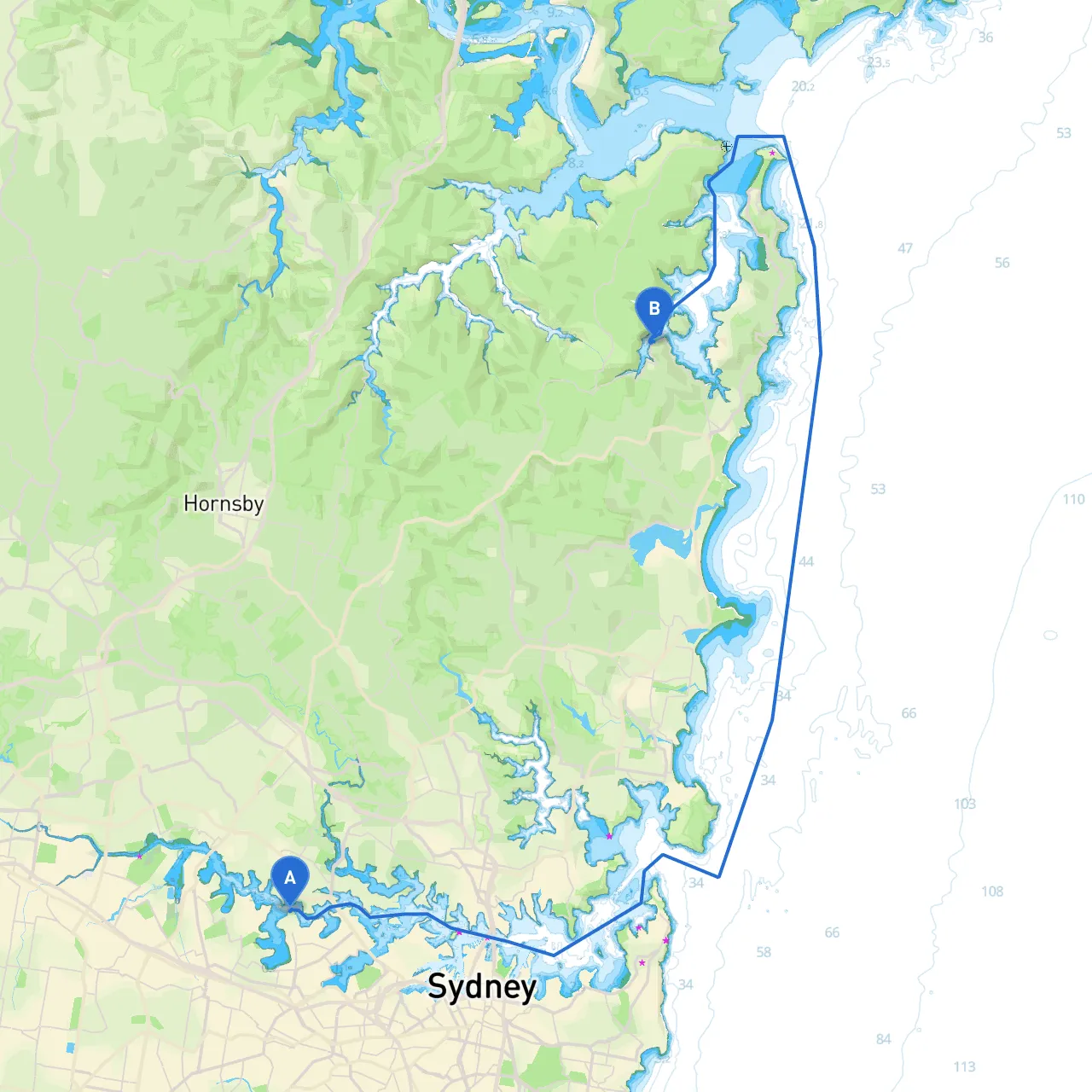
This route from the bustling shores of Sydney to the tranquil waters of Church Point offers a wonderful combination of scenic beauty, vibrant marine life, and sheltered bays. The journey is suitable for experienced sailors and powerboat operators alike, allowing you to navigate through some of Australia’s most picturesque waterways.
Location & Facilities Starting your voyage at Sydney (Latitude: -33.8439, Longitude: 151.1282), you will find excellent marine facilities, including marinas, fuel stations, and shops for provisioning. It’s always wise to check the weather conditions and ensure your vessel is properly equipped for the trip ahead.
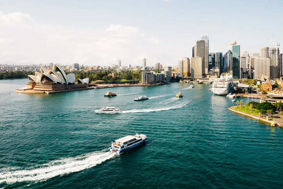
1. Sydney Harbour: This is the jumping-off point. As you sail away, take the moment to appreciate the iconic Sydney Opera House and the Sydney Harbour Bridge one last time.
2. Rose Bay & Watsons Bay: A perfect midpoint for a stopover. You can anchor at Rose Bay for lunch and reclaim some energy while enjoying gorgeous views of the city skyline. Watsons Bay also provides a picturesque beach and famous seafood eateries.
3. North Head: When navigating past North Head, keep watch for the strong currents often present here, especially during tidal changes.
As you make your way, consider these sheltered bays in case the weather becomes unfavorable:
1. Navigational Aids: - Sailing marks around the harbor will guide you out of Sydney’s busy waters. Keep a keen eye on navigation aids and GPS markers as you plot your progress. - Buoys and channel markers are present throughout your journey, particularly in the thicker traffic areas. Always adhere to these markers to avoid hazardous reefs and shoals.
2. Tide Considerations: Pay attention to local tide tables. Sydney experiences significant tidal ranges, which can affect your navigation, especially in shallow areas.
3. Marine Traffic Regulations: Be aware that you are sharing these waters with a variety of vessels. Maintain a lookout for ferries, fishing boats, and other recreational vessels. It’s advisable to stay within marked channels to ensure safety.
Location & Facilities Church Point (Latitude: -33.6459, Longitude: 151.2805) serves as a fantastic stopping point within the beautiful Pittwater region. The area hosts multiple marinas, with facilities for refueling and provisions. Once you arrive, be sure to take a moment to enjoy the serene surroundings and engage with the local community.
For your journey, consider utilizing navigational apps to make the most of your experience. I recommend downloading savvy navvy, which is a user-friendly app that provides real-time charts and built-in navigation tools. Other useful apps include Navionics and MarineTraffic for tracking marine traffic and receiving alerts.
This comfortable yet adventurous route from Sydney to Church Point combines the charm of sheltered bays and vibrant marine life while prioritizing safety above all. Whether you’re a seasoned sailor or a novice boater, this trip will undoubtedly provide an abundance of memories to cherish. Happy boating!