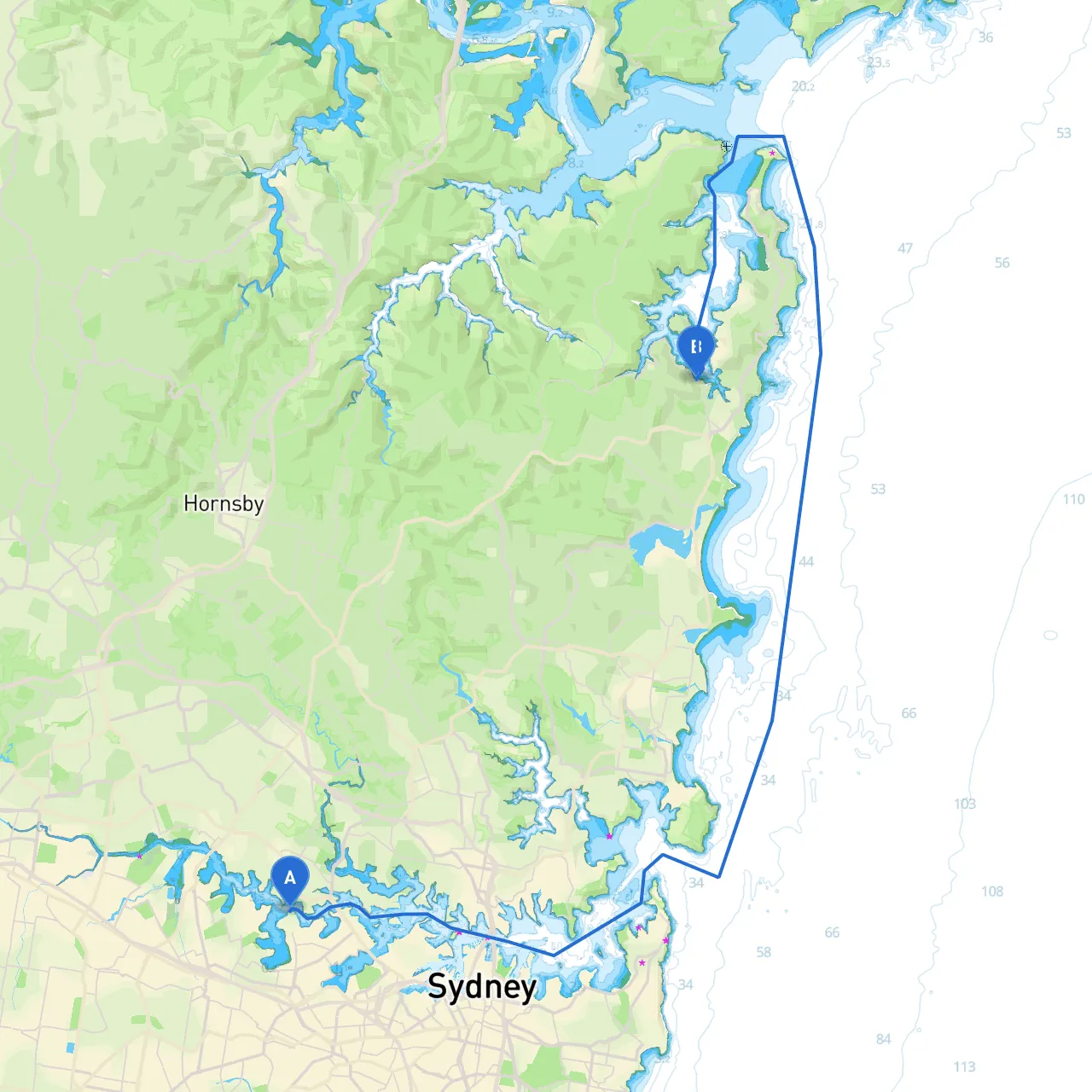
Starting Point: Sydney, NSW Ending Point: Bayview, NSW
As you embark on this scenic cruise from the bustling heart of Sydney to the tranquil waters of Bayview, you'll be treated to a striking combination of iconic landmarks, beautiful bays, and serene waterways. This trip is especially suited for intermediate to experienced boaters, given the need to navigate both busy shipping channels and quieter coastal waters.
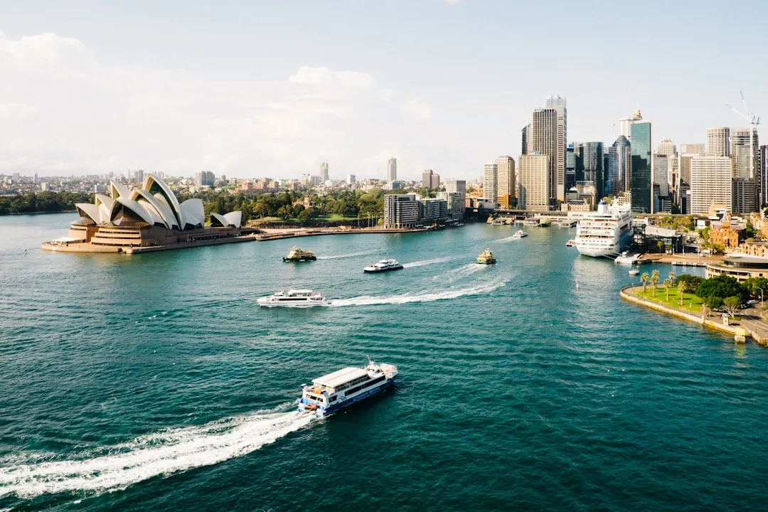
1. Departure from Sydney Harbour: - Start your journey at the iconic Sydney Harbour, renowned for its dramatic skyline and the famous Sydney Opera House and Sydney Harbour Bridge. As you exit the harbour, take note of the navigational aids around you, including the buoyage marking the main channels. Pay particular attention to the ferries and other commercial vessels that frequent these busy waters.
2. Navigating the Inner Harbour: - Following the marked channel, head towards North Head. Be aware of tidal influences and currents that can sometimes catch inexperienced boaters off guard. It's advisable to familiarize yourself with tide times and wind conditions that may affect your travel.
3. Out Through the Heads: - As you make your way towards the heads, you'll encounter the iconic cliffs of the headlands. Keep an eye on the swell and wave patterns here, as conditions can change dramatically. Under calm weather, this is a fantastic spot for views and maybe even some early morning fishing.
4. Into the Pittwater: - Once you've navigated through the heads, you’ll be entering the Pittwater. This area offers numerous sheltered bays perfect for weather emergencies. Make a point of stopping in at places like Mona Vale Beach or the quieter Careel Bay, where you can safely anchor for a while and enjoy the surrounding nature.
5. Exploring Ku-ring-gai Chase National Park: - As you continue, you’ll have the opportunity to explore the beautiful waters of Ku-ring-gai Chase National Park. Look out for its stunning landscapes and perhaps take a detour for some hiking trails if time allows. This area is dotted with safe anchorage spots, including Lyon's Cove and Towlers Bay, ideal for shelter.
6. Approaching Bayview: - As you draw closer to Bayview, keep an eye open for marker buoys guiding you into the marina. The waters here are generally calm, but always be vigilant, especially with the presence of other vessels and water activities in the bay.
Should weather conditions take a sudden turn for the worse, the following bays provide excellent shelter:
1. Mona Vale: With calm waters and mooring options, it's a reliable stop.2. Careel Bay: Situated in a more secluded area, this bay offers safety from both wind and swell.3. Lyon's Cove: Nestled in the pristine national park area, great for a quick retreat.
This journey embodies the perfect blend of adventure, discovery, and nature. By prioritizing safety, respecting local regulations, and being mindful of your surroundings, you'll not only enjoy every moment of the journey but also ensure a smooth and enjoyable experience on the water. Safe voyaging!