
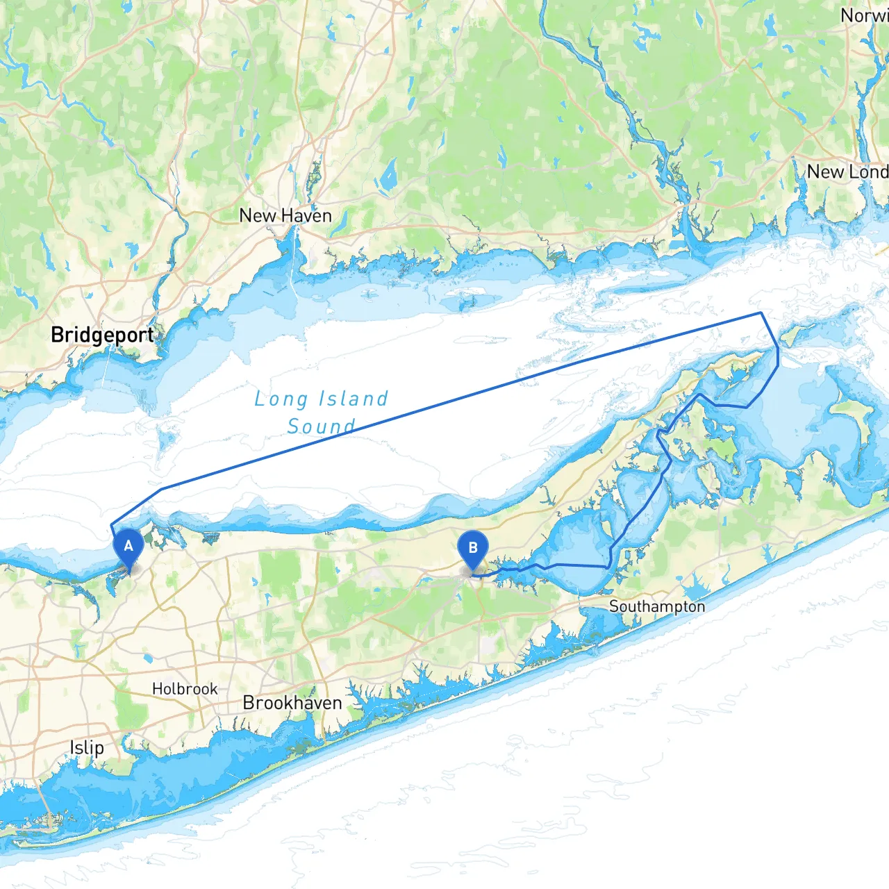
Pilotage Plan: Stony Brook, NY to Riverhead, NY
Route Overview:The journey from Stony Brook, NY to Riverhead, NY offers a scenic and relatively short trip across some beautiful waters in Long Island. This route is ideal for recreational boaters, families, or anyone who is keen on enjoying a picturesque day on the water. It's manageable for novice boaters yet still holds enough interest to engage seasoned mariners.
Section 1: Departure from Stony BrookAs you set off from Stony Brook (coordinates -73.1505, 40.9201666667), you will navigate through Stony Brook Harbor. The harbor is well-marked with navigational aids, so be sure to take note of the buoys and markers, particularly as you head out toward the Bellport Bay.
Just after departure, you may want to make use of Stony Brook Harbor’s calm waters. It’s an excellent spot should the weather take a turn for the worse. The harbor is surrounded by several amenities, including restaurants and views of the scenic town.
Section 2: Navigation Across Long Island SoundHeading east, you will be moving into Great South Bay. Keep an eye out for the buoyed channel that leads you towards the patch that opens up into the bay. The waters can be busy, especially if you're traveling during peak summer months, so always be vigilant for fishing boats and recreational vessels.
During this stretch, there are several points of interest along the coast. The beautiful Fire Island is within sight to the south, where you can glimpse the iconic lighthouse at Fire Island and perhaps plan a future trip to explore its beaches.
Section 3: Shelter OptionsAs you approach the midpoint of your trip, if you're feeling adverse weather, you have options for shelter. Both Patchogue Bay and the Moriches Bay provide excellent refuge with well-marked entrance points. The patches of water are often quieter and present opportunities for exploring the coastline or stopping for a picnic on the shore.
Section 4: Approaching RiverheadUpon nearing Riverhead (coordinates -72.6548333333, 40.9178333333), you'll navigate through the Peconic River, which flows into the bay. Be attentive to the navigation markers and maintain your course within the channel to avoid grounding. This area is rich in aquatic life, and you may see fishing boats active, so keep an eye on your surroundings.
As you draw closer to Riverhead, consider taking a detour into the scenic parts of the Peconic River, offering a chance to spot local wildlife. Riverhead itself has a bustling waterfront and plenty of attractions, including the Long Island Aquarium and various dining options.
Navigational Considerations:
Final Thoughts:This route from Stony Brook to Riverhead allows you to experience a blend of beautiful waterways, rich local culture, and safe shelter options. It accommodates novice and experienced boaters alike. Remember safety is paramount—check your weather conditions and navigational aids regularly, and ensure you have all safety equipment on board.
Get ready to enjoy your voyage on the tranquil waters of Long Island!