
Overview:Embarking on this journey from St. Simons to Savannah offers a delightful mixture of coastal beauty and rich cultural experiences. Suitable for intermediate to experienced boaters, this route carefully guides you through navigable waters while ensuring the utmost attention to safety, navigation aids, and potential stopping points for enjoyment.
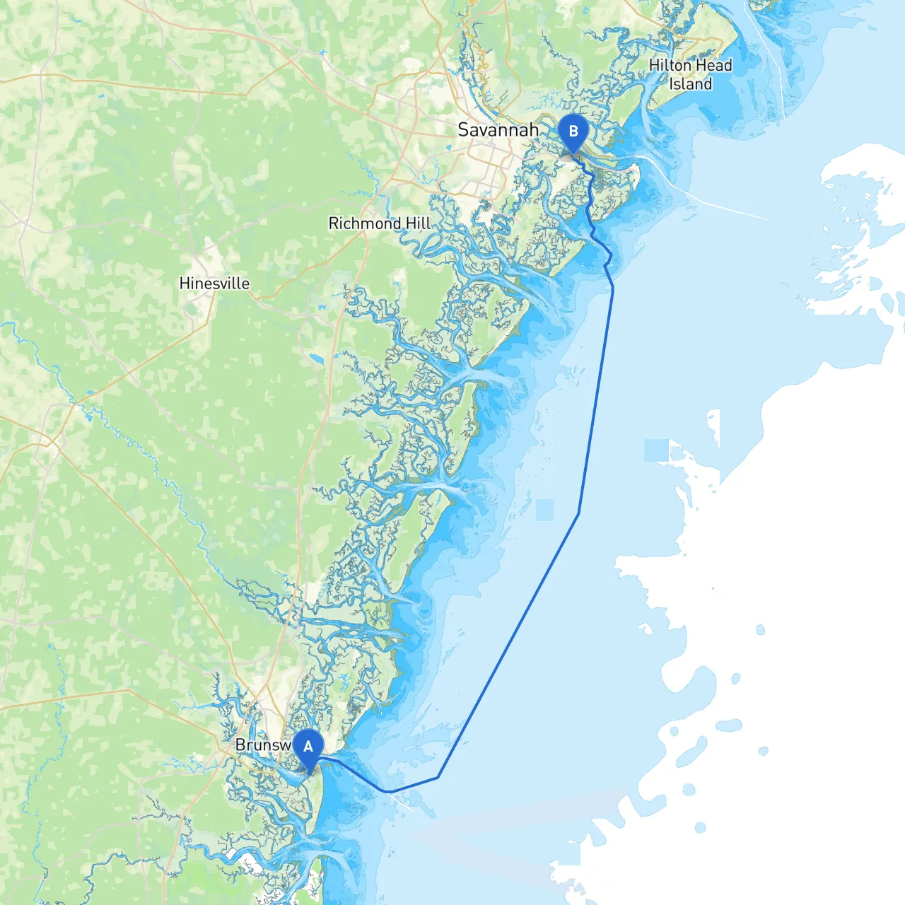
1. Departure from St. Simons Island - Starting Point: St. Simons Island, GA - Coordinates: -81.42889412, 31.105745692 - As you set sail, be mindful of local traffic as St. Simons has a lively boating community. Use the local marina as your starting point, and ensure all safety gear is aboard.
2. Navigational Aids and Hazards - Navigational Aids: Pay attention to marked channels as you depart; buoys will guide you. Look for the St. Simons Sound entrance buoys, which can help navigate towards the ICW (Intracoastal Waterway). - Potential Hazards: Watch out for shifting shoals, especially near the entrance to the sound. The shallow areas require careful navigation to avoid grounding, particularly at low tide.
3. Highlighted Points of Interest Along the Route
- Cumberland Island National Seashore: A slight detour from your course leads to this unspoiled paradise. Famous for wild horses and pristine beaches, it’s a perfect spot to drop anchor and explore its natural beauty. - Darien, GA: A charming coastal town known for its seafood and rich history. A great place to take a break, enjoy a meal, or explore the waterfront park.
4. Sheltered Bays and Hurricane Holes: - Cannon’s Point Preserve: This area is an effective shelter if weather conditions deteriorate. It offers calm waters and a beautiful natural setting. - Sapelo Island: Another viable option should the weather start to turn. The southern end has areas where you can securely anchor and ride out adverse weather conditions.
5. Approaching Savannah - Navigational Aids: As you near Savannah, stay alert for the Savannah River Buoys, which signal the entrance to the river. Use radar if visibility is low, due to potential fog in the area. - Local Restrictions: Be aware of maritime traffic and regulations while entering the Savannah River, especially regarding commercial shipping lanes. Monitor local VHF radio channels for any traffic advisories or potential hazards.
1. Weather Monitoring: Always check marine weather forecasts before departing and during your journey. Weather can change rapidly, especially along the coast, so be prepared.
2. Communication and Navigation Apps: Consider utilizing navigation apps like Savvy Navvy. It will help you chart the safest course, monitor tide changes, and keep track of your progress. Other recommended apps include Navionics and Windy for marine weather updates.
3. Safety Gear: Ensure you have PFDs (personal flotation devices) for all passengers, a working VHF radio, a first aid kit, and basic survival gear aboard.
4. Tide Considerations: Familiarize yourself with the local tide schedules as they can significantly affect your navigation and safety. Being mindful of tides will help avoid shallow waters and ensure a smoother passage.
This voyage from St. Simons to Savannah combines elements of adventure and discovery while keeping safety as a priority. It’s an experience that intertwines natural beauty with opportunities to engage with charming coastal towns and serene waters. Enjoy the journey as much as the destination – happy cruising!