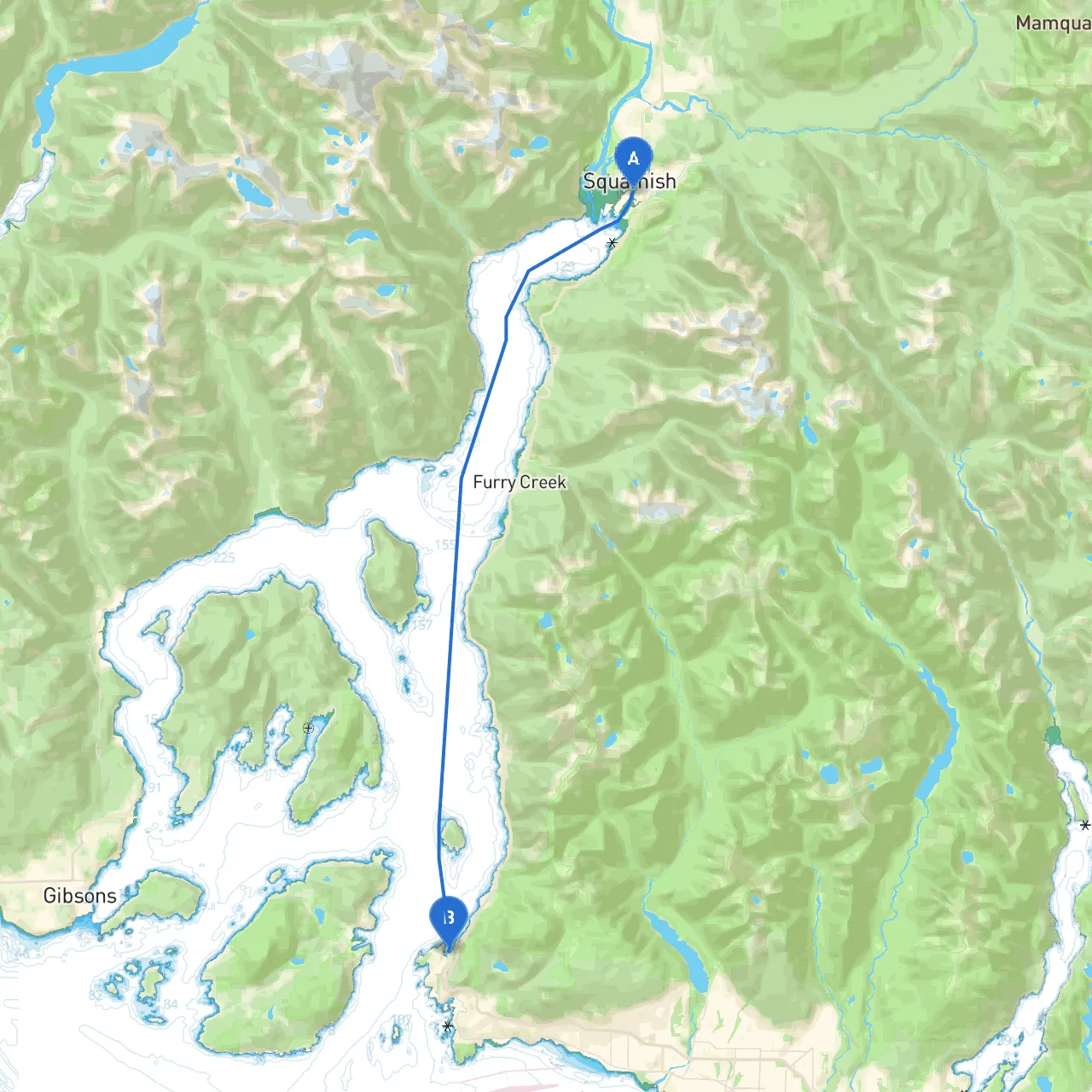
Pilotage Plan: From Squamish, BC to West Vancouver, BC
Route Overview:Embarking on this journey from Squamish, BC, to West Vancouver offers a fantastic opportunity to cruise through stunning coastal waters, all while engaging with the remarkable nature and culture of the Sea to Sky region. This route is ideal for experienced boaters looking for both a scenic and navigational challenge, as well as for recreational sailors seeking calm waters and beautiful landscapes.
Route Details:
Starting Point: Squamish, BC
- Coordinates: -123.1535, 49.6935
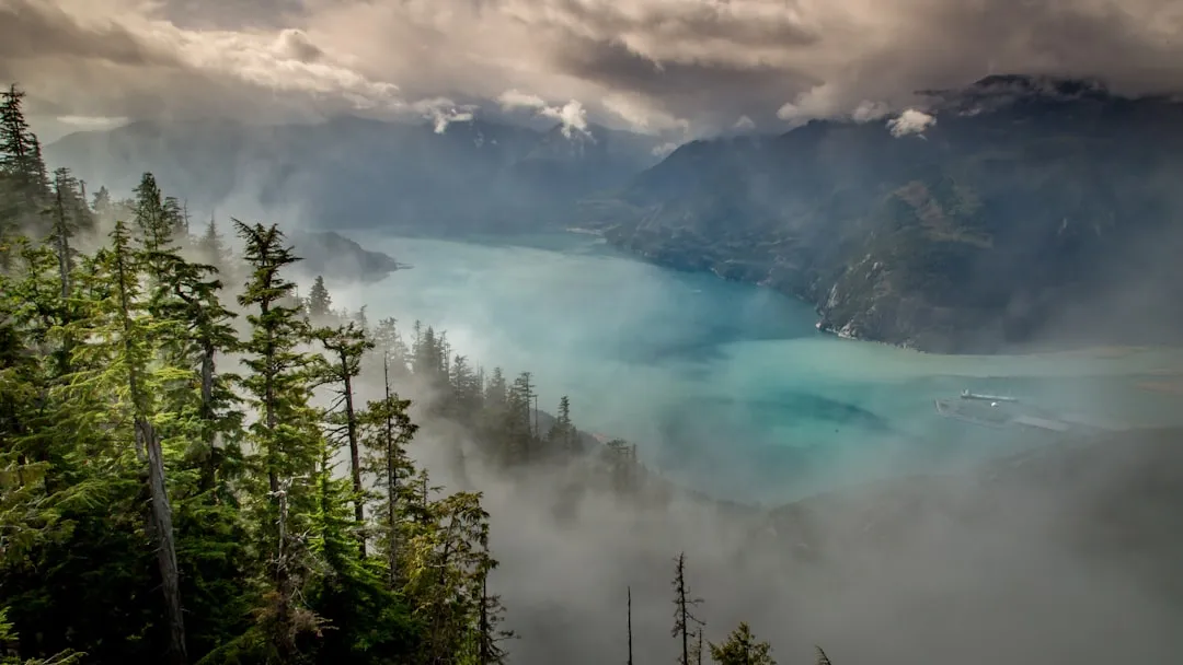
- Before setting off, check local marine forecasts. Squamish provides a scenic backdrop with views of the iconic Stawamus Chief Mountain.
Navigational Considerations:
- As you head south, keep an eye on Deep Cove, where the waters can get choppy—plan your time accordingly.
- Pay attention to the East side of Howe Sound, which can be susceptible to strong winds. It’s advisable to monitor wind patterns and be cautious around the fjords.
- Use navigational aids such as buoys and markers along the route to ensure safe passage.
Key Points of Interest & Sheltering Bays:
1. Whytecliff Park: - Just south of Horseshoe Bay, this park is perfect for a short stop. You can engage in tide pooling or visit the beach. The park's breakwater offers good shelter if conditions worsen.
2. Horseshoe Bay: - A charming little village where you can refuel, grab a coffee, or even enjoy some fish and chips. This bay also has excellent facilities and can shelter you from unexpected weather changes.
3. Lions Gate Bridge: - As you approach West Vancouver, the iconic Lions Gate Bridge frames your pathway. It’s breathtaking and serves as both a landmark and a significant navigation point. - Be aware of the bridge’s clearance; larger vessels should navigate around low tide to ensure safety.
Navigational Aids:
- Throughout the journey, keep an eye on channel markers and lighted buoys along the route. This area can have some light commercial traffic, so stay attentive.
- Utilize local marine charts, as they provide vital information regarding depths, hazards, and restricted areas, ensuring safe navigation.
Regulations and Safety Measures:
- Adhere to local boating regulations, particularly near marinas and in protected areas.
- Maintain a safe distance from marine wildlife, especially during migration seasons.
- Ensure that safety equipment, such as life jackets and flares, is onboard and accessible.
- Before departure, inform someone of your route and estimated arrival time.
Finishing Point: West Vancouver, BC
- Coordinates: -123.2723, 49.3773
- As you arrive in West Vancouver, you’ll find a bustling marine culture rich with amenities for after a long cruise. From the scenic Ambleside Park to the shops along Marine Drive, there are plenty of activities to unwind after your journey.
Apps and Resources:
- Savvy Navvy: An excellent navigation tool that provides charts, weather updates, and route planning.
- Navionics: Offers comprehensive charts and can help with navigation in real-time.
- Windy: Great for checking wind patterns, particularly important for this route.
By taking this route, boaters will experience a remarkable blend of coastal beauty and adventure. Enjoy the journey, stay alert, and remember: while this trip promises captivating sights and great stops, your safety is paramount. Happy sailing!