
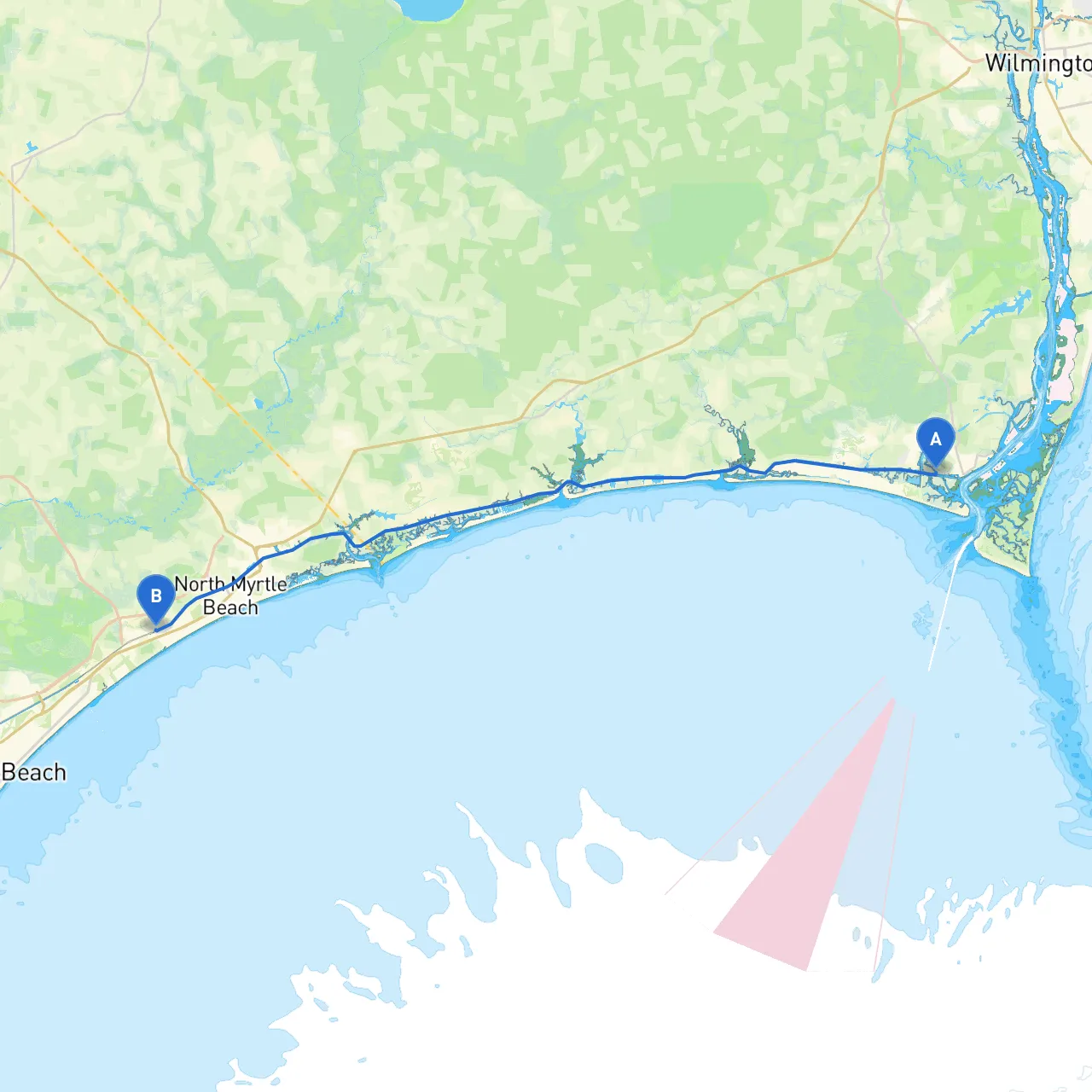
Pilotage Plan from Southport, North Carolina to North Myrtle Beach, South Carolina
Starting Point: Southport, NCLocated at the mouth of the Cape Fear River, Southport offers a quaint atmosphere with its historic waterfront. Before setting off, ensure you have checked your vessel’s systems and stocked up on necessary provisions. The waters here can be busy with local fishing vessels and tourist boats, so keeping an attentive lookout is essential.
Route OverviewYour journey to North Myrtle Beach will take you through a series of charming inlets and coastal waters. The distance is approximately 40 nautical miles and offers a variety of scenic views, with the potential of seeing wildlife along the way.
Leg 1: Southport to Lockwood Folly InletHeading out from Southport, follow the Cape Fear River northbound until you reach the Thirteen Mile Swash markers. Be on the lookout for commercial shipping traffic as you exit the river. Approx. 5 nautical miles later, you will approach Lockwood Folly Inlet—consider this a safe area for sheltering. This inlet is known to provide good anchorage and excellent fishing opportunities, making it a perfect spot to break your journey if the weather changes unexpectedly.
Points of Interest:Lockwood Folly Inlet is surrounded by Myrtle Beach State Park, offering beautiful beaches and hiking trails for those who wish to explore further ashore.
Leg 2: Lockwood Folly Inlet to Shallotte InletAfter navigating through Lockwood Folly Inlet, resume your course along the Intracoastal Waterway (ICW). This section runs approximately 10 nautical miles, with Shallotte Inlet being the next major reference point. Watch for the navigational aids such as buoys and day markers along the ICW; they are crucial for keeping you in safe waters, especially in areas where the channel can shift.
Useful Shelter:If conditions become rough, the Shallotte Inlet provides a sheltered area where you can anchor. The inlet itself is shallow and requires careful navigation to avoid grounding, but once inside, you can find calm waters.
Leg 3: Shallotte Inlet to North Myrtle BeachContinuing southbound, you’ll proceed through the ICW. The next leg is about 12 nautical miles. Keep an eye out for wildlife, such as dolphins and a variety of bird species, as you pass through the lush coastal environment. Notable landmarks include the Holden Beach Bridge which signals your approach to densely populated areas nearing North Myrtle Beach.
As you debark, be aware of local mooring regulations at North Myrtle Beach. The area can get crowded, especially during peak tourist season, so aim to arrive during daylight hours for easier navigation into the marina.
Keys to a Safe Journey:
Final Remarks:This route is ideal for recreational boaters looking for beautiful coastal scenery mixed with the adventure of navigating inlets. With safe shelter options and decent amenities along the way, you are sure to enjoy a remarkable and safe passage from Southport to North Myrtle Beach. The mix of beautiful surroundings, wildlife, and points of interest makes this a trip not just for finding your destination, but for enjoying everything the coastal region has to offer. Happy sailing!