Pilotage Plan: Selby on the Bay, MD to North East, MD
Overview
This journey from Selby on the Bay to North East, Maryland, will take you through the stunning landscapes and waterways of the Chesapeake Bay region. It is suitable for intermediate to experienced boaters familiar with navigational aids and ready for some light open water cruising. Safety is a priority, given the busy waters and potential weather changes, but there are plenty of sights and places to explore along the way.
Route Summary
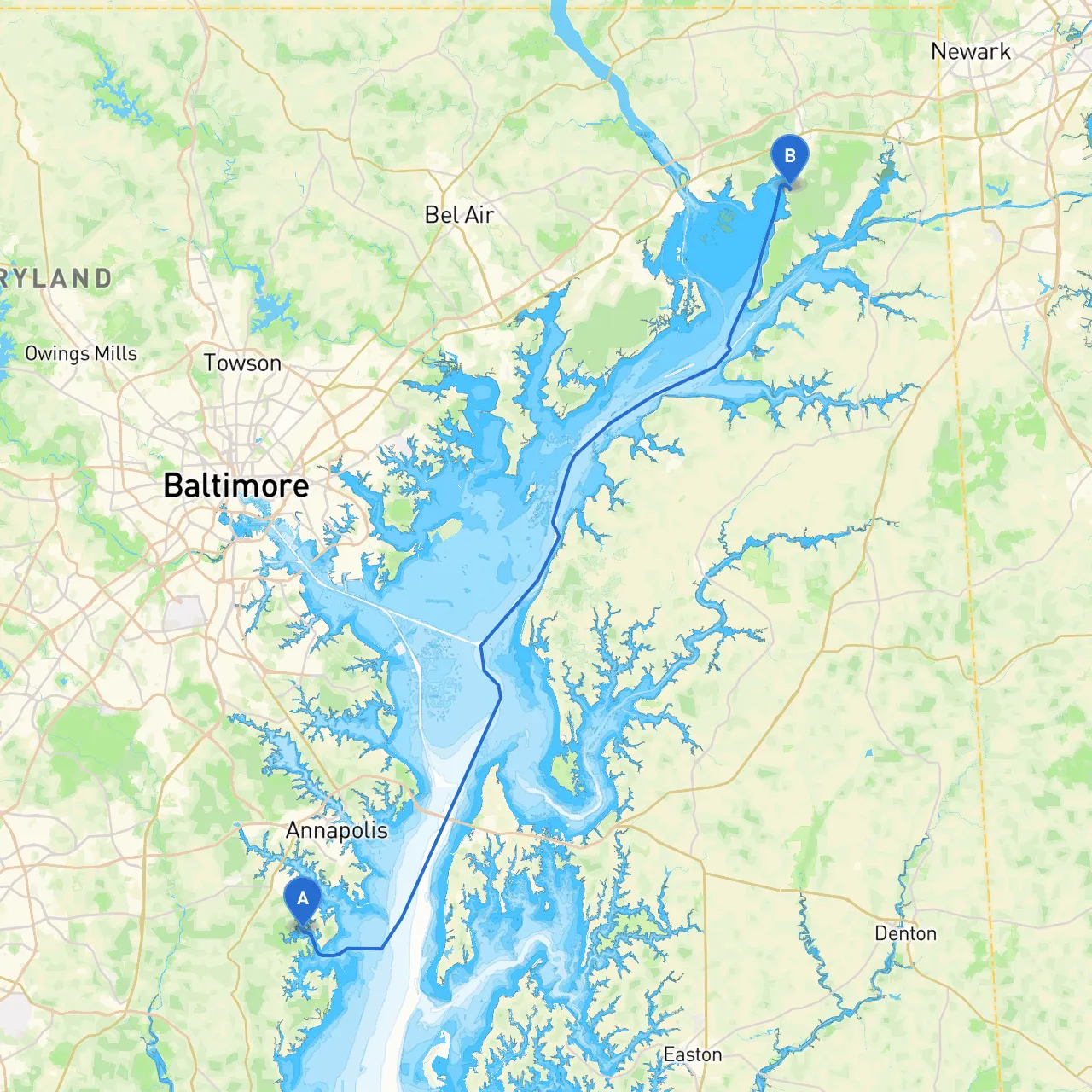
- Departing from: Selby on the Bay, MD (38.8862° N, 76.5317° W)
- Arriving at: North East, MD (39.5581° N, 75.9628° W)
Relevant Hazards and Navigational Considerations
Before setting out, it’s crucial to review the current weather conditions and any marine notices that may apply. The Chesapeake Bay can be unpredictable, so pay attention to changes in wind speed and direction.
Key hazards to watch out for include:
- Shallow waters in some areas, particularly around the mouths of rivers.
- Busy marinas and commercial shipping traffic as you near the mouth of the Susquehanna River.
- Navigating through the Kent Narrows, where strong currents may be present.
Points of Interest Along the Route
: A perfect spot to take a break. Known for its sandy beaches and picturesque views of the Chesapeake Bay Bridge, it’s a wonderful place for a land excursion or a picnic.
2. Annapolis: A slight detour for a visit to the historic capital of Maryland. The city is rich in maritime history, with the U.S. Naval Academy being a key attraction. Consider docking at one of the local marinas for a few hours of exploration.
3. Sassafras River: A beautiful inlet that offers calm waters and scenic views, ideal for those wanting a sheltered resting point. The town of Georgetown is a quaint stop here with opportunities for fishing or a leisurely stroll.
4. Rock Hall: A small and charming town that’s perfect for a lunch stop. Known for its laid-back vibe, you’ll find local seafood restaurants and shops to explore.
Navigational Aids
Throughout your journey, keep an eye out for critical navigation markers:- Iona Light: This navigational aid marks St. Leonard's Creek and is critical for safe passage.
- Reedville Marker: Identifying your position relative to this marker will help you stay on course.
- Fixed and Floating Bouys: Ensure you’re aware of which color indicates which side to pass.
Make good use of your charts to remain aware of your position in relation to shorelines, particularly in places like the Kent Narrows and near tidal rivers where changes in water depth can occur rapidly.
Local Regulations and Safety
As a boater, you are responsible for understanding local rules:- Make sure you comply with all speed limits, particularly in designated no-wake zones near marinas and residential areas.
- Be mindful of commercial traffic, especially when entering the Susquehanna River area.
- Keep proper safety equipment onboard, including life jackets, first aid kits, and flares.
Apps to Enhance Your Journey
For up-to-date navigation and safety, consider using the following apps during your trip:- Savvy Navvy: A powerful tool for route planning, live weather updates, and navigational aids, making it indispensable for a safe journey.
- Navionics: Great for electronic navigation charts.
- Weather Underground: To keep an eye on changing weather conditions as you travel.
Conclusion
This trip from Selby on the Bay to North East, Maryland, combines safety-focused navigation with opportunities for leisure and exploration. Whether you're anchored in a quiet cove or enjoying local dining, this route is both adventurous and relaxing—perfect for the boater looking to balance excitement with safety. Happy cruising!