
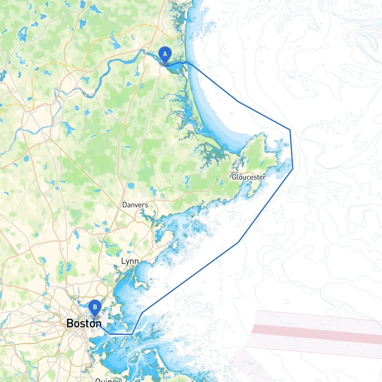
Pilotage Plan from Salisbury, Massachusetts to East Boston, MA
Welcome to this exciting journey along the beautiful coastline from Salisbury, Massachusetts to East Boston! This route is not just a transit, but a delightful exploration of New England's maritime beauty, perfect for experienced boaters looking to enjoy the scenic views while ensuring a safe passage.
Starting Point: Salisbury, MA Ending Point: East Boston, MA Distance: Approximately 20 nautical miles
Before setting off, always check a reliable weather forecast through the day of cruising. Weather conditions along the Massachusetts coast can change rapidly. High winds, fog, and sudden squalls are not uncommon, especially in the late afternoon. Ensure you have life jackets, a first-aid kit, flares, and a VHF radio for communications.
1. Departing Salisbury: - As you leave the jetty, keep a watchful eye on the buoys marking the channel to ensure you stay clear of the beach and its associated hazards.
2. Merrimack River Passage: - Navigate southward towards the mouth of the Merrimack River, where you’ll encounter the Merrimack River Light (Fl R 4s). This light is crucial for marking the entrance, particularly in low visibility.
3. Heading Towards Newburyport: - Steer into Newburyport Harbor after passing Georgetown Light, where you must slow down for possible fishing vessels. Maintain vigilance for local traffic and adhere to all navigational markers.
4. Leaving Newburyport: - From Newburyport, head southeast towards the mouth of the Merrimack. Use the Newburyport Harbor Buoys to guide your way into deeper waters as you continue your voyage.
5. Round Cape Ann: - As you turn the corner into Ipswich Bay, stay alert for boat traffic and always monitor the GPS for any moves necessary against the tidal flow, which can be strong in this area.
6. Approaching Boston: - You'll now need to pay attention to the Boston Harbor Entrance markers. The Harbor has numerous ferries and commercial traffic; use and keep a close eye on the charts showing the active shipping channels.
7. Entering East Boston: - As you approach East Boston, navigate towards the Lynn Harbor markers and heed the local regulations regarding speed limits and coastal anchorage areas.
During your journey, make sure you have the following navigational aids on hand:
For this trip, I would recommend experienced boaters who are familiar with coastal navigation principles and have a sturdy, well-equipped vessel. This pilotage plan welcomes you to enjoy the freedom of the open water while ensuring you have tools for safety and communication.
For best navigational updates and route planning, consider using boat apps like Chartplotter, Navionics, and Savvy Navvy. Each of these apps can provide real-time information on weather and tides, enhancing your journey and keeping you informed on changing conditions.
By prioritizing safety while enjoying this picturesque New England coastal voyage, you’ll create memorable experiences navigating from the seaside beauty of Salisbury to the bustling atmosphere of East Boston. Happy boating!