
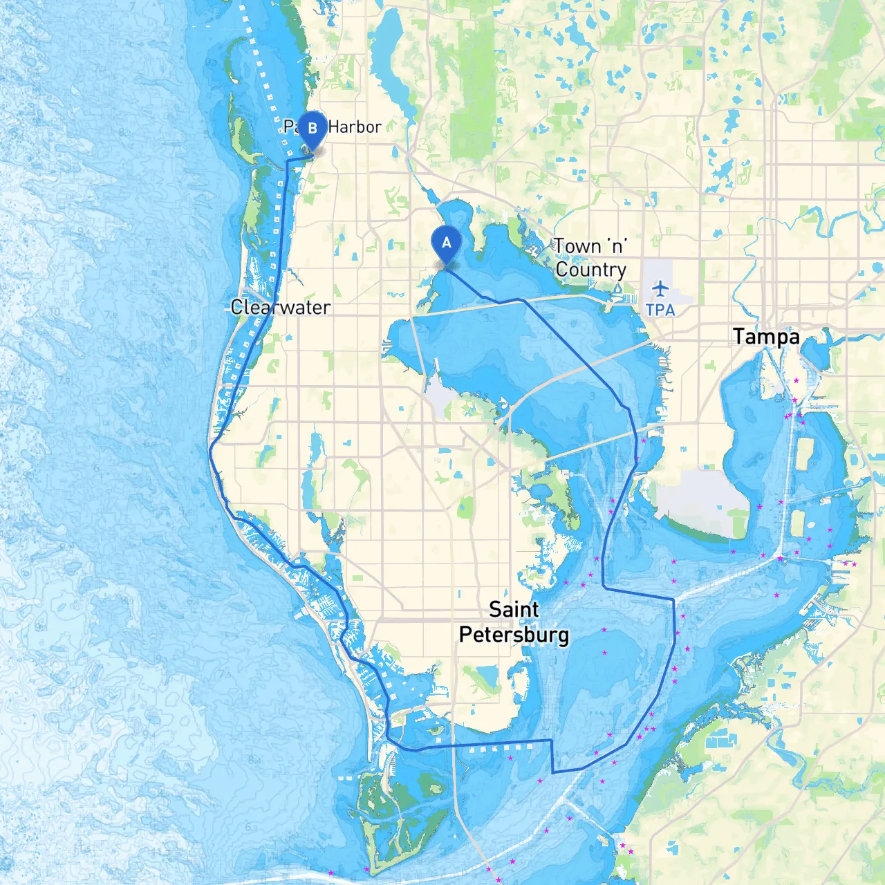
Embarking on this journey from Safety Harbor to Palm Harbor offers a lovely short trip along the scenic coastline of Florida's Tampa Bay area. The route is suited for both novice and experienced boaters, providing opportunities to explore beautiful waterways, perfect for day trips while being mindful of safety considerations.
Starting Point: Safety Harbor, FL Ending Point: Palm Harbor, FL Route Length: Approximately 6 nautical miles (depending on chosen waypoints)
As you make your way across the waters, you’ll have an opportunity to enjoy a few local attractions:
1. Safety Harbor: Start your trip by enjoying the charming atmosphere of Safety Harbor, known for the historic Safety Harbor Spa and the revitalizing waters of its natural springs. If you have some time before setting sail, consider a stroll along the waterfront or visiting one of the local cafes.
2. Philippe Park: Located just west of Safety Harbor, this park offers beautiful waterfront views and historical markers worth checking out. It’s a great spot for a brief break if needed.
3. Dunedin Marina: If you decide to take a small detour, Dunedin offers an excellent marina and pleasant surroundings. It's an ideal place for lunch or to explore local shops.
4. Caladesi Island State Park: Further down, this park is a beautiful spot to stop for a swim or hike. The island is only accessible by boat and offers pristine beaches and nature trails if you are feeling adventurous.
5. Bayside Bridge: As you approach Palm Harbor, you’ll have a nice view of the Bayside Bridge, a notable navigational landmark.
While the waters along this route are generally calm, paying attention to potential hazards is crucial:
The following navigational aids will guide you safely along your route:
In case you encounter adverse weather, here are some sheltered areas where you can find safety:
This trip from Safety Harbor to Palm Harbor is perfect for boaters of all skill levels. The waters are generally calm, the scenery delightful, and the attractions inviting for a weekend getaway or an afternoon adventure. Make sure to equip your boat with appropriate safety gear, keep your navigation aids handy, and most importantly, enjoy your time out on the water!
For additional support on the water, consider utilizing boating apps such as Savvy Navvy, which provides invaluable route planning tools, along with real-time weather updates and navigational resources to ensure a smooth sailing experience.
Respect the waterways, enjoy the journey, and make lasting memories on your boating adventure! Safe travels!