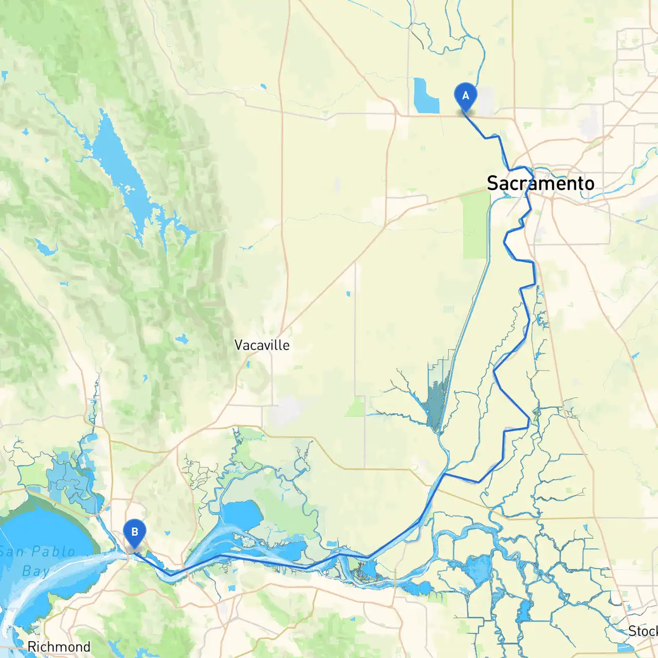
Pilotage Plan: Sacramento, CA to Vallejo, CA
- Route Overview:
Starting from Sacramento, CA, you will embark on a journey that traverses the Sacramento River, eventually making your way to the vast waters of San Francisco Bay. This route is stimulating for both novice and experienced boaters, with the unique twist of urban and natural scenery. The distance between Sacramento and Vallejo is approximately 55 nautical miles if you navigate through the river and the bay, offering plenty of opportunities to explore and find shelter if the weather turns rough. - Departure from Sacramento:
Leaving from the Sacramento yacht harbor, it’s essential to familiarize yourself with the river’s depth and current as you navigate downstream. The Sacramento River can occasionally have strong currents, especially near river bends. - Key Navigation Aids:
As you proceed east on the Sacramento River, pay attention to the following navigation markers:
Buoys and Daymarks:These will guide you along the river. Follow the green on your left when heading downstream and red on your right.
Sacramento River Lighthouse: While it’s a notable landmark, remember that it should not represent a navigational aid; always keep track of your own course and position. - Points of Interest:
Maidu Museum– A short detour can be made near Roseville to visit this museum which displays local Native American history.
Old Sacramento– Historic buildings, restaurants, and shops line the waterfront. A perfect stop for a break or lunch. - Transition to the Delta:
As you approach the confluence of the Sacramento River and the California Delta, be mindful of the changing water conditions, particularly those introduced by tides. Here, you may encounter small craft sailing aficionados. - San Francisco Bay Entrance:
Once you reach the confluence, you will need to head towards the Sacramento Deep Water Ship Channel, which eventually takes you into San Francisco Bay. Stay clear of commercial shipping traffic and utilize the navigational aids like buoys and markers that indicate ship lanes. - Notable Shelters on Route:
Benicia Marina: A welcoming marina offering transient dockage with amenities in case you need to hunker down.
Point Isabel Regional Shoreline: A good place to take a break before entering the bay; you can enjoy a nice walk or some birdwatching. - Arrival at Vallejo:
As you approach Vallejo, ensure you're in tune with local marine traffic and aware of the busy ferry terminals as they may affect your navigational course. The Vallejo Marina is an excellent place for safe docking, with various services available to boaters. - Local Regulations:
Make sure to adhere to the following safety precautions:
- Always wear life jackets while on deck.
- Know the speed limits, especially in marinas and heavily trafficked areas.
- Be aware of 'No Wake Zones' when approaching areas with docks or residential locales.
- Recommended Apps:
To help with planning and navigation, consider using:
Savvy Navvy: Great for route planning; it provides real-time weather updates.
Navionics: Offers detailed charts and weather tracking.
Windy: Useful for checking wind patterns particularly significant for boating on the bay.
This trip from Sacramento to Vallejo is a fine example of uniting safety with fantastic sights, all while navigating one of California's most diverse water systems. Feel free to explore, but always stay within safe navigational practices to ensure a wonderful experience on the water.