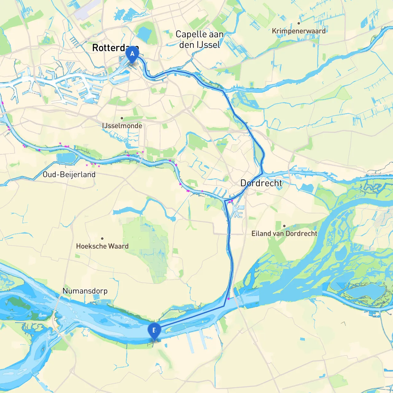
Embarking on this journey from Rotterdam to Klundert offers an exciting opportunity to explore the scenic waterways of the Netherlands. This route is particularly suited for intermediate to experienced boaters, providing a mix of urban and natural environments along with historical landmarks. Safety is paramount, and this plan outlines essential navigational considerations, potential hazards, and points of interest.
Coordinates: 4.49996, 51.90987
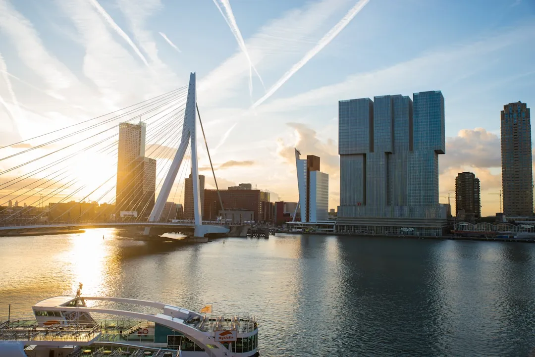
Starting in Rotterdam, you'll find yourself in one of Europe’s largest port cities. Ensure your vessel is well-prepared for the journey ahead. Before leaving the harbor, take a moment to enjoy Rotterdam's impressive skyline, including iconic structures like the Erasmus Bridge and the Markthal.
Navigational Considerations:
As you set out from Rotterdam, you'll navigate through various waterways, and it's essential to be attentive to both navigational aids and changing weather conditions.
1. Oude Maas River - Distance: Approximately 10 km - This river leads you away from Rotterdam and can be somewhat narrow. Use buoys to guide your path. - Hazard Awareness: Watch for currents and larger vessels; maintain a safe distance.
2. Beneden-Merwede River - Distance: Approximately 8 km - As you continue south, the Beneden-Merwede River is broad and well-marked. Look out for traffic signs and local vessels. - Safe Anchorages: Consider Marka, a small natural bay on the river's west side for shelter if needed.
3. Dordrecht - A possible stopover city with a rich history and beautiful canals. The beautiful architecture is certainly worth a visit. - Activities: Explore the historic city center and take a break at one of the local restaurants.
4. Sliedrecht - Continuing upstream, keep an eye out for the Sliedrecht Boven route allowing access to quieter canals. The Sliedrecht houses recreational spots perfect for a short rest in case of bad weather. - Local Regulation: Ensure to respect speed limits in residential areas.
Along the route, there are several navigational aids that provide guidance. Look for buoys, day markers, and lighthouses that are well-maintained and critical to your course.
Key Regulations:
Coordinates: 4.52906, 51.68456
Upon reaching Klundert, you'll find a charming village with a relaxed atmosphere. The harbor here is well equipped for visiting vessels, making it a suitable stop for refueling or relaxing after the journey.
The route is dotted with potential shelters. Particularly during inclement weather, the best options include:
To enhance your journey, consider using these apps:
This route from Rotterdam to Klundert not only embraces the spirit of Dutch waterways but offers valuable experiences along the way. Stay alert to navigational aids and shelter options, and enjoy the journey as much as the destination.