
Pilotage Plan for a Boat Trip from Rotterdam to Hellevoetsluis
Route Overview:This trip from Rotterdam, NL to Hellevoetsluis, NL spans approximately 25 nautical miles through the scenic waters of Southern Holland, combining vibrant urban scenery with tranquil natural surroundings. It is particularly suitable for intermediate to experienced boaters who are comfortable navigating in busy waterways and variable weather conditions.
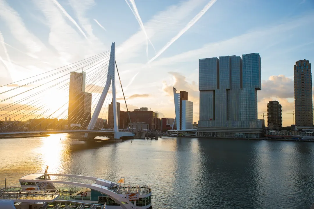
Starting Point: Rotterdam, NLAs you set sail from Rotterdam, you'll begin in the bustling heart of one of Europe’s largest ports. The port is well-marked with navigational aids, and you’ll weave through commercial shipping lanes, so it's essential to stay alert and adhere to right-of-way rules to ensure safe passage. Navigation apps, such as Savvy Navvy, can provide real-time updates on traffic and weather conditions.
Notable Landmarks:The iconic skyline of Rotterdam, dominated by modern architecture like the Erasmus Bridge and the Markthal, offers a scenic backdrop as you depart. Keep your eyes peeled for the historic sailing ships in the Maritime Museum, providing a cultural glimpse into maritime history.
Navigation Considerations:As you progress out of the port area, look for buoy markers that define the channels. The approach to the Nieuwe Maas River will lead you through areas with commercial traffic. Maintain a safe distance from larger vessels, and ideally, choose a time when the shipping traffic is lighter (weekends can be better).
Shelter Stops Along the Route:If weather conditions become unfavorable, you may want to consider stopping at:
1. Spijkenisse - Located just up the river, this relatively sheltered harbor can provide refuge from rough winds. The town itself has lovely parks and a few quaint eateries to explore.
2. Hellevoetsluis Marina - Your final destination offers well-equipped facilities and easy access to local attractions, should you decide to take a detour.
Latitudes and Navigational Aids:While cruising towards Hellevoetsluis, you will enter the Haringvliet, where the water can vary in depth, so pay close attention to charts and buoyage systems indicating shallow areas. Regularly update your navigational position using GPS and maintain awareness of natural features such as the Haringvliet locks, which operate on schedule for vessel transit.
Points of Interest:En route, consider a brief detour to North Island (Noordereiland) in the Nieuwe Maas for its tranquil parks and historical sites, perfect for a picnic. The island’s calmness provides a nice contrast to the bustling cityscape.
As you approach Hellevoetsluis, be aware of the local sailing areas where recreational boating might be more restricted, especially during peak times. Familiarize yourself with local regulations which can often be found in well-marked guides at marinas or online.
Arrival in Hellevoetsluis:Upon arrival, you will find a charming town with historical significance, featuring a maritime museum and the old fortress. The marina is welcoming, with plenty of facilities and a friendly local boating community.
Safety Precautions:Throughout the trip, ensure that you have:
This route encapsulates a perfect blend of urban scenery and tranquil waters, offering an adventurous yet safe passage to Hellevoetsluis. With a strong focus on navigation, safety, and local attractions, your journey is poised to be a memorable and enjoyable experience!