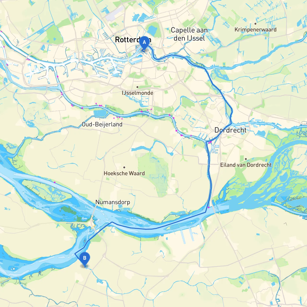
Embarking on a cruise from Rotterdam to Dinteloord presents an exciting opportunity to navigate through the scenic Dutch waterways, while maintaining safety as the top priority. This journey, which stretches across approximately 30 nautical miles, is perfect for recreational boaters looking for a moderate trip filled with natural beauty and cultural landmarks.
Starting from Rotterdam, you'll navigate through a blend of rivers and canals, characterized by their flat landscapes and charming surroundings. There are two primary routes you can consider: the direct route via the Spui River or an alternate through the Nieuwe Maas and Brielle.
1. Starting Point: Rotterdam, NL - Coordinates: 4.4999, 51.9099
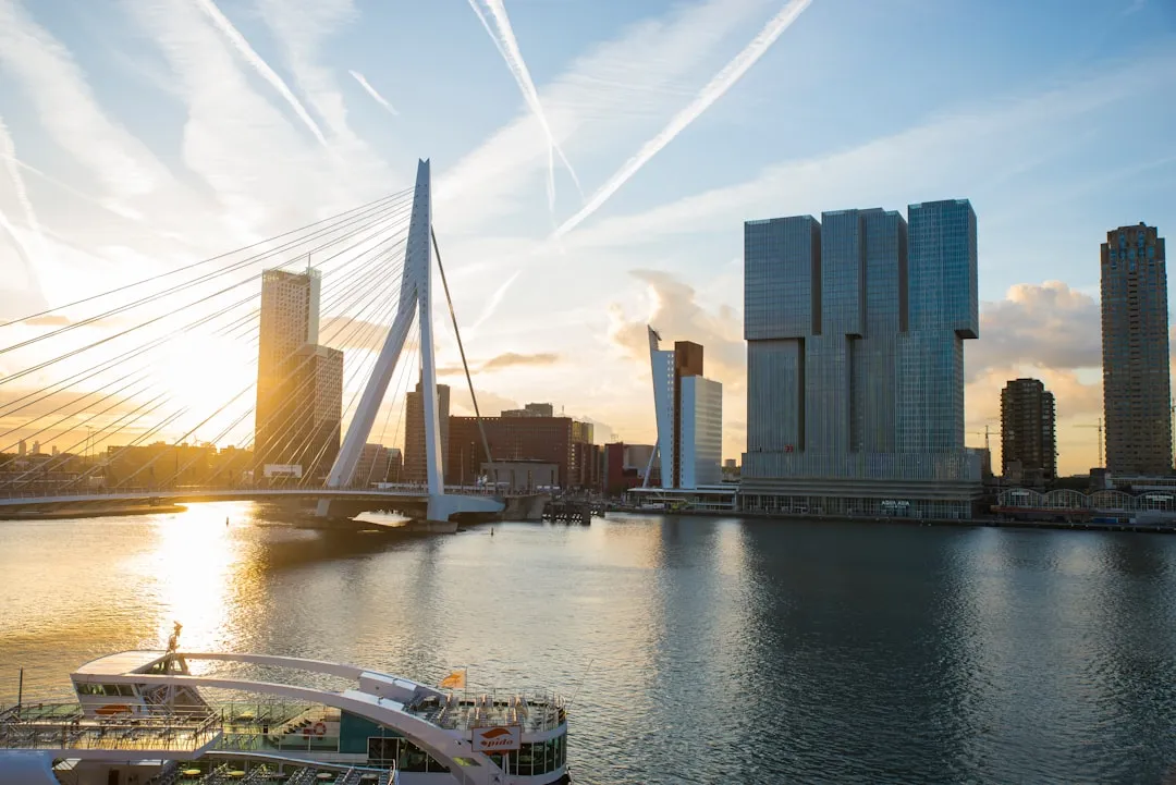
- Notable Landmarks: The iconic Erasmus Bridge and the historic port area are just a few of the notable sights in Rotterdam. Before setting off, consider a brief exploration of this vibrant city, known for its modern architecture and maritime heritage.
2. Route Choice: Spui River Route - Proceed southeast from Rotterdam and enter the Spui River as you maneuver past the bustling port traffic. Keep a vigilant watch on the navigation aids along the waterways, especially the buoys and signal markers.
3. Points of Interest Along the Way: - Vlaardingen: A quaint town located near the banks of the Spui, known for its maritime history. It’s an excellent stop for lunch or a break. - Maassluis: Boasting charming waterfront cafes and local shops, this town is a great place to take a stroll.
4. Sheltering Bays: - De Ruigte: This small bay off the Spui provides an excellent refuge if inclement weather pushes in. It’s well-sheltered and free from strong currents. - Brielse Meer: If you choose the direct route, this expansive lake offers protection from winds if needed.
5. Navigational Aids: - Be attentive to the beacons along the Spui River; they indicate safe passage channels. Use your charts to ensure you’re adhering to the recommended routes. - Be aware of the speed limits: Many areas have specific regulations, especially around the towns and marinas.
Overall, this route from Rotterdam to Dinteloord tenderly showcases the Dutch landscape while ensuring safety remains paramount. It’s suitable for relaxed weekend cruisers as well as day-trippers eager to absorb the local culture and natural beauty. Equip yourself with a good understanding of navigational aids, local regulations, and weather conditions, and you are set for a remarkable nautical adventure. Enjoy your journey!