
Pilotage Plan: Riviera Beach, Maryland to North East, Maryland
Starting Point: Riviera Beach, MD Riviera Beach offers a fantastic launching point with access to a range of amenities, including fuel stations and provisioning options. As you prepare to embark on your journey, ensure your vessel is equipped and your safety gear is in order, including life jackets, fire extinguishers, and a functioning VHF radio.
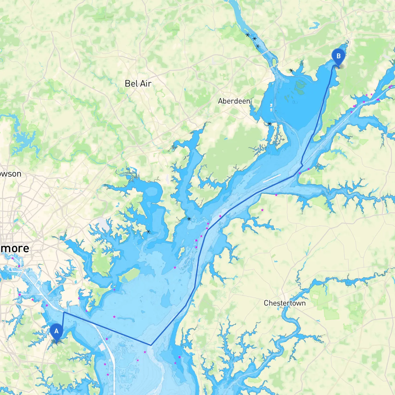
Route Overview:This trip takes you through the scenic and historically rich Chesapeake Bay region. Your journey will typically span approximately 30 nautical miles if you can navigate the direct line through the Patapsco River and into the Upper Chesapeake Bay. This route is ideal for seasoned boaters and leisure sailors alike, providing exposure to both calm waters and the occasional tidal play.
Key Sections of the Route:
1. Leaving Riviera Beach: As you head out from Riviera Beach, navigate carefully through the local docks and marinas. Follow the marked channels to exit the small bay area, keeping an eye on the local commercial and recreational traffic.
2. Patapsco River: Once you’re heading down the Patapsco River, pay attention to navigation markers. The river can be busy, and you may encounter commercial shipping traffic, especially as you approach the Baltimore Harbor area. The harbor’s wide channel allows for safe passage, but be vigilant of vessel wakes.
3. Upper Chesapeake Bay: After clearing the confluence into the Upper Chesapeake Bay, your journey shifts to a more tranquil setting. This region is perfect for leisurely cruising with stunning views of the natural landscape.
Points of Interest & Shelters:
Navigational Aids:As you traverse the waters, keep an eye on the numerous navigational buoys marking your path. The Chesapeake Bay has well-established aids that indicate safe channels, obstacles, and sandbars. Always have updated nautical charts onboard, and consider using reliable apps like Navionics or savvy navvy to keep track of your position and surrounding hazards.
Local Regulations:Be aware of local speed limits, especially in no-wake zones prevalent near marinas and residential areas. Also, stay updated on any seasonal regulations, such as fishing limits or active marine life periods where special care is needed.
Conclusion:This plan presents a well-rounded experience for boaters, combining a safe route with opportunities to explore and enjoy what the Chesapeake Bay has to offer. Make sure to always check the weather beforehand since conditions can change rapidly, and have a contingency plan ready to head to shelter if needed. With stunning scenery, potential for wildlife encounters, and the rich maritime history of the area, this is a trip well worth undertaking. Safe travels!