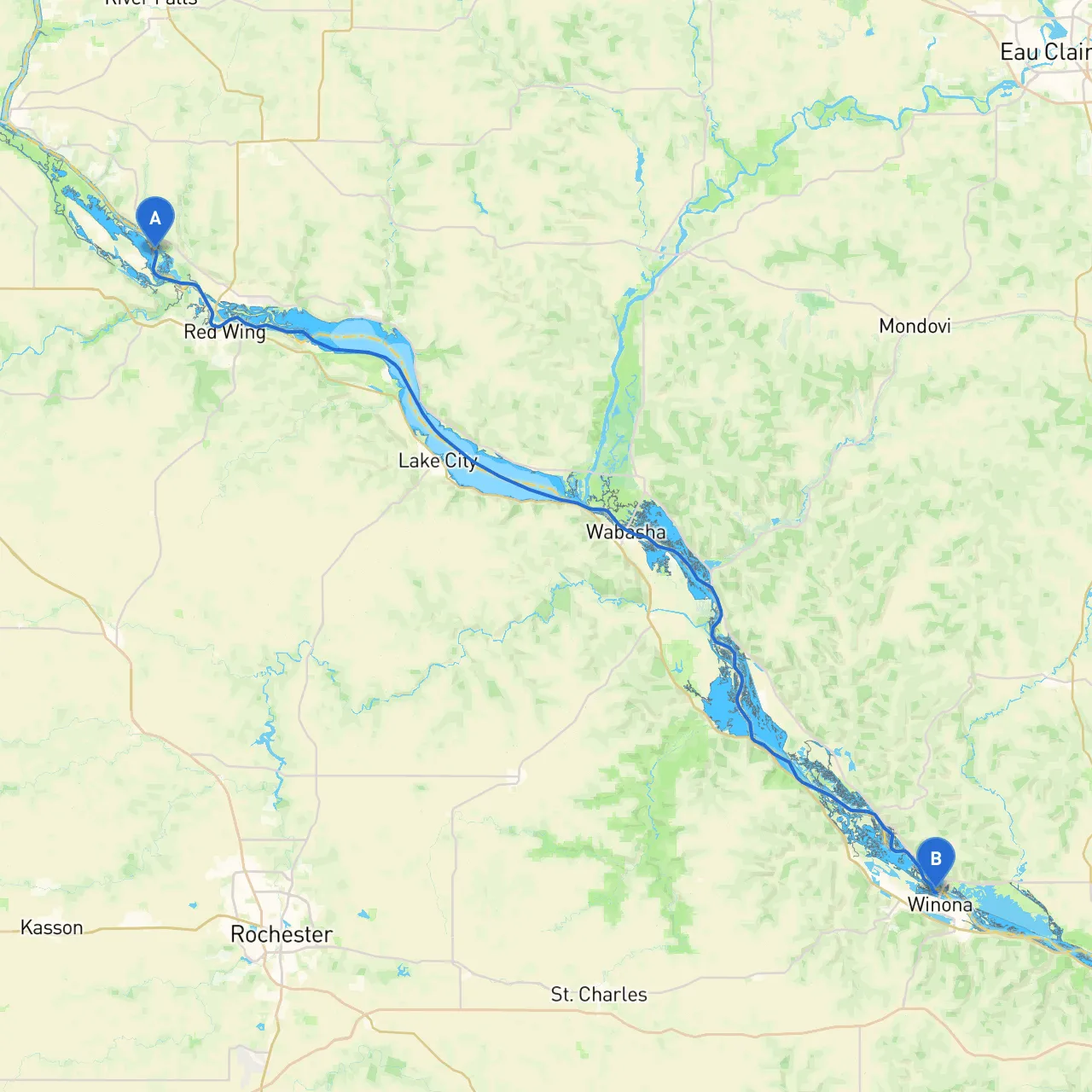
Embarking on a boating journey from Red Wing, Minnesota, to Winona offers a delightful opportunity to explore the scenic beauty of the Upper Mississippi River. This route caters well to recreational boaters, including families, couples, and solo adventurers, with a mix of tranquil navigation and pockets of engaging activities. This journey stretches approximately 38 nautical miles downriver and ensures safe passage with attention to navigational aids and sheltering bays.
1. Starting Point: Red Wing, MN - Coordinates: Longitude -92.6207, Latitude 44.6341 - Before setting off, enjoy the riverfront park or visit the Red Wing Pottery for some local culture. Red Wing's harbor is well-equipped for departing vessels, and the welcoming community adds a refreshing start to your journey.
2. Points of Interest Along the Route - Lake Pepin: This large, scenic lake serves as a natural oasis about halfway into your journey. With ample opportunities for fishing, you may also encounter recreational boaters enjoying water sports. It is a good spot to take a break if the weather permits. - Pepin, WI: As you travel by, glance towards the charming town of Pepin. If the weather is fine, consider stopping to explore the marina or grab a bite at one of the local eateries. - Local Parks & Campgrounds: The shores of the Mississippi are dotted with beautiful parks, such as the Maiden Rock Park, providing picnic spots and nature trails.
3. Sheltering Bays - Should conditions worsen, you can seek refuge at Lake City Marina or Wabasha. Each provides safe docking facilities and basic amenities. Wabasha is also known for its Eagle Center, which can be an excellent educational stop if the weather allows.
This route from Red Wing to Winona is not only practical but also breathtaking, blending serene landscapes with the thrill of the river. Ideal for leisure boaters and families, there’s plenty to enjoy while prioritizing safety at every step. By staying alert to navigational measures and nearby sheltering points, your journey can be both fulfilling and secure. Keep savvy navvy on hand for real-time updates on weather and navigation to enhance your experience!
As you complete this journey, you'll not only revel in the natural beauty and local towns of this region but also gain valuable boating experience and memories. Enjoy the river's embrace and the adventures that await!