
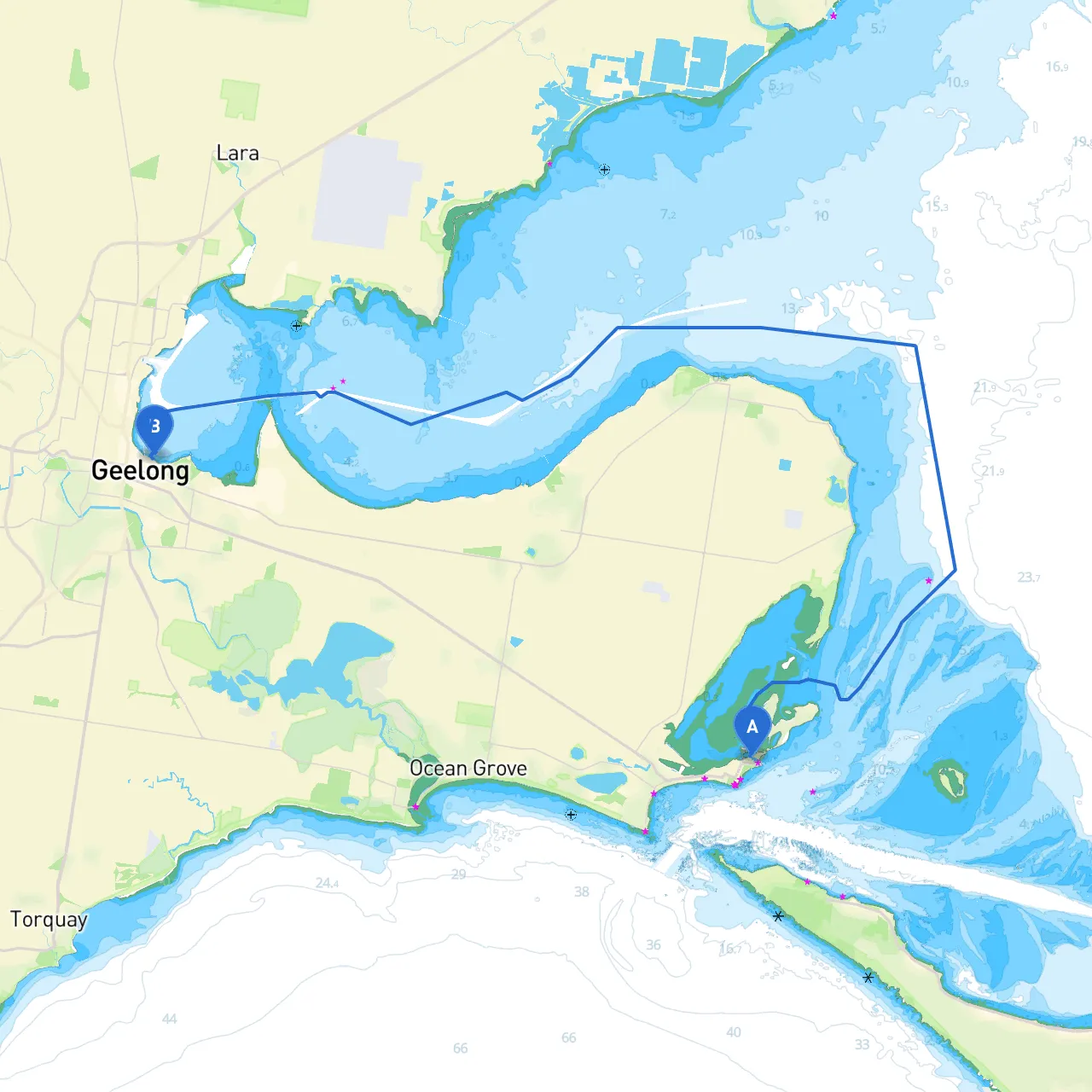
This coastal route from Queenscliff to Geelong spans approximately 20 nautical miles across Port Phillip Bay, offering alluring views and a few charming spots for exploration and relaxation. This trip is well-suited for experienced boaters with some familiarity of the waters, due to the shallow areas and busy shipping lanes you will navigate through.
Starting Point: Queenscliff Queenscliff, situated at the entrance to Port Phillip Bay, is a bustling maritime hub with a rich maritime history. Before setting sail, make sure to fuel up and check the local weather conditions. The Queenscliff Harbour provides ample facilities including provisions and mooring.
Safety Considerations: Keep an eye on weather predictions before departure. Thick fog is common, so ensure your navigation lights and foghorn are functional. Maintain a lookout for ferry traffic; the Queenscliff Ferry operates frequently across the bay.
Points of Interest:
As you navigate out from Queenscliff, your course will predominantly be south-southwest towards Geelong.
Navigational Aids:
Local Regulations: Within Port Phillip Bay, be aware of speed limits, particularly in designated areas surrounding the ferry routes. Keep your VHF radio tuned to channel 16 for communication with Melbourne Water Traffic Services.
Points for Shelter:1. Point Nepean (to the west of Port Phillip Heads): A solid choice for shelter with its rock formations, it also provides a scenic view of the bay entrance.2. Sorrento’s Bay: If weather conditions deteriorate unexpectedly, Sorrento offers temporary anchorage, with protective natural features against adverse winds.
As you approach Geelong from Port Phillip, begin to tune into local traffic channels to coordinate your entry, especially as this area can see considerable commercial vessel movement.
Arrival Point: GeelongUpon arrival, make use of the Geelong Boating Facilities, where you can dock safely and explore the vibrant waterfront. Enjoy the well-kept pathways and public amenities around the waterfront area.
Local Points of Interest:
This route through Port Phillip Bay not only offers a safe and manageable passage but also a visually captivating journey. The rich maritime heritage, cultural points of interest, and convenient shelter options make this not just a transit route, but a fulfilling boating adventure.
With thorough planning, awareness of local regulations, and a keen eye on the weather, your transition from Queenscliff to Geelong promises to be both safe and memorable. Enjoy your adventure!