
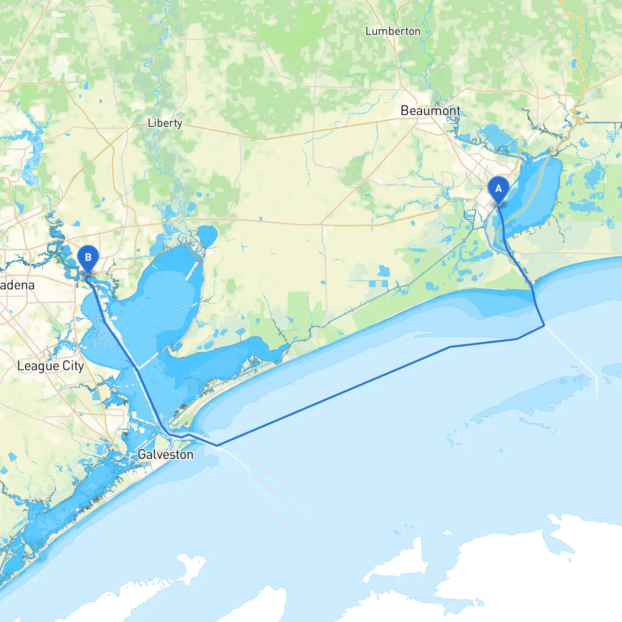
Embark on an exciting and safe journey from Port Arthur to Baytown, navigating the picturesque waters of Texas. This route is ideal for novice and experienced boaters alike who are eager to explore coastal views while remaining aware of safety and navigational requirements. With a combination of sheltered bays, charming towns, and the thrill of navigating through the waterways, this trip encapsulates the beauty of the Texas coastline.
1. Departure from Port ArthurBegin your journey at Port Arthur's busy channel, known for its oil industry. Pay particular attention to the Port Arthur Ship Channel, which has a heavy commercial traffic presence. Be sure to stay clear of larger vessels and always adhere to navigation rules for vessels in a congested waterway. Utilize aids to navigation like buoys and markers, and monitor VHF channels for updates on maritime activity.
2. Sabine LakeAs you steer towards the Sabine Lake, a vast body of water surrounded by marshland and wildlife. This is an excellent spot to anchor if weather conditions worsen, providing ample shelter from strong winds. The lake is also a good place to spot local bird species and enjoy the natural scenery.
3. Entering the Gulf Intracoastal Waterway (GIWW)At the northwest end of Sabine Lake, you'll enter the GIWW. This pathway is a boater’s dream, offering safe passage with well-marked channels. Navigational aids are abundant here, including day markers and lighted buoys. Make sure your charts are updated, as depths can vary—it's critical to remain vigilant about local restrictions and regulations, particularly during low tide when some channels may be less navigable.
4. Sheltering OptionsIf weather conditions deteriorate while on the GIWW, several bay options are nearby: - Coffee Ground Cove: A tranquil spot for anchoring, this cove offers protection from strong wind and waves. - Trinity Bay: Convenient and spacious, Trinity Bay not only provides shelter but also a chance to enjoy some fishing or wildlife watching.
5. Approaching BaytownAs you make your way toward Baytown, you'll be greeted with scenic views of the waterfront and the welcoming vibe of the town. Be on the lookout for the Baytown Bridge, a significant landmark marking your approach to the city. It’s essential to maintain communication on VHF channels while passing under the bridge, as traffic can fluctuate.
6. Arrival in BaytownUpon arrival at Baytown, you’ll find several marinas available for docking. Make sure to secure your boat properly and adhere to local port regulations. Here, you can enjoy local dining, shops, and parks such as Shelter in the Storm or visit historical sites to unwind after your journey.
This passage from Port Arthur to Baytown offers a beautiful blend of natural beauty, safe navigation, and vibrant maritime culture. Ideal for families, novices, or seasoned adventurers, the route encourages exploration while emphasizing safety and responsibility on the water. With ample opportunities for shelter and enjoyment along the way, the adventure is as rewarding as the destination itself.