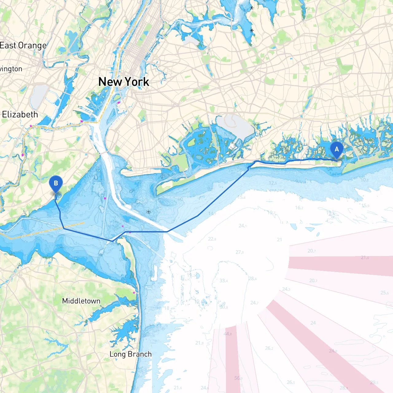
Pilotage Plan from Point Lookout, NY to Staten Island, NY
As you embark on your voyage from Point Lookout in New York, you are setting the stage for an enjoyable cruise with stunning views, diverse marine life, and an array of coastal attractions. This route is particularly suitable for mid to experienced-level boaters, given its mix of navigational challenges, scenic bays, and the occasional busy shipping lanes.
1. Route Overview:
Your adventure begins at Point Lookout, NY, known for its beautiful beaches and vibrant waterfront community. The final destination is Staten Island, an area celebrated for its lush parks, historical landmarks, and the iconic Staten Island Ferry. The journey spans approximately 10 nautical miles and weaves through local waters rich with sights and experiences.
2. Notable Points of Interest:
As you leave Point Lookout:
- Jones Beach: A quick detour can bring you close to Jones Beach State Park, where one can admire miles of sandy shores and perhaps drop anchor for a swim or a beachside picnic.
- Freeport: Just a bit north of your direct path, the Freeport area offers several spots for dining and recreation, with various marinas for a short pause if needed.
- Fire Island: If the conditions allow, consider a slight deviation to the south to explore Fire Island. It has beautiful seaside communities and plenty of opportunities for shore activities.
- Staten Island Historic Districts: Upon nearing Staten Island, you have the chance to explore several historic neighborhoods, including Richmond Town, which features preserved buildings dating back to the 17th century.
3. Sheltered Bays for Bad Weather:
In the event of inclement weather, here are some safe havens along your route:
- Hempstead Bay: This large bay is just to the north of your route and offers a solid option for seeking shelter. Its marine facilities provide a good refuge if storms appear.
- Upper New York Bay: As you approach Staten Island, this bay is surrounded by land, giving you a break from harsh winds and rough waters.
4. Navigational Considerations:
- Hazards: Be cautious of shallow areas and submerged rocks near Point Lookout and parts along the southern coast of Brooklyn. Always consult your nautical charts.
- Navigational Aids: Pay close attention to the buoys marking navigational channels. Look for the Hempstead Harbor Light and Rockaway Point Light, vital references in your journey.
- Ship Traffic: Your route may intersect with busy shipping lanes, particularly as you approach the Narrows. Maintain a lookout for larger vessels and adhere to the right of way regulations.
5. Local Restrictions and Regulations:
- Speed Limits: While navigating through residential areas and near marinas, be mindful of speed limits to ensure safety on the water.
- Wildlife Protection Areas: Some regions may have seasonal restrictions to protect spawning grounds and habitats. Stay updated with NOAA or local boating regulations for more information.
6. Recommended Apps:
To aid your journey, it's wise to equip yourself with useful tools. In addition to traditional navigational charts, I recommend using the following apps:
- Savvy Navvy: This planning app is perfect for real-time navigation with up-to-date charts and weather updates tailored for your route.
- Navionics: An excellent app for detailed nautical charts and sonar imagery.
- Windy: For real-time weather updates and wind forecasts that will help you adjust your travel plans as needed.
Conclusion:
This journey from Point Lookout to Staten Island promises not only a refreshing offshore experience but also provides a fantastic opportunity to explore the unique charm of Long Island and Staten Island. Just remember to prioritize safety by checking the weather forecast, remaining alert to navigational aids, and having a plan for bad weather. With this plan in hand, you're ready to set sail and create memorable moments on the water. Safe travels!