
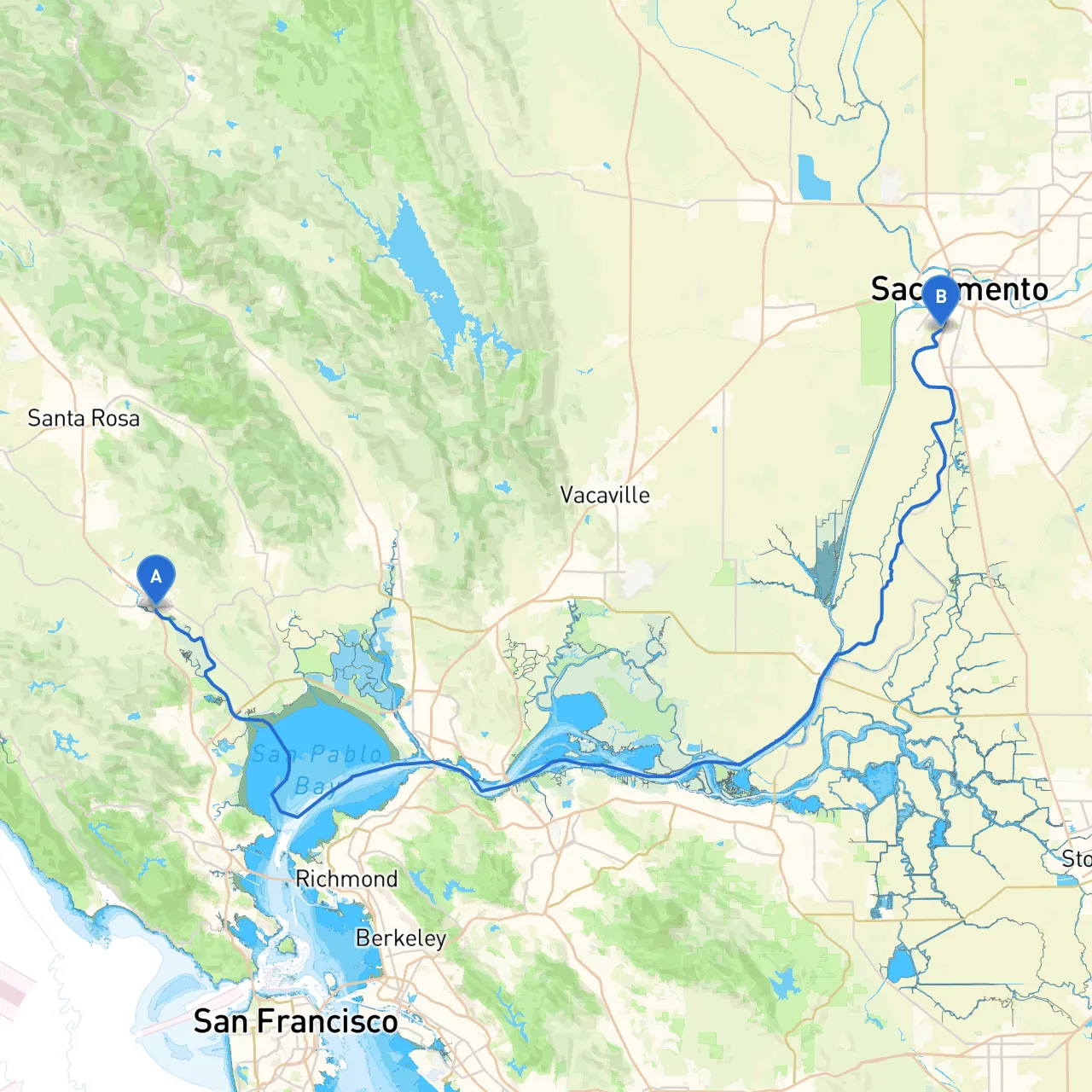
Pilotage Plan: Petaluma, CA to West Sacramento, CA
Trip Overview:This journey takes you from the charming depths of Petaluma, located within the lush wine country of Northern California, to the vibrant waterways of West Sacramento, a city bustling with history and contemporary culture. The route combines urban landmarks, beautiful natural scenery, and the opportunity to navigate through some saltwater and freshwater environments, making it an ideal journey for those with moderate boating experience.
Departure Point: Petaluma, CA
Your adventure begins in Petaluma, beautifully situated along the Petaluma River. Before heading out, take a moment to enjoy the town’s quaint downtown, known for its historic architecture and vibrant artisanal storefronts.
Navigational Aids:As you prepare to exit, pay close attention to the Petaluma River's channel markers. The river can narrow in parts and includes a few shallows, so maintaining a vigilant watch on your chart plotter or paper charts is essential.
Route Highlights:
1. Leaving the Petaluma River: As you make your way down the Petaluma River, take note of the tidal influences for safe navigation. Keep an eye on the tide schedule, as it is crucial for ensuring you avoid shallow areas, particularly during low tide.
2. Navigating Through San Pablo Bay: Upon reaching the San Pablo Bay, you’ll enter a wide-open area with potential for strong tides and currents. Be aware of the navigational aids such as buoys lining the shipping channels. You’ll want to stay well within these channels to ensure safe passage.
Shelter Options: Should weather conditions shift or if you anticipate turbulent waters, both the town of Richmond and Marin Islands offer suitable bays for shelter. The Richmond Marina is a great stop with amenities, while the local parks provide a nice place to stretch your legs.
3. Point Isabel Regional Shoreline: Enjoy the scenic views of the Point Isabel Regional Shoreline, a great spot for a welfare stop if conditions allow. The wildlife and panoramic views—particularly of the San Francisco skyline on a clear day—make it worthwhile.
4. Delta Waters: As you transition into the Delta waters, the current may shift unexpectedly. Maintain a cautious speed, particularly near the confluence of the Sacramento River. Here, markers and buoys become particularly important to follow closely as you navigate the winding twists of the waterway.
Points of Interest Along the Route:
Approaching West Sacramento:
As you near your destination, keep your eyes peeled for the noticeable California State Capitol building, visible from the water. This is a great photo opportunity and a landmark for navigation.
Final Navigational Considerations:Focus on prominent buoys marking the shipping lanes as you ease into West Sacramento’s harbor. Be mindful of any local ordinances regarding noise and wake management, particularly in this urban area.
Safety and Regulations:
The journey requires a good understanding of both tidal patterns and weather forecasts. Always check for updates before departure. While navigating through urban and natural environments, remember to respect local wildlife regulations and maintain a safe distance from nests or breeding areas.
For added assurance, consider boating apps—specifically leverage tools like savvy navvy for route planning, real-time navigation updates, and local weather conditions. Other apps to consider would include marine weather services and community fishing reports.
Conclusion:This is a versatile route, well-suited for intermediate to experienced boaters looking for a mix of adventure and sight-seeing in California’s magnificent waterways. While safety remains your top priority, the journey promises delightful experiences at every turn, ensuring your voyage from Petaluma to West Sacramento is both memorable and fulfilling. Safe travels!